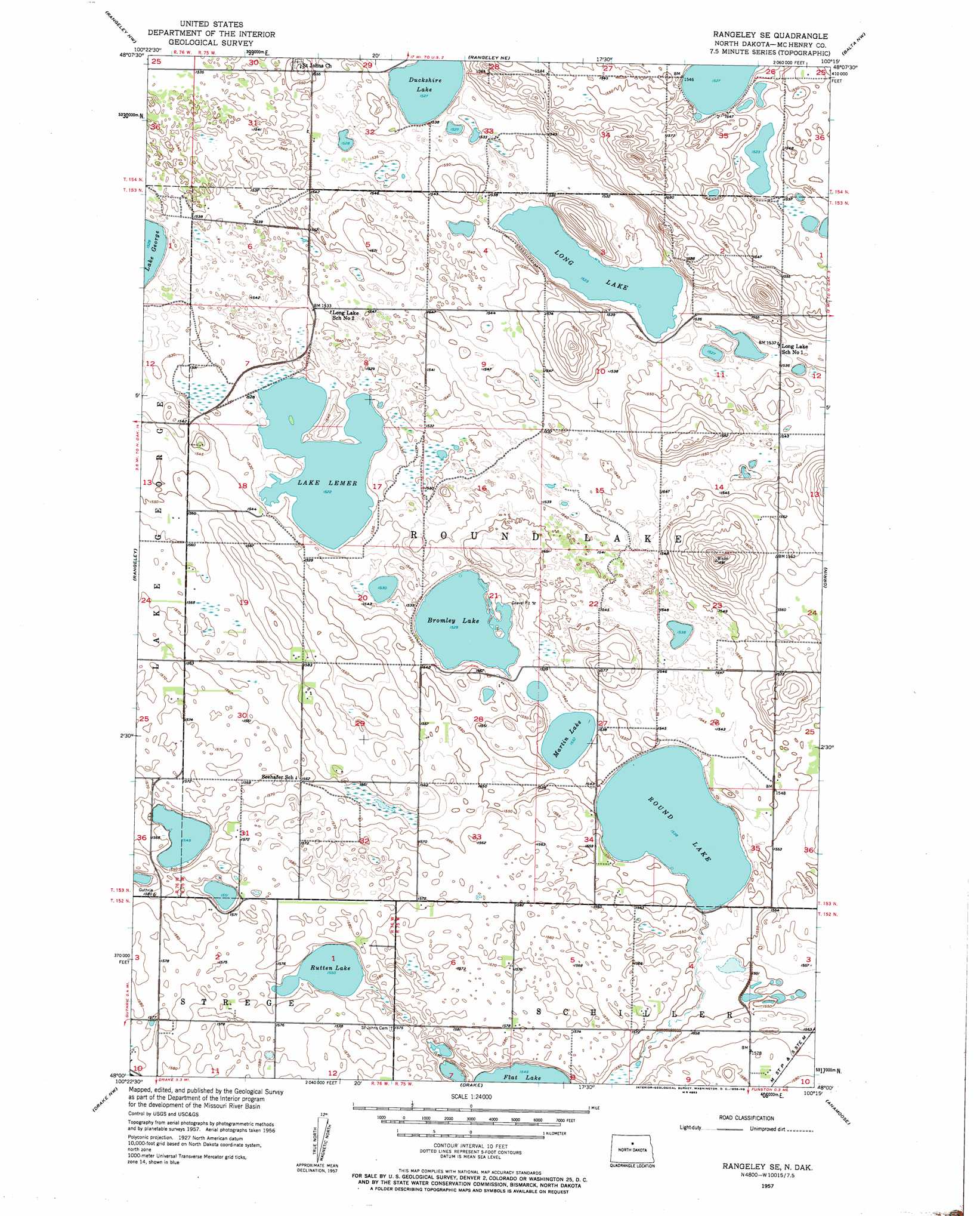
Rangeley Se Topo Map North Dakota
To zoom in, hover over the map of Rangeley Se
USGS Topo Quad 48100a3 - 1:24,000 scale
| Topo Map Name: | Rangeley Se |
| USGS Topo Quad ID: | 48100a3 |
| Print Size: | ca. 21 1/4" wide x 27" high |
| Southeast Coordinates: | 48° N latitude / 100.25° W longitude |
| Map Center Coordinates: | 48.0625° N latitude / 100.3125° W longitude |
| U.S. State: | ND |
| Filename: | O48100A3.jpg |
| Download Map JPG Image: | Rangeley Se topo map 1:24,000 scale |
| Map Type: | Topographic |
| Topo Series: | 7.5´ |
| Map Scale: | 1:24,000 |
| Source of Map Images: | United States Geological Survey (USGS) |
| Alternate Map Versions: |
Rangeley SE ND 1957, updated 1958 Download PDF Buy paper map Rangeley SE ND 2011 Download PDF Buy paper map Rangeley SE ND 2014 Download PDF Buy paper map |
1:24,000 Topo Quads surrounding Rangeley Se
Denbigh |
Towner |
Towner Se |
Berwick |
Tunbridge |
Karlsruhe Ne |
Rangeley Nw |
Rangeley Ne |
Balta Nw |
Balta |
Karlsruhe |
Rangeley |
Rangeley Se |
Orrin |
Balta Se |
Balfour |
Drake Nw |
Drake |
Anamoose |
Clifton |
Kief |
Drake Sw |
Drake Se |
Anamoose Sw |
Martin |
> Back to 48100a1 at 1:100,000 scale
> Back to 48100a1 at 1:250,000 scale
> Back to U.S. Topo Maps home
Rangeley Se topo map: Gazetteer
Rangeley Se: Lakes
Bromley Lake elevation 466m 1528′Duckshire Lake elevation 466m 1528′
Lake Lemer elevation 464m 1522′
Long Lake elevation 465m 1525′
Martin Lake elevation 467m 1532′
Round Lake elevation 469m 1538′
Rutten Lake elevation 477m 1564′
Rangeley Se digital topo map on disk
Buy this Rangeley Se topo map showing relief, roads, GPS coordinates and other geographical features, as a high-resolution digital map file on DVD:
Eastern North Dakota & Eastern South Dakota
Buy digital topo maps: Eastern North Dakota & Eastern South Dakota