Balta Topo Map North Dakota
To zoom in, hover over the map of Balta
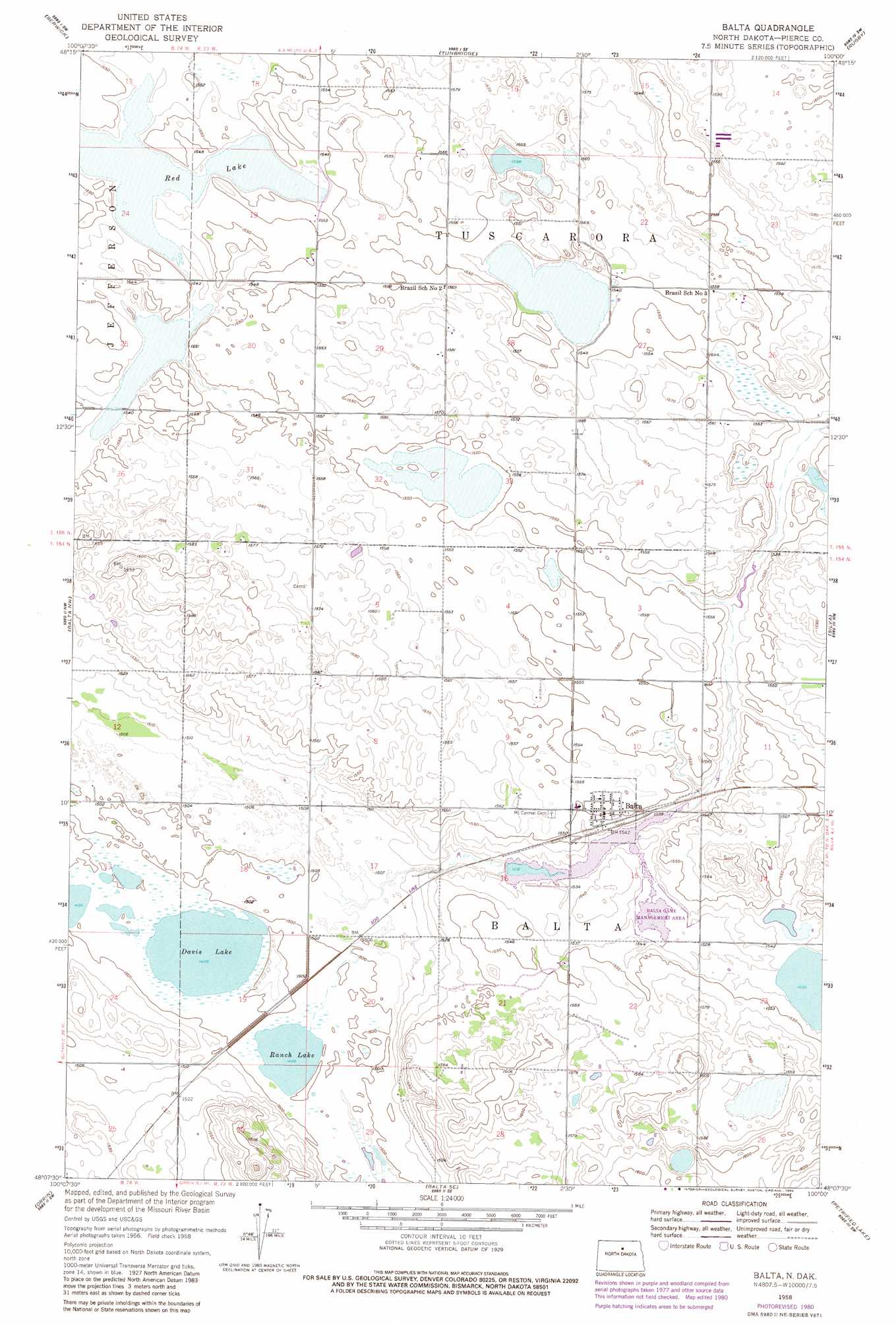
USGS Topo Quad 48100b1 - 1:24,000 scale
| Topo Map Name: | Balta |
| USGS Topo Quad ID: | 48100b1 |
| Print Size: | ca. 21 1/4" wide x 27" high |
| Southeast Coordinates: | 48.125° N latitude / 100° W longitude |
| Map Center Coordinates: | 48.1875° N latitude / 100.0625° W longitude |
| U.S. State: | ND |
| Filename: | O48100B1.jpg |
| Download Map JPG Image: | Balta topo map 1:24,000 scale |
| Map Type: | Topographic |
| Topo Series: | 7.5´ |
| Map Scale: | 1:24,000 |
| Source of Map Images: | United States Geological Survey (USGS) |
| Alternate Map Versions: |
Balta ND 1958, updated 1959 Download PDF Buy paper map Balta ND 1958, updated 1980 Download PDF Buy paper map Balta ND 2011 Download PDF Buy paper map Balta ND 2014 Download PDF Buy paper map |
1:24,000 Topo Quads surrounding Balta
Towner Ne |
Round Lake |
Leverich |
Rugby Nw |
Rugby Ne |
Towner Se |
Berwick |
Tunbridge |
Rugby |
Pleasant Lake |
Rangeley Ne |
Balta Nw |
Balta |
Silva |
Fillmore |
Rangeley Se |
Orrin |
Balta Se |
Petrified Lake |
Esmond |
Drake |
Anamoose |
Clifton |
Selz Nw |
Selz Ne |
> Back to 48100a1 at 1:100,000 scale
> Back to 48100a1 at 1:250,000 scale
> Back to U.S. Topo Maps home
Balta topo map: Gazetteer
Balta: Dams
Balta Dam elevation 464m 1522′Balta: Lakes
Davis Lake elevation 457m 1499′Ranch Lake elevation 457m 1499′
Red Lake elevation 469m 1538′
Balta: Populated Places
Balta elevation 473m 1551′Balta digital topo map on disk
Buy this Balta topo map showing relief, roads, GPS coordinates and other geographical features, as a high-resolution digital map file on DVD:
Eastern North Dakota & Eastern South Dakota
Buy digital topo maps: Eastern North Dakota & Eastern South Dakota