Simcoe Topo Map North Dakota
To zoom in, hover over the map of Simcoe
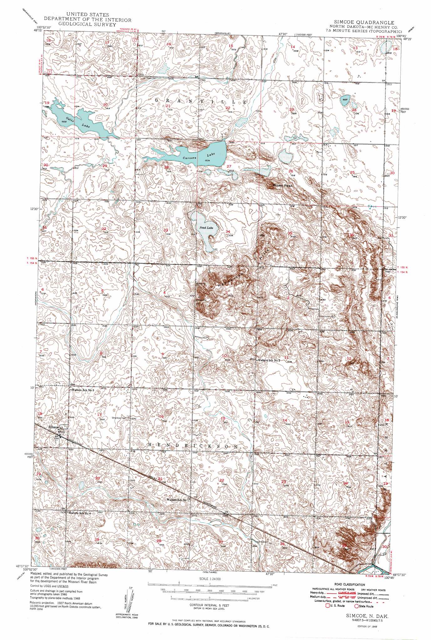
USGS Topo Quad 48100b7 - 1:24,000 scale
| Topo Map Name: | Simcoe |
| USGS Topo Quad ID: | 48100b7 |
| Print Size: | ca. 21 1/4" wide x 27" high |
| Southeast Coordinates: | 48.125° N latitude / 100.75° W longitude |
| Map Center Coordinates: | 48.1875° N latitude / 100.8125° W longitude |
| U.S. State: | ND |
| Filename: | O48100B7.jpg |
| Download Map JPG Image: | Simcoe topo map 1:24,000 scale |
| Map Type: | Topographic |
| Topo Series: | 7.5´ |
| Map Scale: | 1:24,000 |
| Source of Map Images: | United States Geological Survey (USGS) |
| Alternate Map Versions: |
Simcoe ND 1949 Download PDF Buy paper map Simcoe ND 2011 Download PDF Buy paper map Simcoe ND 2014 Download PDF Buy paper map |
1:24,000 Topo Quads surrounding Simcoe
Deering |
Granville Nw |
Granville Ne |
Bantry Nw |
Bantry |
Deering Se |
Granville Sw |
Granville |
Riga |
Denbigh |
Sawyer Ne |
Norwich |
Simcoe |
Karlsruhe Nw |
Karlsruhe Ne |
Sawyer |
Velva |
Voltaire |
Bergen |
Karlsruhe |
Robinson Coulee |
Blacktail Coulee |
Kongsberg Ne |
Balfour Nw |
Balfour |
> Back to 48100a1 at 1:100,000 scale
> Back to 48100a1 at 1:250,000 scale
> Back to U.S. Topo Maps home
Simcoe topo map: Gazetteer
Simcoe: Lakes
Carvers Lake elevation 459m 1505′Nead Lake elevation 460m 1509′
Oslie Lake elevation 459m 1505′
Simcoe: Populated Places
Simcoe elevation 483m 1584′Simcoe: Ranges
Henderson Hills elevation 482m 1581′Simcoe: Summits
Mikes Peak elevation 489m 1604′Simcoe digital topo map on disk
Buy this Simcoe topo map showing relief, roads, GPS coordinates and other geographical features, as a high-resolution digital map file on DVD:
Eastern North Dakota & Eastern South Dakota
Buy digital topo maps: Eastern North Dakota & Eastern South Dakota