Granville Topo Map North Dakota
To zoom in, hover over the map of Granville
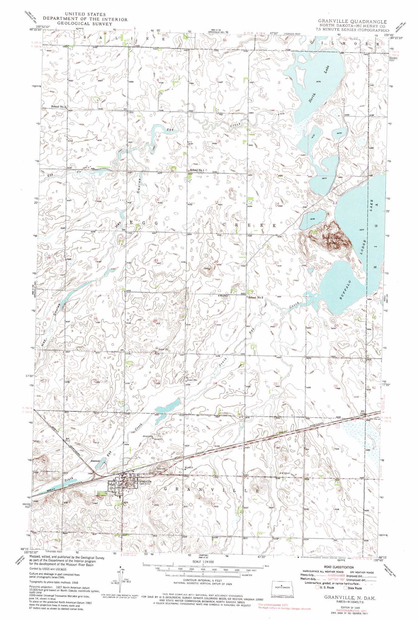
USGS Topo Quad 48100c7 - 1:24,000 scale
| Topo Map Name: | Granville |
| USGS Topo Quad ID: | 48100c7 |
| Print Size: | ca. 21 1/4" wide x 27" high |
| Southeast Coordinates: | 48.25° N latitude / 100.75° W longitude |
| Map Center Coordinates: | 48.3125° N latitude / 100.8125° W longitude |
| U.S. State: | ND |
| Filename: | O48100C7.jpg |
| Download Map JPG Image: | Granville topo map 1:24,000 scale |
| Map Type: | Topographic |
| Topo Series: | 7.5´ |
| Map Scale: | 1:24,000 |
| Source of Map Images: | United States Geological Survey (USGS) |
| Alternate Map Versions: |
Granville ND 1949 Download PDF Buy paper map Granville ND 1949, updated 1980 Download PDF Buy paper map Granville ND 2011 Download PDF Buy paper map Granville ND 2014 Download PDF Buy paper map |
1:24,000 Topo Quads surrounding Granville
Eckman Se |
Newburg Sw |
Newburg Se |
Upham |
Upham Se |
Deering |
Granville Nw |
Granville Ne |
Bantry Nw |
Bantry |
Deering Se |
Granville Sw |
Granville |
Riga |
Denbigh |
Sawyer Ne |
Norwich |
Simcoe |
Karlsruhe Nw |
Karlsruhe Ne |
Sawyer |
Velva |
Voltaire |
Bergen |
Karlsruhe |
> Back to 48100a1 at 1:100,000 scale
> Back to 48100a1 at 1:250,000 scale
> Back to U.S. Topo Maps home
Granville topo map: Gazetteer
Granville: Dams
Buffalo Creek Dam elevation 455m 1492′Granville: Lakes
Buffalo Lodge Lake elevation 451m 1479′North Lake elevation 450m 1476′
Granville: Populated Places
Granville elevation 461m 1512′Granville: Streams
Egg Creek elevation 450m 1476′South Egg Creek elevation 451m 1479′
Granville: Summits
Buffalo Lodge Butte elevation 485m 1591′Granville: Valleys
Hay Coulee elevation 453m 1486′Granville digital topo map on disk
Buy this Granville topo map showing relief, roads, GPS coordinates and other geographical features, as a high-resolution digital map file on DVD:
Eastern North Dakota & Eastern South Dakota
Buy digital topo maps: Eastern North Dakota & Eastern South Dakota