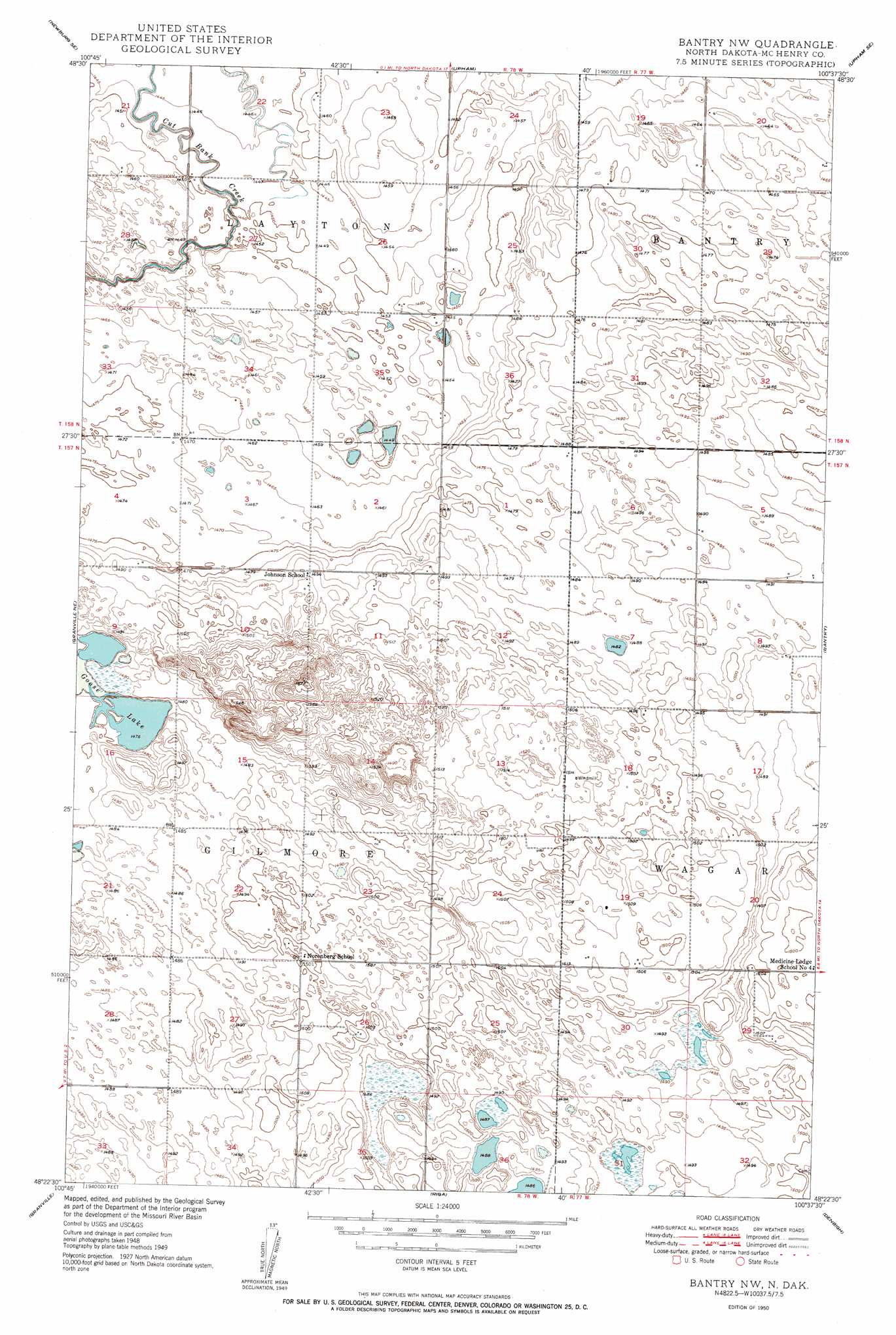
Bantry Nw Topo Map North Dakota
To zoom in, hover over the map of Bantry Nw
USGS Topo Quad 48100d6 - 1:24,000 scale
| Topo Map Name: | Bantry Nw |
| USGS Topo Quad ID: | 48100d6 |
| Print Size: | ca. 21 1/4" wide x 27" high |
| Southeast Coordinates: | 48.375° N latitude / 100.625° W longitude |
| Map Center Coordinates: | 48.4375° N latitude / 100.6875° W longitude |
| U.S. State: | ND |
| Filename: | O48100D6.jpg |
| Download Map JPG Image: | Bantry Nw topo map 1:24,000 scale |
| Map Type: | Topographic |
| Topo Series: | 7.5´ |
| Map Scale: | 1:24,000 |
| Source of Map Images: | United States Geological Survey (USGS) |
| Alternate Map Versions: |
Bantry NW ND 1950, updated 1950 Download PDF Buy paper map Bantry NW ND 2011 Download PDF Buy paper map Bantry NW ND 2014 Download PDF Buy paper map |
1:24,000 Topo Quads surrounding Bantry Nw
Newburg |
Deep |
Kramer |
Upham Ne |
Gardena |
Newburg Sw |
Newburg Se |
Upham |
Upham Se |
Willow City Sw |
Granville Nw |
Granville Ne |
Bantry Nw |
Bantry |
Towner Nw |
Granville Sw |
Granville |
Riga |
Denbigh |
Towner |
Norwich |
Simcoe |
Karlsruhe Nw |
Karlsruhe Ne |
Rangeley Nw |
> Back to 48100a1 at 1:100,000 scale
> Back to 48100a1 at 1:250,000 scale
> Back to U.S. Topo Maps home
Bantry Nw digital topo map on disk
Buy this Bantry Nw topo map showing relief, roads, GPS coordinates and other geographical features, as a high-resolution digital map file on DVD:
Eastern North Dakota & Eastern South Dakota
Buy digital topo maps: Eastern North Dakota & Eastern South Dakota