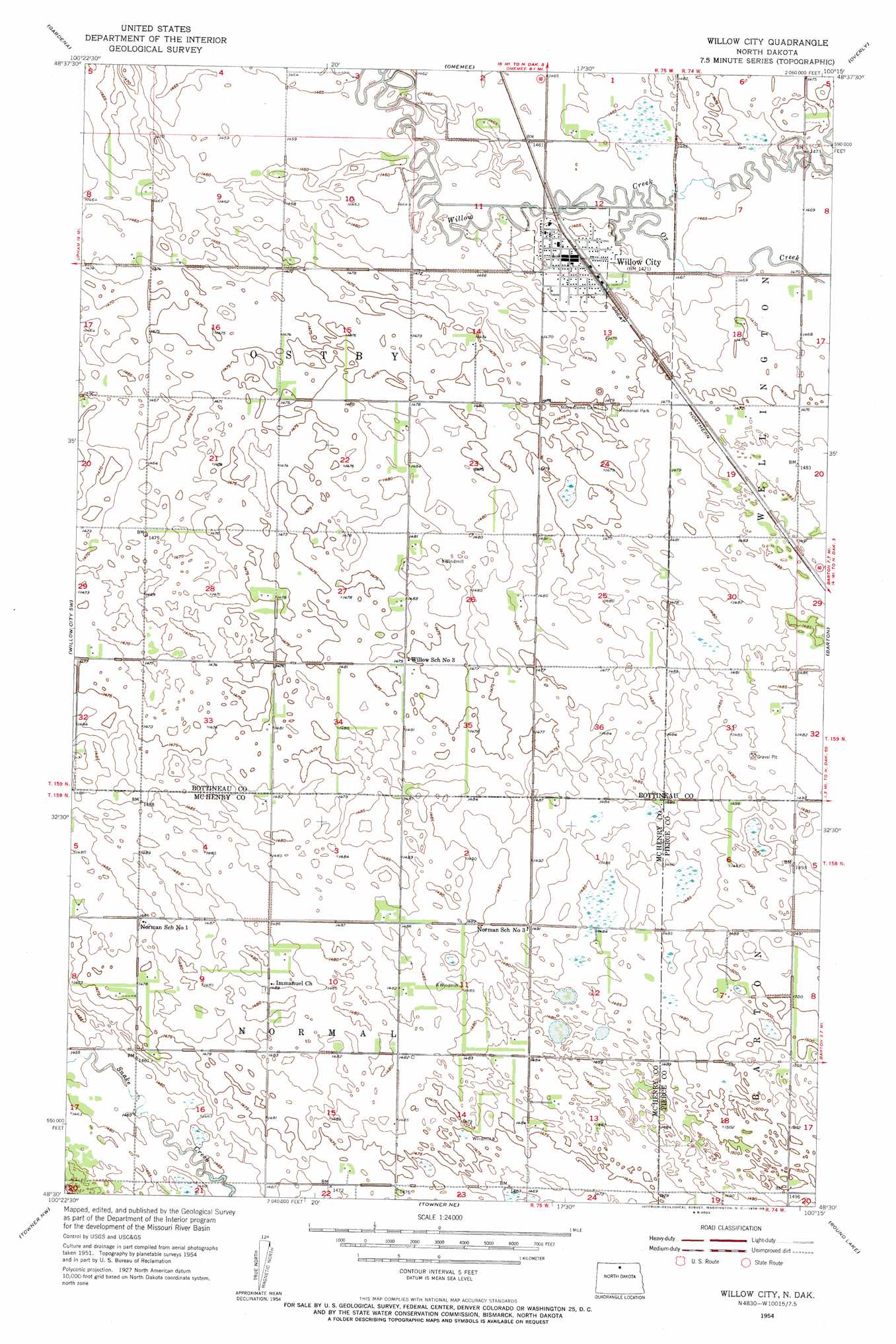
Willow City Topo Map North Dakota
To zoom in, hover over the map of Willow City
USGS Topo Quad 48100e3 - 1:24,000 scale
| Topo Map Name: | Willow City |
| USGS Topo Quad ID: | 48100e3 |
| Print Size: | ca. 21 1/4" wide x 27" high |
| Southeast Coordinates: | 48.5° N latitude / 100.25° W longitude |
| Map Center Coordinates: | 48.5625° N latitude / 100.3125° W longitude |
| U.S. State: | ND |
| Filename: | O48100E3.jpg |
| Download Map JPG Image: | Willow City topo map 1:24,000 scale |
| Map Type: | Topographic |
| Topo Series: | 7.5´ |
| Map Scale: | 1:24,000 |
| Source of Map Images: | United States Geological Survey (USGS) |
| Alternate Map Versions: |
Willow City ND 1954, updated 1956 Download PDF Buy paper map Willow City ND 2011 Download PDF Buy paper map Willow City ND 2014 Download PDF Buy paper map |
1:24,000 Topo Quads surrounding Willow City
Souris Se |
Bottineau |
Bottineau Se |
Lords Lake |
Dunseith |
Upham Ne |
Gardena |
Omemee |
Overly |
Fonda |
Upham Se |
Willow City Sw |
Willow City |
Barton |
Overly Se |
Bantry |
Towner Nw |
Towner Ne |
Round Lake |
Leverich |
Denbigh |
Towner |
Towner Se |
Berwick |
Tunbridge |
> Back to 48100e1 at 1:100,000 scale
> Back to 48100a1 at 1:250,000 scale
> Back to U.S. Topo Maps home
Willow City topo map: Gazetteer
Willow City: Populated Places
Willow City elevation 448m 1469′Willow City: Streams
Ox Creek elevation 445m 1459′Willow City digital topo map on disk
Buy this Willow City topo map showing relief, roads, GPS coordinates and other geographical features, as a high-resolution digital map file on DVD:
Eastern North Dakota & Eastern South Dakota
Buy digital topo maps: Eastern North Dakota & Eastern South Dakota