Lords Lake Topo Map North Dakota
To zoom in, hover over the map of Lords Lake
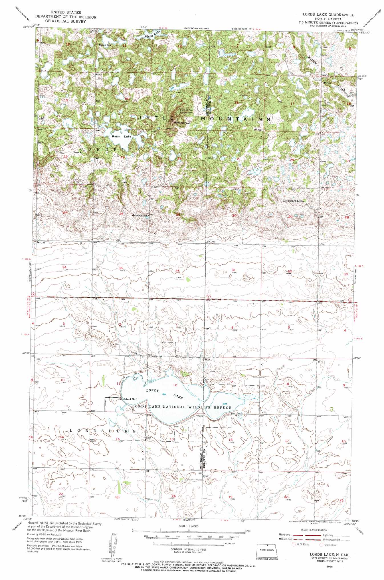
USGS Topo Quad 48100g2 - 1:24,000 scale
| Topo Map Name: | Lords Lake |
| USGS Topo Quad ID: | 48100g2 |
| Print Size: | ca. 21 1/4" wide x 27" high |
| Southeast Coordinates: | 48.75° N latitude / 100.125° W longitude |
| Map Center Coordinates: | 48.8125° N latitude / 100.1875° W longitude |
| U.S. State: | ND |
| Filename: | O48100G2.jpg |
| Download Map JPG Image: | Lords Lake topo map 1:24,000 scale |
| Map Type: | Topographic |
| Topo Series: | 7.5´ |
| Map Scale: | 1:24,000 |
| Source of Map Images: | United States Geological Survey (USGS) |
| Alternate Map Versions: |
Lords Lake ND 1955, updated 1956 Download PDF Buy paper map Lords Lake ND 2011 Download PDF Buy paper map Lords Lake ND 2014 Download PDF Buy paper map |
1:24,000 Topo Quads surrounding Lords Lake
Lake Klingenberg |
Metigoshe Lake |
Boundary Lake |
International Peace Garden |
Carpenter Lake |
Bottineau |
Bottineau Se |
Lords Lake |
Dunseith |
Lake Upsilon Sw |
Gardena |
Omemee |
Overly |
Fonda |
Thorne |
Willow City Sw |
Willow City |
Barton |
Overly Se |
Rolette Sw |
> Back to 48100e1 at 1:100,000 scale
> Back to 48100a1 at 1:250,000 scale
> Back to U.S. Topo Maps home
Lords Lake topo map: Gazetteer
Lords Lake: Dams
Lords Lake Dam elevation 487m 1597′Lords Lake: Lakes
Butte Lake elevation 618m 2027′Lords Lake elevation 485m 1591′
Platte Lake elevation 667m 2188′
Lords Lake: Parks
Butte Saint Paul Historic Site elevation 671m 2201′Lords Lake National Wildlife Refuge elevation 485m 1591′
Lords Lake: Reservoirs
Lords Lake elevation 487m 1597′Lords Lake: Summits
Butte Saint Paul elevation 695m 2280′Lords Lake digital topo map on disk
Buy this Lords Lake topo map showing relief, roads, GPS coordinates and other geographical features, as a high-resolution digital map file on DVD:
Eastern North Dakota & Eastern South Dakota
Buy digital topo maps: Eastern North Dakota & Eastern South Dakota