Westhope Topo Map North Dakota
To zoom in, hover over the map of Westhope
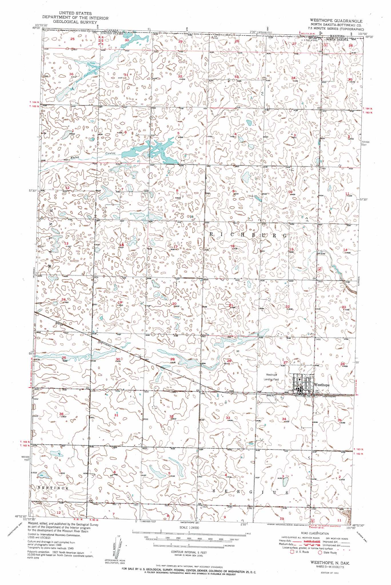
USGS Topo Quad 48101h1 - 1:24,000 scale
| Topo Map Name: | Westhope |
| USGS Topo Quad ID: | 48101h1 |
| Print Size: | ca. 21 1/4" wide x 27" high |
| Southeast Coordinates: | 48.875° N latitude / 101° W longitude |
| Map Center Coordinates: | 48.9375° N latitude / 101.0625° W longitude |
| U.S. State: | ND |
| Filename: | O48101H1.jpg |
| Download Map JPG Image: | Westhope topo map 1:24,000 scale |
| Map Type: | Topographic |
| Topo Series: | 7.5´ |
| Map Scale: | 1:24,000 |
| Source of Map Images: | United States Geological Survey (USGS) |
| Alternate Map Versions: |
Westhope ND 1951, updated 1951 Download PDF Buy paper map Westhope ND 1951, updated 1951 Download PDF Buy paper map Westhope ND 2011 Download PDF Buy paper map Westhope ND 2014 Download PDF Buy paper map |
1:24,000 Topo Quads surrounding Westhope
Antler |
Kuroki |
Westhope |
Landa |
Roth |
Renville |
Westhope Sw |
Westhope Se |
Landa Sw |
Landa Se |
Lansford Ne |
Maxbass |
Eckman |
Newburg |
Deep |
> Back to 48101e1 at 1:100,000 scale
> Back to 48100a1 at 1:250,000 scale
> Back to U.S. Topo Maps home
Westhope topo map: Gazetteer
Westhope: Airports
Westhope Municipal Airport elevation 455m 1492′Westhope: Populated Places
Westhope elevation 458m 1502′Westhope: Valleys
Hulse Coulee elevation 455m 1492′Westhope digital topo map on disk
Buy this Westhope topo map showing relief, roads, GPS coordinates and other geographical features, as a high-resolution digital map file on DVD:
Eastern North Dakota & Eastern South Dakota
Buy digital topo maps: Eastern North Dakota & Eastern South Dakota