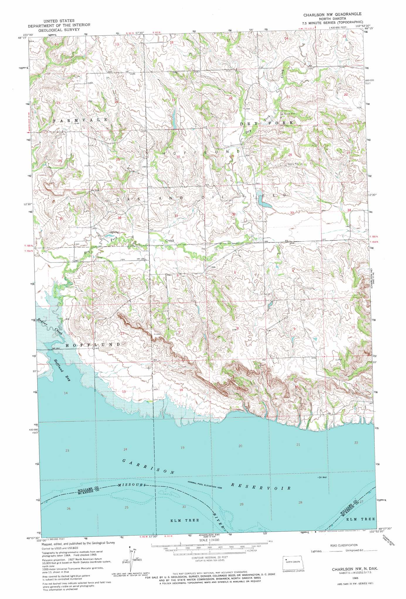
Charlson Nw Topo Map North Dakota
To zoom in, hover over the map of Charlson Nw
USGS Topo Quad 48102b8 - 1:24,000 scale
| Topo Map Name: | Charlson Nw |
| USGS Topo Quad ID: | 48102b8 |
| Print Size: | ca. 21 1/4" wide x 27" high |
| Southeast Coordinates: | 48.125° N latitude / 102.875° W longitude |
| Map Center Coordinates: | 48.1875° N latitude / 102.9375° W longitude |
| U.S. State: | ND |
| Filename: | O48102B8.jpg |
| Download Map JPG Image: | Charlson Nw topo map 1:24,000 scale |
| Map Type: | Topographic |
| Topo Series: | 7.5´ |
| Map Scale: | 1:24,000 |
| Source of Map Images: | United States Geological Survey (USGS) |
| Alternate Map Versions: |
Charlson NW ND 1965, updated 1967 Download PDF Buy paper map Charlson NW ND 2011 Download PDF Buy paper map Charlson NW ND 2014 Download PDF Buy paper map |
1:24,000 Topo Quads surrounding Charlson Nw
Ray Nw |
Temple |
Tioga |
White Earth |
Ross Nw |
Ray |
Ray Se |
Tioga Sw |
Tioga Se |
Manitou |
Cussicks Spring |
Red Mike Hill |
Charlson Nw |
Charlson Ne |
Rat Lake |
Banks |
Tobacco Garden Bay |
Charlson Sw |
Charlson |
Rat Lake Sw |
Timber Prong Creek |
Demicks Lake |
Keene |
Blue Buttes |
Sanish Nw |
> Back to 48102a1 at 1:100,000 scale
> Back to 48102a1 at 1:250,000 scale
> Back to U.S. Topo Maps home
Charlson Nw topo map: Gazetteer
Charlson Nw: Bays
Hofflund Bay elevation 561m 1840′Charlson Nw: Islands
Little Bear Island (historical) elevation 561m 1840′Strawberry Island (historical) elevation 561m 1840′
Charlson Nw: Oilfields
Hofflund Gas and Oil Field elevation 628m 2060′Charlson Nw: Streams
Beaver Creek elevation 561m 1840′Dry Fork Creek elevation 561m 1840′
Charlson Nw digital topo map on disk
Buy this Charlson Nw topo map showing relief, roads, GPS coordinates and other geographical features, as a high-resolution digital map file on DVD:
Eastern Montana & Western North Dakota
Buy digital topo maps: Eastern Montana & Western North Dakota