Palermo Ne Topo Map North Dakota
To zoom in, hover over the map of Palermo Ne
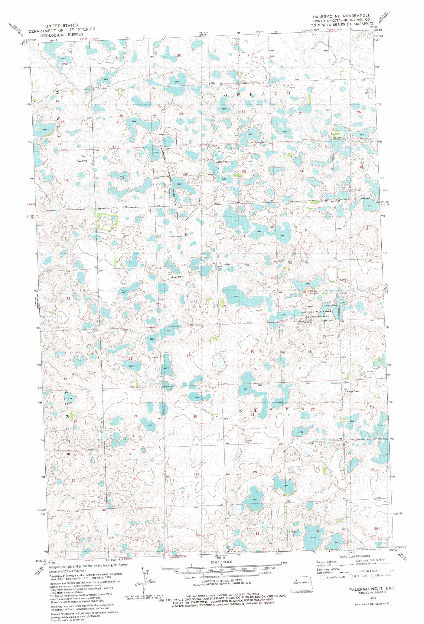
USGS Topo Quad 48102d1 - 1:24,000 scale
| Topo Map Name: | Palermo Ne |
| USGS Topo Quad ID: | 48102d1 |
| Print Size: | ca. 21 1/4" wide x 27" high |
| Southeast Coordinates: | 48.375° N latitude / 102° W longitude |
| Map Center Coordinates: | 48.4375° N latitude / 102.0625° W longitude |
| U.S. State: | ND |
| Filename: | O48102D1.jpg |
| Download Map JPG Image: | Palermo Ne topo map 1:24,000 scale |
| Map Type: | Topographic |
| Topo Series: | 7.5´ |
| Map Scale: | 1:24,000 |
| Source of Map Images: | United States Geological Survey (USGS) |
| Alternate Map Versions: |
Palermo NE ND 1981, updated 1981 Download PDF Buy paper map Palermo NE ND 2011 Download PDF Buy paper map Palermo NE ND 2014 Download PDF Buy paper map |
1:24,000 Topo Quads surrounding Palermo Ne
Vanville Ne |
Niobe |
Kenmare |
Norma |
Tolley |
Westby Lake |
Mosquito Butte |
Coulee |
Donnybrook |
Tolley Se |
Clearwater Lake |
Palermo Nw |
Palermo Ne |
Aurelia |
Hartland |
Stanley Se |
Palermo |
Blaisdell |
Tagus |
Tagus Se |
Belden |
Epworth Nw |
Shell Lake |
Plaza Nw |
Plaza Ne |
> Back to 48102a1 at 1:100,000 scale
> Back to 48102a1 at 1:250,000 scale
> Back to U.S. Topo Maps home
No gazetteer data is available for the Palermo Ne topo map sheet.
Palermo Ne digital topo map on disk
Buy this Palermo Ne topo map showing relief, roads, GPS coordinates and other geographical features, as a high-resolution digital map file on DVD:
Eastern Montana & Western North Dakota
Buy digital topo maps: Eastern Montana & Western North Dakota