Bowbells Se Topo Map North Dakota
To zoom in, hover over the map of Bowbells Se
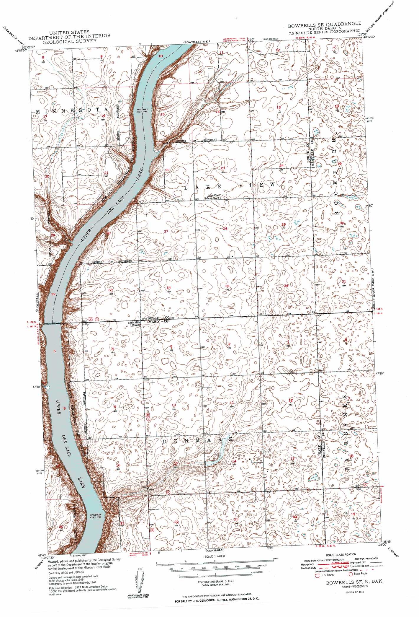
USGS Topo Quad 48102g1 - 1:24,000 scale
| Topo Map Name: | Bowbells Se |
| USGS Topo Quad ID: | 48102g1 |
| Print Size: | ca. 21 1/4" wide x 27" high |
| Southeast Coordinates: | 48.75° N latitude / 102° W longitude |
| Map Center Coordinates: | 48.8125° N latitude / 102.0625° W longitude |
| U.S. State: | ND |
| Filename: | O48102G1.jpg |
| Download Map JPG Image: | Bowbells Se topo map 1:24,000 scale |
| Map Type: | Topographic |
| Topo Series: | 7.5´ |
| Map Scale: | 1:24,000 |
| Source of Map Images: | United States Geological Survey (USGS) |
| Alternate Map Versions: |
Bowbells SE ND 1949, updated 1949 Download PDF Buy paper map Bowbells SE ND 2011 Download PDF Buy paper map Bowbells SE ND 2014 Download PDF Buy paper map |
1:24,000 Topo Quads surrounding Bowbells Se
Northgate |
Bowbells Nw |
Bowbells Ne |
Mouse River Park Nw |
Mouse River Park Ne |
Coteau |
Bowbells |
Bowbells Se |
Mouse River Park Sw |
Mouse River Park |
Vanville Ne |
Niobe |
Kenmare |
Norma |
Tolley |
Westby Lake |
Mosquito Butte |
Coulee |
Donnybrook |
Tolley Se |
> Back to 48102e1 at 1:100,000 scale
> Back to 48102a1 at 1:250,000 scale
> Back to U.S. Topo Maps home
Bowbells Se topo map: Gazetteer
Bowbells Se: Parks
Des Lacs National Wildlife Refuge elevation 584m 1916′Bowbells Se: Populated Places
Nine Mile Corner elevation 581m 1906′Bowbells Se: Streams
Stony Creek elevation 545m 1788′Bowbells Se digital topo map on disk
Buy this Bowbells Se topo map showing relief, roads, GPS coordinates and other geographical features, as a high-resolution digital map file on DVD:
Eastern Montana & Western North Dakota
Buy digital topo maps: Eastern Montana & Western North Dakota