Rennie Lake Topo Map North Dakota
To zoom in, hover over the map of Rennie Lake
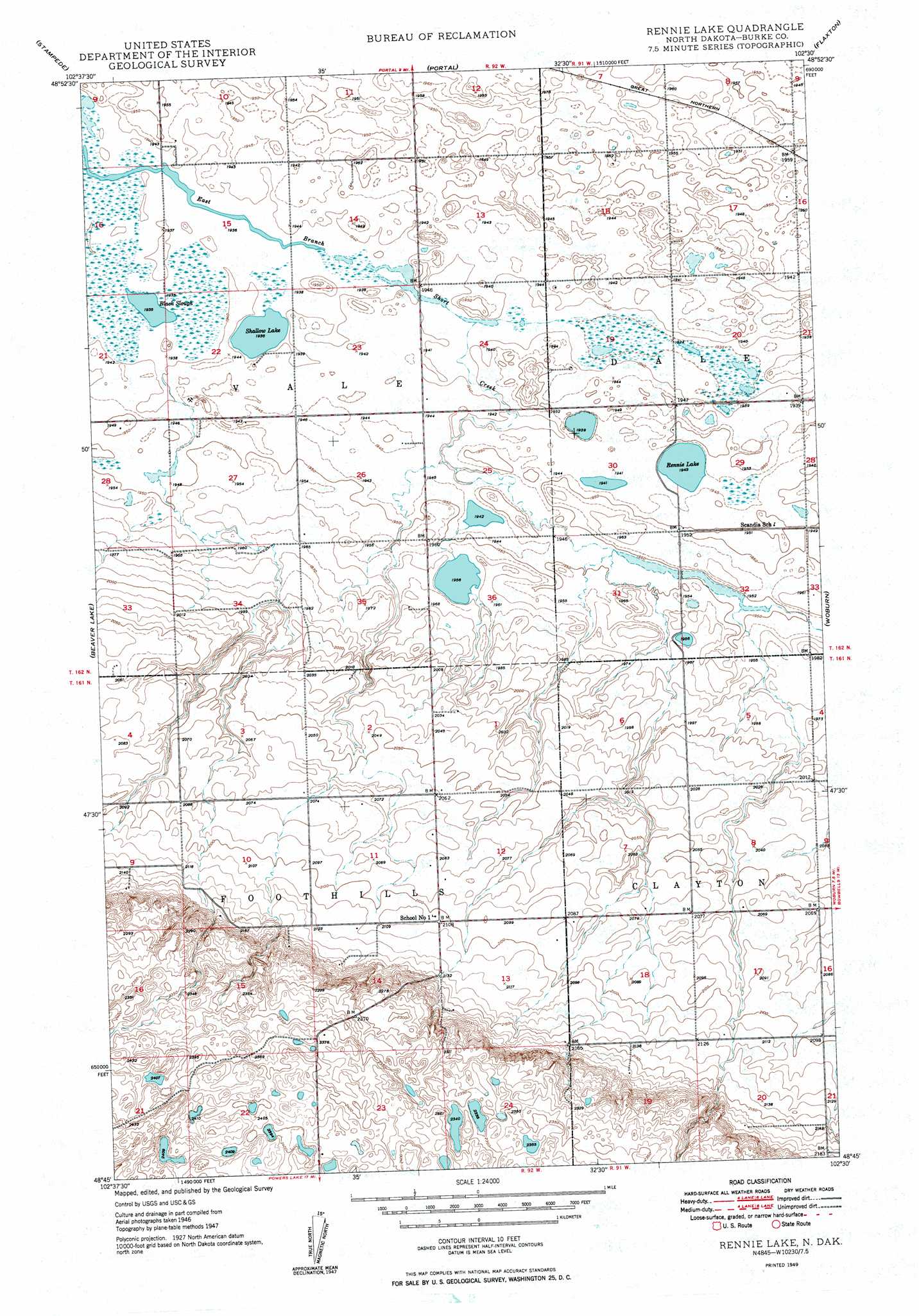
USGS Topo Quad 48102g5 - 1:24,000 scale
| Topo Map Name: | Rennie Lake |
| USGS Topo Quad ID: | 48102g5 |
| Print Size: | ca. 21 1/4" wide x 27" high |
| Southeast Coordinates: | 48.75° N latitude / 102.5° W longitude |
| Map Center Coordinates: | 48.8125° N latitude / 102.5625° W longitude |
| U.S. State: | ND |
| Filename: | O48102G5.jpg |
| Download Map JPG Image: | Rennie Lake topo map 1:24,000 scale |
| Map Type: | Topographic |
| Topo Series: | 7.5´ |
| Map Scale: | 1:24,000 |
| Source of Map Images: | United States Geological Survey (USGS) |
| Alternate Map Versions: |
Rennie Lake ND 1949, updated 1949 Download PDF Buy paper map Rennie Lake ND 2011 Download PDF Buy paper map Rennie Lake ND 2014 Download PDF Buy paper map |
1:24,000 Topo Quads surrounding Rennie Lake
Columbus |
Stampede |
Portal |
Flaxton |
Northgate |
Columbus Se |
Beaver Lake |
Rennie Lake |
Woburn |
Coteau |
Grand View |
Grubb Lake |
Helde Lake |
Thompson Lake |
Vanville Ne |
Battleview |
Powers Lake |
Lunds Valley |
Lostwood Lakes |
Westby Lake |
> Back to 48102e1 at 1:100,000 scale
> Back to 48102a1 at 1:250,000 scale
> Back to U.S. Topo Maps home
Rennie Lake topo map: Gazetteer
Rennie Lake: Guts
Black Slough elevation 590m 1935′Rennie Lake: Lakes
Rennie Lake elevation 593m 1945′Shallow Lake elevation 591m 1938′
Rennie Lake digital topo map on disk
Buy this Rennie Lake topo map showing relief, roads, GPS coordinates and other geographical features, as a high-resolution digital map file on DVD:
Eastern Montana & Western North Dakota
Buy digital topo maps: Eastern Montana & Western North Dakota