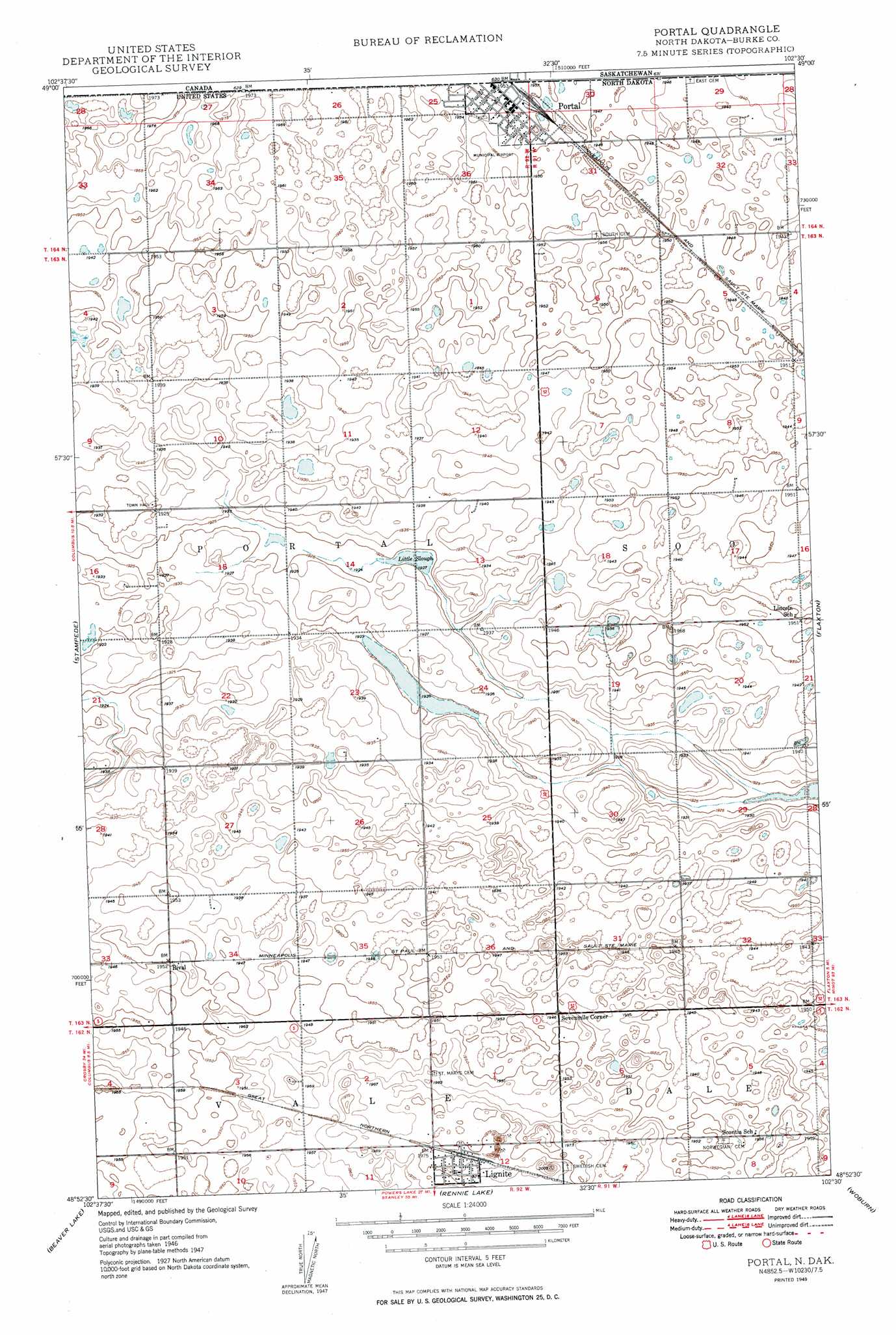
Portal Topo Map North Dakota
To zoom in, hover over the map of Portal
USGS Topo Quad 48102h5 - 1:24,000 scale
| Topo Map Name: | Portal |
| USGS Topo Quad ID: | 48102h5 |
| Print Size: | ca. 21 1/4" wide x 27" high |
| Southeast Coordinates: | 48.875° N latitude / 102.5° W longitude |
| Map Center Coordinates: | 48.9375° N latitude / 102.5625° W longitude |
| U.S. State: | ND |
| Filename: | O48102H5.jpg |
| Download Map JPG Image: | Portal topo map 1:24,000 scale |
| Map Type: | Topographic |
| Topo Series: | 7.5´ |
| Map Scale: | 1:24,000 |
| Source of Map Images: | United States Geological Survey (USGS) |
| Alternate Map Versions: |
Portal ND 1949, updated 1949 Download PDF Buy paper map Portal ND 2011 Download PDF Buy paper map Portal ND 2014 Download PDF Buy paper map |
1:24,000 Topo Quads surrounding Portal
Columbus |
Stampede |
Portal |
Flaxton |
Northgate |
Columbus Se |
Beaver Lake |
Rennie Lake |
Woburn |
Coteau |
Grand View |
Grubb Lake |
Helde Lake |
Thompson Lake |
Vanville Ne |
> Back to 48102e1 at 1:100,000 scale
> Back to 48102a1 at 1:250,000 scale
> Back to U.S. Topo Maps home
Portal topo map: Gazetteer
Portal: Airports
Portal Municipal Airport elevation 595m 1952′Portal: Guts
Little Slough elevation 587m 1925′Portal: Populated Places
Lignite elevation 604m 1981′Portal elevation 596m 1955′
Rival elevation 596m 1955′
Sevenmile Corner elevation 594m 1948′
Portal digital topo map on disk
Buy this Portal topo map showing relief, roads, GPS coordinates and other geographical features, as a high-resolution digital map file on DVD:
Eastern Montana & Western North Dakota
Buy digital topo maps: Eastern Montana & Western North Dakota