Lake Jessie Topo Map North Dakota
To zoom in, hover over the map of Lake Jessie
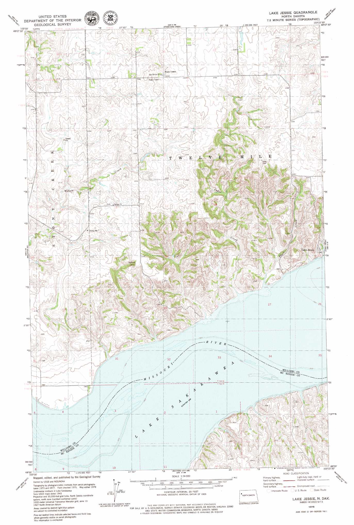
USGS Topo Quad 48103a4 - 1:24,000 scale
| Topo Map Name: | Lake Jessie |
| USGS Topo Quad ID: | 48103a4 |
| Print Size: | ca. 21 1/4" wide x 27" high |
| Southeast Coordinates: | 48° N latitude / 103.375° W longitude |
| Map Center Coordinates: | 48.0625° N latitude / 103.4375° W longitude |
| U.S. State: | ND |
| Filename: | O48103A4.jpg |
| Download Map JPG Image: | Lake Jessie topo map 1:24,000 scale |
| Map Type: | Topographic |
| Topo Series: | 7.5´ |
| Map Scale: | 1:24,000 |
| Source of Map Images: | United States Geological Survey (USGS) |
| Alternate Map Versions: |
Lake Jessie ND 1978, updated 1978 Download PDF Buy paper map Lake Jessie ND 2011 Download PDF Buy paper map Lake Jessie ND 2014 Download PDF Buy paper map |
1:24,000 Topo Quads surrounding Lake Jessie
Otter Tail Creek |
Blacktail Lake Se |
Spring Brook |
Epping |
Ray |
Williston West |
Williston East |
Stockyard Creek |
Gamache Creek |
Cussicks Spring |
Williston Sw |
Williston Se |
Lake Jessie |
Chris Creek |
Banks |
Camp Creek West |
Camp Creek East |
Watford City Nw |
Watford City Ne |
Timber Prong Creek |
Alexander |
Rawson |
Arnegard |
Watford City |
Schafer |
> Back to 48103a1 at 1:100,000 scale
> Back to 48102a1 at 1:250,000 scale
> Back to U.S. Topo Maps home
Lake Jessie topo map: Gazetteer
Lake Jessie: Bends
Little Muddy Cut-off (historical) elevation 561m 1840′Parkers Bend (historical) elevation 561m 1840′
Lake Jessie: Populated Places
Lake Jessie elevation 577m 1893′Lake Jessie: Streams
Cedar Creek elevation 567m 1860′Plum Creek elevation 565m 1853′
Lake Jessie digital topo map on disk
Buy this Lake Jessie topo map showing relief, roads, GPS coordinates and other geographical features, as a high-resolution digital map file on DVD:
Eastern Montana & Western North Dakota
Buy digital topo maps: Eastern Montana & Western North Dakota