Twin Lakes Topo Map North Dakota
To zoom in, hover over the map of Twin Lakes
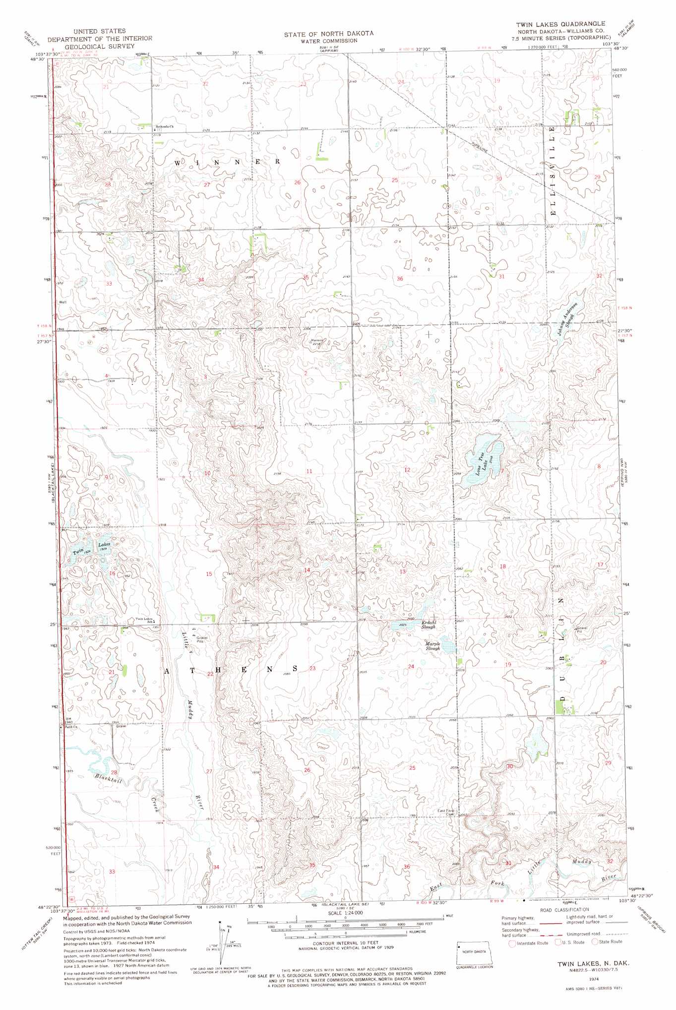
USGS Topo Quad 48103d5 - 1:24,000 scale
| Topo Map Name: | Twin Lakes |
| USGS Topo Quad ID: | 48103d5 |
| Print Size: | ca. 21 1/4" wide x 27" high |
| Southeast Coordinates: | 48.375° N latitude / 103.5° W longitude |
| Map Center Coordinates: | 48.4375° N latitude / 103.5625° W longitude |
| U.S. State: | ND |
| Filename: | O48103D5.jpg |
| Download Map JPG Image: | Twin Lakes topo map 1:24,000 scale |
| Map Type: | Topographic |
| Topo Series: | 7.5´ |
| Map Scale: | 1:24,000 |
| Source of Map Images: | United States Geological Survey (USGS) |
| Alternate Map Versions: |
Twin Lakes ND 1974, updated 1977 Download PDF Buy paper map Twin Lakes ND 2011 Download PDF Buy paper map Twin Lakes ND 2014 Download PDF Buy paper map |
1:24,000 Topo Quads surrounding Twin Lakes
Writing Rock South |
Stady |
Smoky Butte |
Bright Water Lake |
Alamo Ne |
Hanks |
Zahl |
Appam |
Alamo |
Corinth |
Bonetraill |
Blacktail Lake |
Twin Lakes |
Epping Nw |
Epping Ne |
Bonetraill Se |
Otter Tail Creek |
Blacktail Lake Se |
Spring Brook |
Epping |
Trenton Ne |
Williston West |
Williston East |
Stockyard Creek |
Gamache Creek |
> Back to 48103a1 at 1:100,000 scale
> Back to 48102a1 at 1:250,000 scale
> Back to U.S. Topo Maps home
Twin Lakes topo map: Gazetteer
Twin Lakes: Guts
Johnny Anderson Slough elevation 639m 2096′Twin Lakes: Lakes
Erdahl Slough elevation 618m 2027′Lone Tree Lake elevation 625m 2050′
Marple Slough elevation 615m 2017′
Twin Lakes elevation 587m 1925′
Twin Lakes: Streams
Blacktail Creek elevation 580m 1902′Twin Lakes digital topo map on disk
Buy this Twin Lakes topo map showing relief, roads, GPS coordinates and other geographical features, as a high-resolution digital map file on DVD:
Eastern Montana & Western North Dakota
Buy digital topo maps: Eastern Montana & Western North Dakota