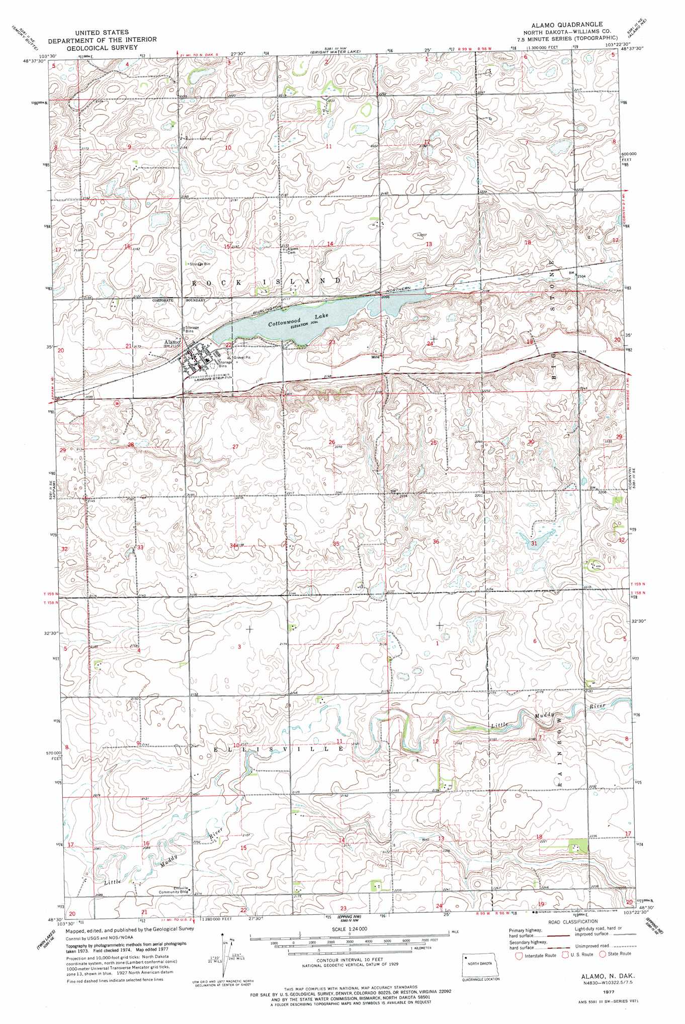
Alamo Topo Map North Dakota
To zoom in, hover over the map of Alamo
USGS Topo Quad 48103e4 - 1:24,000 scale
| Topo Map Name: | Alamo |
| USGS Topo Quad ID: | 48103e4 |
| Print Size: | ca. 21 1/4" wide x 27" high |
| Southeast Coordinates: | 48.5° N latitude / 103.375° W longitude |
| Map Center Coordinates: | 48.5625° N latitude / 103.4375° W longitude |
| U.S. State: | ND |
| Filename: | O48103E4.jpg |
| Download Map JPG Image: | Alamo topo map 1:24,000 scale |
| Map Type: | Topographic |
| Topo Series: | 7.5´ |
| Map Scale: | 1:24,000 |
| Source of Map Images: | United States Geological Survey (USGS) |
| Alternate Map Versions: |
Alamo ND 1977, updated 1978 Download PDF Buy paper map Alamo ND 2011 Download PDF Buy paper map Alamo ND 2014 Download PDF Buy paper map |
1:24,000 Topo Quads surrounding Alamo
Alexandria |
Colgan Se |
Crosby Sw |
Crosby Se |
Noonan Sw |
Stady |
Smoky Butte |
Bright Water Lake |
Alamo Ne |
Wildrose |
Zahl |
Appam |
Alamo |
Corinth |
Tom Berg Lake |
Blacktail Lake |
Twin Lakes |
Epping Nw |
Epping Ne |
Ray Nw |
Otter Tail Creek |
Blacktail Lake Se |
Spring Brook |
Epping |
Ray |
> Back to 48103e1 at 1:100,000 scale
> Back to 48102a1 at 1:250,000 scale
> Back to U.S. Topo Maps home
Alamo topo map: Gazetteer
Alamo: Lakes
Cottonwood Lake elevation 639m 2096′Alamo: Populated Places
Alamo elevation 647m 2122′Alamo digital topo map on disk
Buy this Alamo topo map showing relief, roads, GPS coordinates and other geographical features, as a high-resolution digital map file on DVD:
Eastern Montana & Western North Dakota
Buy digital topo maps: Eastern Montana & Western North Dakota