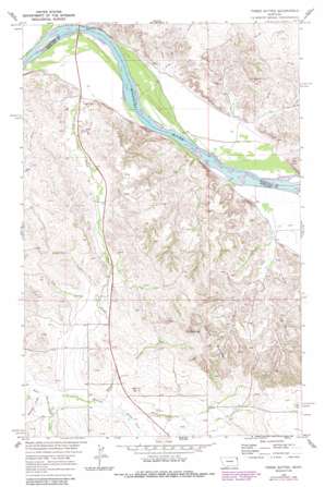
Three Buttes Topo Map Montana
To zoom in, hover over the map of Three Buttes
USGS Topo Quad 48104a4 - 1:24,000 scale
| Topo Map Name: | Three Buttes |
| USGS Topo Quad ID: | 48104a4 |
| Print Size: | ca. 21 1/4" wide x 27" high |
| Southeast Coordinates: | 48° N latitude / 104.375° W longitude |
| Map Center Coordinates: | 48.0625° N latitude / 104.4375° W longitude |
| U.S. State: | MT |
| Filename: | o48104a4.jpg |
| Download Map JPG Image: | Three Buttes topo map 1:24,000 scale |
| Map Type: | Topographic |
| Topo Series: | 7.5´ |
| Map Scale: | 1:24,000 |
| Source of Map Images: | United States Geological Survey (USGS) |
| Alternate Map Versions: |
Three Buttes MT 1969, updated 1973 Download PDF Buy paper map Three Buttes MT 1969, updated 1989 Download PDF Buy paper map Three Buttes MT 2011 Download PDF Buy paper map Three Buttes MT 2014 Download PDF Buy paper map |
1:24,000 Topo Quads surrounding Three Buttes
> Back to 48104a1 at 1:100,000 scale
> Back to 48104a1 at 1:250,000 scale
> Back to U.S. Topo Maps home
Three Buttes topo map: Gazetteer
Three Buttes: Bridges
Culbertson Missouri River Bridge elevation 577m 1893′Three Buttes: Cliffs
The Point elevation 638m 2093′Three Buttes: Streams
Cherry Creek elevation 621m 2037′Day Creek elevation 585m 1919′
Devil Creek elevation 586m 1922′
South Fork Cherry Creek elevation 629m 2063′
Three Buttes: Summits
Three Buttes elevation 765m 2509′Three Buttes: Valleys
Elm Coulee elevation 634m 2080′Goodman Coulee elevation 621m 2037′
Shaw Coulee elevation 632m 2073′
Three Buttes: Wells
26N56E16AADA01 Well elevation 622m 2040′26N57E17ADAA01 Well elevation 720m 2362′
27N56E03CCA_01 Well elevation 581m 1906′
27N56E10CC__01 Well elevation 595m 1952′
27N56E15BB__01 Well elevation 594m 1948′
27N56E22BB__01 Well elevation 620m 2034′
27N56E22DC__01 Well elevation 615m 2017′
27N56E22DC__02 Well elevation 615m 2017′
27N56E22DCBD01 Well elevation 617m 2024′
27N56E22DD__01 Well elevation 622m 2040′
27N56E34AABC01 Well elevation 629m 2063′
27N57E07BDCA01 Well elevation 605m 1984′
27N57E18AB__01 Well elevation 588m 1929′
27N57E19DC__01 Well elevation 595m 1952′
27N57E19DCBD01 Well elevation 586m 1922′
27N57E29AD__01 Well elevation 582m 1909′
27N57E32BACD01 Well elevation 594m 1948′
27N57E32BACD02 Well elevation 595m 1952′
27N57E32BC__01 Well elevation 602m 1975′
27N57E32BC__02 Well elevation 602m 1975′
Three Buttes digital topo map on disk
Buy this Three Buttes topo map showing relief, roads, GPS coordinates and other geographical features, as a high-resolution digital map file on DVD:
Eastern Montana & Western North Dakota
Buy digital topo maps: Eastern Montana & Western North Dakota


