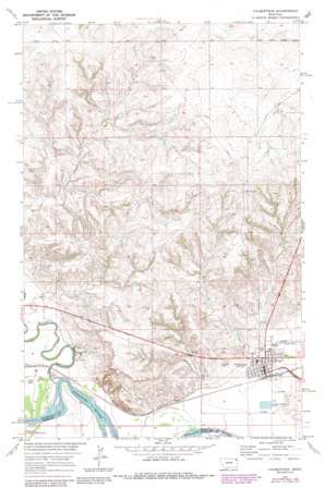
Culbertson Topo Map Montana
To zoom in, hover over the map of Culbertson
USGS Topo Quad 48104b5 - 1:24,000 scale
| Topo Map Name: | Culbertson |
| USGS Topo Quad ID: | 48104b5 |
| Print Size: | ca. 21 1/4" wide x 27" high |
| Southeast Coordinates: | 48.125° N latitude / 104.5° W longitude |
| Map Center Coordinates: | 48.1875° N latitude / 104.5625° W longitude |
| U.S. State: | MT |
| Filename: | o48104b5.jpg |
| Download Map JPG Image: | Culbertson topo map 1:24,000 scale |
| Map Type: | Topographic |
| Topo Series: | 7.5´ |
| Map Scale: | 1:24,000 |
| Source of Map Images: | United States Geological Survey (USGS) |
| Alternate Map Versions: |
Culbertson MT 1969, updated 1973 Download PDF Buy paper map Culbertson MT 1969, updated 1989 Download PDF Buy paper map Culbertson MT 2011 Download PDF Buy paper map Culbertson MT 2014 Download PDF Buy paper map |
1:24,000 Topo Quads surrounding Culbertson
> Back to 48104a1 at 1:100,000 scale
> Back to 48104a1 at 1:250,000 scale
> Back to U.S. Topo Maps home
Culbertson topo map: Gazetteer
Culbertson: Airports
Big Sky Field elevation 595m 1952′Culbertson: Dams
Culbertson Sewage Disposal Ponds Dam elevation 581m 1906′Culbertson: Parks
Bruegger Centennial Park elevation 587m 1925′C C Recreation Complex elevation 591m 1938′
Swimming Pool Park elevation 588m 1929′
Culbertson: Populated Places
Culbertson elevation 589m 1932′Finnicum Mobile Home Park elevation 594m 1948′
Walker Mobile Home Park elevation 594m 1948′
Culbertson: Post Offices
Culbertson Post Office elevation 588m 1929′Culbertson: Streams
Big Muddy Creek elevation 579m 1899′Clover Creek elevation 582m 1909′
Culbertson: Wells
28N55E01CB__01 Well elevation 691m 2267′28N55E22BB__01 Well elevation 599m 1965′
28N55E23ABDB01 Well elevation 647m 2122′
28N55E23AD__01 Well elevation 657m 2155′
28N55E24BA__01 Well elevation 680m 2230′
28N55E24DD__01 Well elevation 647m 2122′
28N55E27AC__01 Well elevation 606m 1988′
28N55E27BA__01 Well elevation 602m 1975′
28N55E28CD__01 Well elevation 587m 1925′
28N55E33DA__01 Well elevation 579m 1899′
28N55E34AA__01 Well elevation 604m 1981′
28N55E34AA__02 Well elevation 604m 1981′
28N55E35AD__01 Well elevation 607m 1991′
28N55E36AA__01 Well elevation 596m 1955′
28N55E36AA__02 Well elevation 596m 1955′
28N55E36AA__03 Well elevation 596m 1955′
28N55E36BD__01 Well elevation 596m 1955′
28N55E36CD__01 Well elevation 580m 1902′
28N56E06AD__01 Well elevation 705m 2312′
28N56E07AA__01 Well elevation 739m 2424′
28N56E07ADCA01 Well elevation 703m 2306′
28N56E20CA__01 Well elevation 608m 1994′
28N56E20CB__01 Well elevation 622m 2040′
28N56E29AC__01 Well elevation 594m 1948′
28N56E29BC__01 Well elevation 595m 1952′
28N56E29BC__02 Well elevation 595m 1952′
28N56E29BC__03 Well elevation 595m 1952′
28N56E29CB__01 Well elevation 592m 1942′
28N56E29CD__01 Well elevation 589m 1932′
28N56E29DB__01 Well elevation 590m 1935′
28N56E29DC__01 Well elevation 585m 1919′
28N56E29DD__01 Well elevation 585m 1919′
28N56E30CC__01 Well elevation 601m 1971′
28N56E30DD__01 Well elevation 593m 1945′
28N56E32AA__01 Well elevation 583m 1912′
28N56E32DB__01 Well elevation 582m 1909′
28N56E32DD__02 Well elevation 584m 1916′
Culbertson digital topo map on disk
Buy this Culbertson topo map showing relief, roads, GPS coordinates and other geographical features, as a high-resolution digital map file on DVD:
Eastern Montana & Western North Dakota
Buy digital topo maps: Eastern Montana & Western North Dakota


