Bull Butte Topo Map Montana
To zoom in, hover over the map of Bull Butte
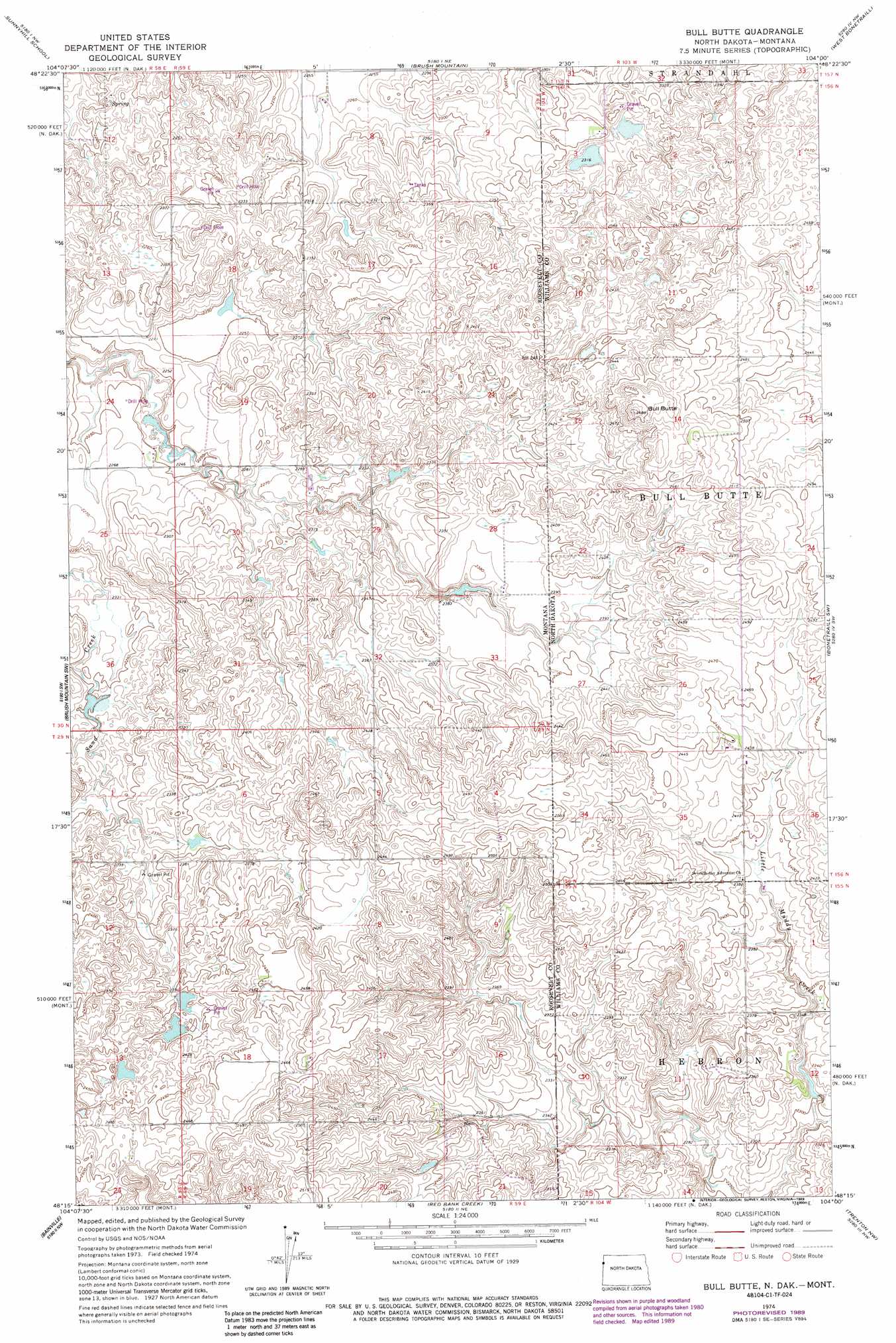
USGS Topo Quad 48104c1 - 1:24,000 scale
| Topo Map Name: | Bull Butte |
| USGS Topo Quad ID: | 48104c1 |
| Print Size: | ca. 21 1/4" wide x 27" high |
| Southeast Coordinates: | 48.25° N latitude / 104° W longitude |
| Map Center Coordinates: | 48.3125° N latitude / 104.0625° W longitude |
| U.S. States: | MT, ND |
| Filename: | o48104c1.jpg |
| Download Map JPG Image: | Bull Butte topo map 1:24,000 scale |
| Map Type: | Topographic |
| Topo Series: | 7.5´ |
| Map Scale: | 1:24,000 |
| Source of Map Images: | United States Geological Survey (USGS) |
| Alternate Map Versions: |
Bull Butte ND 1974, updated 1977 Download PDF Buy paper map Bull Butte ND 1974, updated 1989 Download PDF Buy paper map Bull Butte ND 2011 Download PDF Buy paper map Bull Butte ND 2014 Download PDF Buy paper map |
1:24,000 Topo Quads surrounding Bull Butte
Reserve Se |
Dagmar |
Brush Lake |
Grenora |
Hanks |
Capeneys Lake |
Sunnyhill School |
Brush Mountain |
West Bonetraill |
Bonetraill |
Froid Se |
Brush Mountain Sw |
Bull Butte |
Bonetraill Sw |
Bonetraill Se |
Mccabe East |
Bainville |
Red Bank Creek |
Trenton Nw |
Trenton Ne |
Cedar Coulee |
Bainville Sw |
Bainville Se |
Trenton Sw |
Trenton |
> Back to 48104a1 at 1:100,000 scale
> Back to 48104a1 at 1:250,000 scale
> Back to U.S. Topo Maps home
Bull Butte topo map: Gazetteer
Bull Butte: Dams
Andy Capp Dam elevation 689m 2260′Band Aid Dam elevation 728m 2388′
Horab Dam elevation 729m 2391′
Picard Reservoir Dam elevation 688m 2257′
Bull Butte: Post Offices
Dwyer Post Office (historical) elevation 687m 2253′Bull Butte: Reservoirs
Picard Reservoir elevation 688m 2257′Bull Butte: Summits
Bull Butte elevation 786m 2578′Bull Butte: Wells
29N59E09BDDB01 Well elevation 746m 2447′Bull Butte digital topo map on disk
Buy this Bull Butte topo map showing relief, roads, GPS coordinates and other geographical features, as a high-resolution digital map file on DVD:
Eastern Montana & Western North Dakota
Buy digital topo maps: Eastern Montana & Western North Dakota