Soo Ne Topo Map Montana
To zoom in, hover over the map of Soo Ne
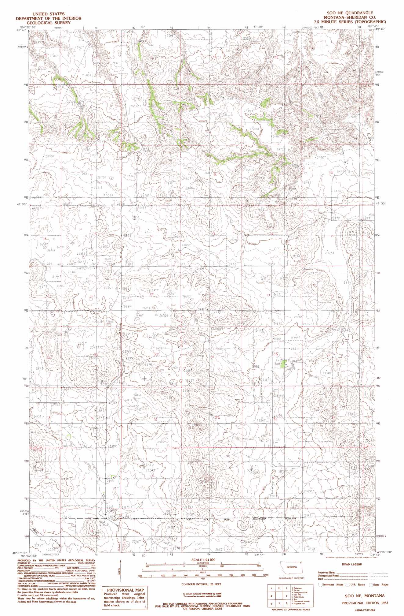
USGS Topo Quad 48104f7 - 1:24,000 scale
| Topo Map Name: | Soo Ne |
| USGS Topo Quad ID: | 48104f7 |
| Print Size: | ca. 21 1/4" wide x 27" high |
| Southeast Coordinates: | 48.625° N latitude / 104.75° W longitude |
| Map Center Coordinates: | 48.6875° N latitude / 104.8125° W longitude |
| U.S. State: | MT |
| Filename: | o48104f7.jpg |
| Download Map JPG Image: | Soo Ne topo map 1:24,000 scale |
| Map Type: | Topographic |
| Topo Series: | 7.5´ |
| Map Scale: | 1:24,000 |
| Source of Map Images: | United States Geological Survey (USGS) |
| Alternate Map Versions: |
Soo NE MT 1983, updated 1983 Download PDF Buy paper map Soo NE MT 2011 Download PDF Buy paper map Soo NE MT 2014 Download PDF Buy paper map |
1:24,000 Topo Quads surrounding Soo Ne
Goodale Coulee |
Daleview |
Outlook |
Plentywood Nw |
Raymond |
Navajo |
Redstone |
Archer |
Plentywood Sw |
Plentywood |
Pleasant Prairie Ne |
Soo Nw |
Soo Ne |
Kisler Butte |
Shippe Canyon |
Pleasant Prairie |
Soo |
Thornwood Ranch |
Flagstaff Hill |
Alkali Coulee |
Hay Creek |
Beam School |
Smoke Creek Ne |
Homestead Nw |
Homestead |
> Back to 48104e1 at 1:100,000 scale
> Back to 48104a1 at 1:250,000 scale
> Back to U.S. Topo Maps home
Soo Ne topo map: Gazetteer
Soo Ne: Post Offices
Welliver Post Office (historical) elevation 725m 2378′Soo Ne: Wells
33N53E02BCBC01 Well elevation 760m 2493′33N53E07AABA01 Well elevation 729m 2391′
34N52E13CDDC01 Well elevation 809m 2654′
34N53E10DDDC01 Well elevation 720m 2362′
34N53E15DCDD01 Well elevation 725m 2378′
34N53E28DCBA01 Well elevation 721m 2365′
Soo Ne digital topo map on disk
Buy this Soo Ne topo map showing relief, roads, GPS coordinates and other geographical features, as a high-resolution digital map file on DVD:
Eastern Montana & Western North Dakota
Buy digital topo maps: Eastern Montana & Western North Dakota