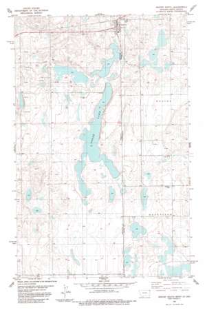
Westby South Topo Map Montana
To zoom in, hover over the map of Westby South
USGS Topo Quad 48104g1 - 1:24,000 scale
| Topo Map Name: | Westby South |
| USGS Topo Quad ID: | 48104g1 |
| Print Size: | ca. 21 1/4" wide x 27" high |
| Southeast Coordinates: | 48.75° N latitude / 104° W longitude |
| Map Center Coordinates: | 48.8125° N latitude / 104.0625° W longitude |
| U.S. States: | MT, ND |
| Filename: | o48104g1.jpg |
| Download Map JPG Image: | Westby South topo map 1:24,000 scale |
| Map Type: | Topographic |
| Topo Series: | 7.5´ |
| Map Scale: | 1:24,000 |
| Source of Map Images: | United States Geological Survey (USGS) |
| Alternate Map Versions: |
Westby South MT 1983, updated 1984 Download PDF Buy paper map Westby South MT 2011 Download PDF Buy paper map Westby South MT 2014 Download PDF Buy paper map |
1:24,000 Topo Quads surrounding Westby South
> Back to 48104e1 at 1:100,000 scale
> Back to 48104a1 at 1:250,000 scale
> Back to U.S. Topo Maps home
Westby South topo map: Gazetteer
Westby South: Lakes
Goose Lake elevation 625m 2050′Westby South: Parks
Noelle Meyer Memorial Park elevation 634m 2080′Onstad Park elevation 634m 2080′
Westby South: Populated Places
Westby elevation 641m 2103′Westby South: Post Offices
Westby Post Office elevation 641m 2103′Westby South: Wells
35N58E01AADA01 Well elevation 633m 2076′35N58E01ACDA01 Well elevation 632m 2073′
35N58E01ADC_01 Well elevation 631m 2070′
35N58E01ADDA01 Well elevation 634m 2080′
35N58E01DABB01 Well elevation 631m 2070′
35N58E01DBAA01 Well elevation 631m 2070′
35N58E01DBDD01 Well elevation 630m 2066′
35N58E24AAAA01 Well elevation 638m 2093′
35N58E24DDDD01 Well elevation 629m 2063′
36N58E23BACA01 Well elevation 661m 2168′
Westby South digital topo map on disk
Buy this Westby South topo map showing relief, roads, GPS coordinates and other geographical features, as a high-resolution digital map file on DVD:
Eastern Montana & Western North Dakota
Buy digital topo maps: Eastern Montana & Western North Dakota


