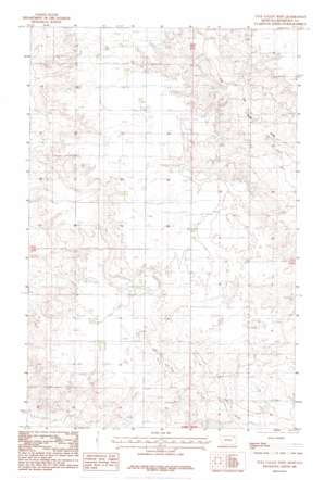
Tule Valley West Topo Map Montana
To zoom in, hover over the map of Tule Valley West
USGS Topo Quad 48105c6 - 1:24,000 scale
| Topo Map Name: | Tule Valley West |
| USGS Topo Quad ID: | 48105c6 |
| Print Size: | ca. 21 1/4" wide x 27" high |
| Southeast Coordinates: | 48.25° N latitude / 105.625° W longitude |
| Map Center Coordinates: | 48.3125° N latitude / 105.6875° W longitude |
| U.S. State: | MT |
| Filename: | o48105c6.jpg |
| Download Map JPG Image: | Tule Valley West topo map 1:24,000 scale |
| Map Type: | Topographic |
| Topo Series: | 7.5´ |
| Map Scale: | 1:24,000 |
| Source of Map Images: | United States Geological Survey (USGS) |
| Alternate Map Versions: |
Tule Valley West MT 1983, updated 1983 Download PDF Buy paper map Tule Valley West MT 2011 Download PDF Buy paper map Tule Valley West MT 2014 Download PDF Buy paper map |
1:24,000 Topo Quads surrounding Tule Valley West
> Back to 48105a1 at 1:100,000 scale
> Back to 48104a1 at 1:250,000 scale
> Back to U.S. Topo Maps home
Tule Valley West topo map: Gazetteer
Tule Valley West: Wells
29N46E01BCDB01 Well elevation 822m 2696′29N46E01BCDB02 Well elevation 824m 2703′
29N46E01BCDB03 Well elevation 824m 2703′
29N46E02DDAC01 Well elevation 818m 2683′
29N46E02DDDB01 Well elevation 816m 2677′
29N46E10DAAB01 Well elevation 824m 2703′
29N46E10DAAC01 Well elevation 824m 2703′
29N46E11DDAC01 Well elevation 822m 2696′
29N47E06CBCC01 Well elevation 818m 2683′
30N46E10DDDB01 Well elevation 830m 2723′
30N46E10DDDB02 Well elevation 830m 2723′
30N46E10DDDB03 Well elevation 830m 2723′
30N46E13CCCC01 Well elevation 829m 2719′
30N46E14DDAC01 Well elevation 829m 2719′
30N46E14DDDD01 Well elevation 829m 2719′
30N46E15CABD01 Well elevation 828m 2716′
30N46E26DCBC01 Well elevation 827m 2713′
30N46E36DAAB01 Well elevation 827m 2713′
30N47E08DBBA01 Well elevation 825m 2706′
30N47E19BBBC01 Well elevation 830m 2723′
30N47E20BBBB01 Well elevation 772m 2532′
30N47E31BCBC01 Well elevation 826m 2709′
30N47E31BCBC02 Well elevation 826m 2709′
30N47E31BCBC03 Well elevation 827m 2713′
Tule Valley West digital topo map on disk
Buy this Tule Valley West topo map showing relief, roads, GPS coordinates and other geographical features, as a high-resolution digital map file on DVD:
Eastern Montana & Western North Dakota
Buy digital topo maps: Eastern Montana & Western North Dakota


