Pleasant Prairie Nw Topo Map Montana
To zoom in, hover over the map of Pleasant Prairie Nw
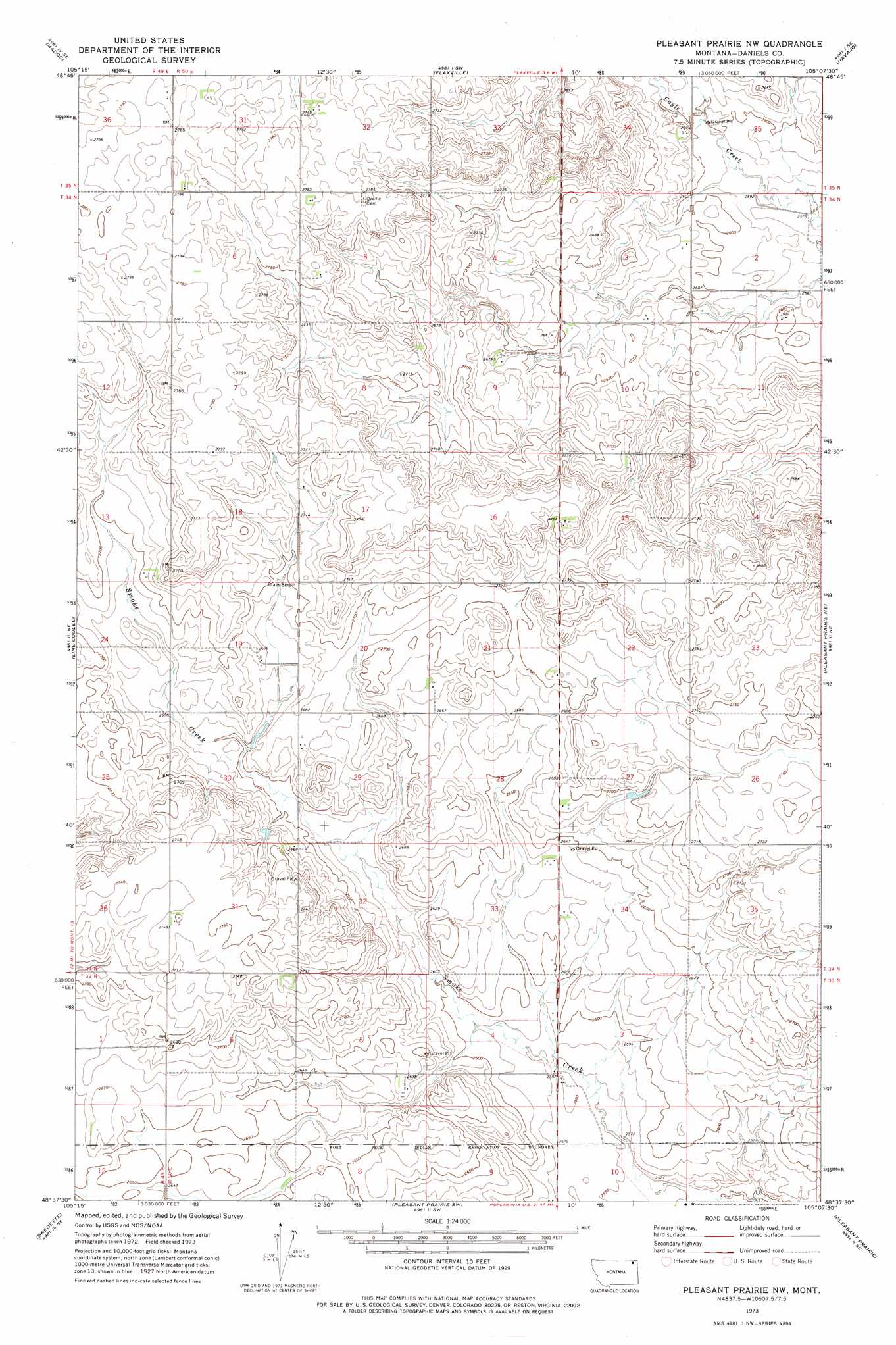
USGS Topo Quad 48105f2 - 1:24,000 scale
| Topo Map Name: | Pleasant Prairie Nw |
| USGS Topo Quad ID: | 48105f2 |
| Print Size: | ca. 21 1/4" wide x 27" high |
| Southeast Coordinates: | 48.625° N latitude / 105.125° W longitude |
| Map Center Coordinates: | 48.6875° N latitude / 105.1875° W longitude |
| U.S. State: | MT |
| Filename: | o48105f2.jpg |
| Download Map JPG Image: | Pleasant Prairie Nw topo map 1:24,000 scale |
| Map Type: | Topographic |
| Topo Series: | 7.5´ |
| Map Scale: | 1:24,000 |
| Source of Map Images: | United States Geological Survey (USGS) |
| Alternate Map Versions: |
Pleasant Prairie NW MT 1973, updated 1976 Download PDF Buy paper map Pleasant Prairie NW MT 2011 Download PDF Buy paper map Pleasant Prairie NW MT 2014 Download PDF Buy paper map |
1:24,000 Topo Quads surrounding Pleasant Prairie Nw
Scobey Nw |
Si Merrell Slough |
Whitetail |
Goodale Coulee |
Daleview |
Scobey |
Madoc |
Flaxville |
Navajo |
Redstone |
Cabarett Coulee |
Line Coulee |
Pleasant Prairie Nw |
Pleasant Prairie Ne |
Soo Nw |
Nielsen Coulee |
Bredette |
Pleasant Prairie Sw |
Pleasant Prairie |
Soo |
Bears Nest |
Windy Butte |
Hay Creek Nw |
Hay Creek |
Beam School |
> Back to 48105e1 at 1:100,000 scale
> Back to 48104a1 at 1:250,000 scale
> Back to U.S. Topo Maps home
Pleasant Prairie Nw topo map: Gazetteer
Pleasant Prairie Nw: Dams
Higgins and Tryan Dam elevation 820m 2690′Pleasant Prairie Nw: Streams
Hay Creek elevation 803m 2634′Pleasant Prairie Nw: Wells
35N50E31CCCD01 Well elevation 851m 2791′35N50E34DAAA01 Well elevation 800m 2624′
Pleasant Prairie Nw digital topo map on disk
Buy this Pleasant Prairie Nw topo map showing relief, roads, GPS coordinates and other geographical features, as a high-resolution digital map file on DVD:
Eastern Montana & Western North Dakota
Buy digital topo maps: Eastern Montana & Western North Dakota