Line Coulee Topo Map Montana
To zoom in, hover over the map of Line Coulee
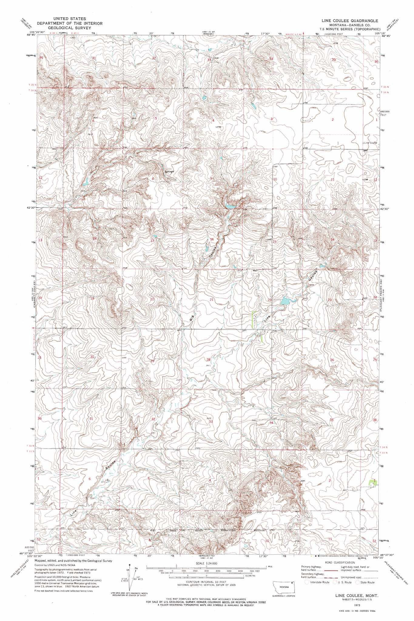
USGS Topo Quad 48105f3 - 1:24,000 scale
| Topo Map Name: | Line Coulee |
| USGS Topo Quad ID: | 48105f3 |
| Print Size: | ca. 21 1/4" wide x 27" high |
| Southeast Coordinates: | 48.625° N latitude / 105.25° W longitude |
| Map Center Coordinates: | 48.6875° N latitude / 105.3125° W longitude |
| U.S. State: | MT |
| Filename: | o48105f3.jpg |
| Download Map JPG Image: | Line Coulee topo map 1:24,000 scale |
| Map Type: | Topographic |
| Topo Series: | 7.5´ |
| Map Scale: | 1:24,000 |
| Source of Map Images: | United States Geological Survey (USGS) |
| Alternate Map Versions: |
Line Coulee MT 1973, updated 1976 Download PDF Buy paper map Line Coulee MT 2011 Download PDF Buy paper map Line Coulee MT 2014 Download PDF Buy paper map |
1:24,000 Topo Quads surrounding Line Coulee
Four Buttes Ne |
Scobey Nw |
Si Merrell Slough |
Whitetail |
Goodale Coulee |
Four Buttes |
Scobey |
Madoc |
Flaxville |
Navajo |
Peerless 4 Ne |
Cabarett Coulee |
Line Coulee |
Pleasant Prairie Nw |
Pleasant Prairie Ne |
Peerless 4 Se |
Nielsen Coulee |
Bredette |
Pleasant Prairie Sw |
Pleasant Prairie |
Reed Springs |
Bears Nest |
Windy Butte |
Hay Creek Nw |
Hay Creek |
> Back to 48105e1 at 1:100,000 scale
> Back to 48104a1 at 1:250,000 scale
> Back to U.S. Topo Maps home
Line Coulee topo map: Gazetteer
Line Coulee: Dams
Danelson Reservoir Dam elevation 768m 2519′Lindquest Number 1 Dam elevation 806m 2644′
Line Coulee: Valleys
Big Coulee elevation 731m 2398′Line Coulee: Wells
34N49E22CADB01 Well elevation 763m 2503′34N49E22CADB02 Well elevation 764m 2506′
34N49E22CCAA01 Well elevation 759m 2490′
34N49E22CCAA02 Well elevation 759m 2490′
34N49E22DCCC01 Well elevation 770m 2526′
34N49E27BAAB01 Well elevation 762m 2500′
34N49E27BABC01 Well elevation 754m 2473′
34N49E30BBBB01 Well elevation 738m 2421′
34N49E33CABB01 Well elevation 737m 2417′
34S49E18ABCC01 Well elevation 756m 2480′
35N49E32BBDB01 Well elevation 779m 2555′
35N49E33ADBB01 Well elevation 805m 2641′
35N49E34DDDA01 Well elevation 852m 2795′
Line Coulee digital topo map on disk
Buy this Line Coulee topo map showing relief, roads, GPS coordinates and other geographical features, as a high-resolution digital map file on DVD:
Eastern Montana & Western North Dakota
Buy digital topo maps: Eastern Montana & Western North Dakota