West Fork Ne Topo Map Montana
To zoom in, hover over the map of West Fork Ne
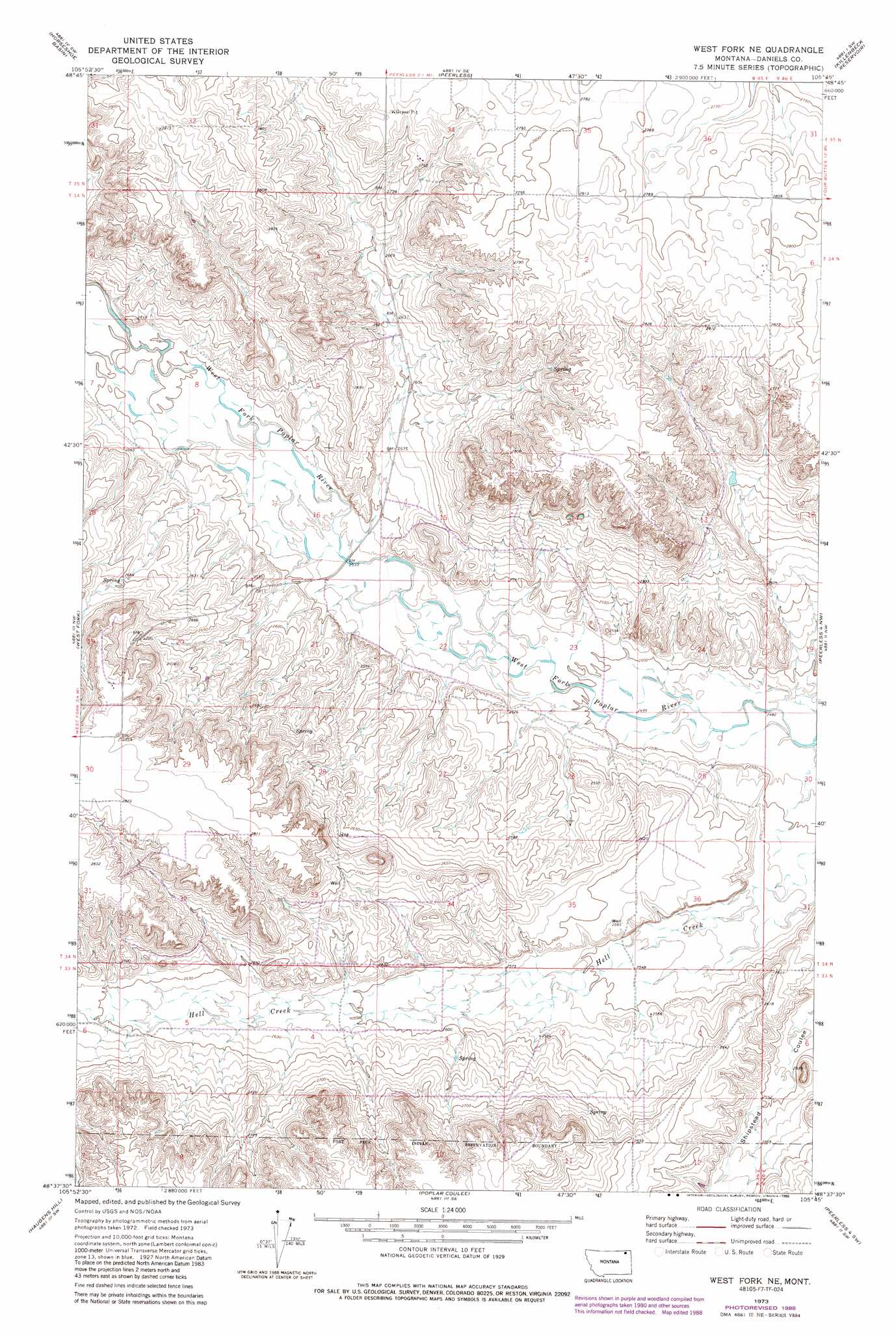
USGS Topo Quad 48105f7 - 1:24,000 scale
| Topo Map Name: | West Fork Ne |
| USGS Topo Quad ID: | 48105f7 |
| Print Size: | ca. 21 1/4" wide x 27" high |
| Southeast Coordinates: | 48.625° N latitude / 105.75° W longitude |
| Map Center Coordinates: | 48.6875° N latitude / 105.8125° W longitude |
| U.S. State: | MT |
| Filename: | o48105f7.jpg |
| Download Map JPG Image: | West Fork Ne topo map 1:24,000 scale |
| Map Type: | Topographic |
| Topo Series: | 7.5´ |
| Map Scale: | 1:24,000 |
| Source of Map Images: | United States Geological Survey (USGS) |
| Alternate Map Versions: |
West Fork NE MT 1973, updated 1976 Download PDF Buy paper map West Fork NE MT 1973, updated 1989 Download PDF Buy paper map West Fork NE MT 2011 Download PDF Buy paper map West Fork NE MT 2014 Download PDF Buy paper map |
1:24,000 Topo Quads surrounding West Fork Ne
Brockway Spring |
Flaherty Coulee |
Carbert |
Four Buttes Nw |
Four Buttes Ne |
Richland |
Horseshoe Basin |
Peerless |
Killenbeck Reservoir |
Four Buttes |
Johnnys Hill |
West Fork |
West Fork Ne |
Peerless 4 Nw |
Peerless 4 Ne |
Blink Springs |
Haugens Hill |
Poplar Coulee |
Peerless 4 Sw |
Peerless 4 Se |
Spring Valley East |
Lustre |
Todd Lakes Ne |
Volt |
Reed Springs |
> Back to 48105e1 at 1:100,000 scale
> Back to 48104a1 at 1:250,000 scale
> Back to U.S. Topo Maps home
West Fork Ne topo map: Gazetteer
West Fork Ne: Streams
Hell Creek elevation 756m 2480′West Fork Ne: Wells
34N45E01ADB_01 Well elevation 857m 2811′34N45E01DAAA01 Well elevation 858m 2814′
34N45E01DAAD01 Well elevation 859m 2818′
34N45E02CCCC01 Well elevation 859m 2818′
34N45E04ADCD01 Well elevation 809m 2654′
34N45E12BDCC01 Well elevation 837m 2746′
35N45E34ACBD01 Well elevation 855m 2805′
35N45E34CCAA01 Well elevation 844m 2769′
West Fork Ne digital topo map on disk
Buy this West Fork Ne topo map showing relief, roads, GPS coordinates and other geographical features, as a high-resolution digital map file on DVD:
Eastern Montana & Western North Dakota
Buy digital topo maps: Eastern Montana & Western North Dakota