West Fork Topo Map Montana
To zoom in, hover over the map of West Fork
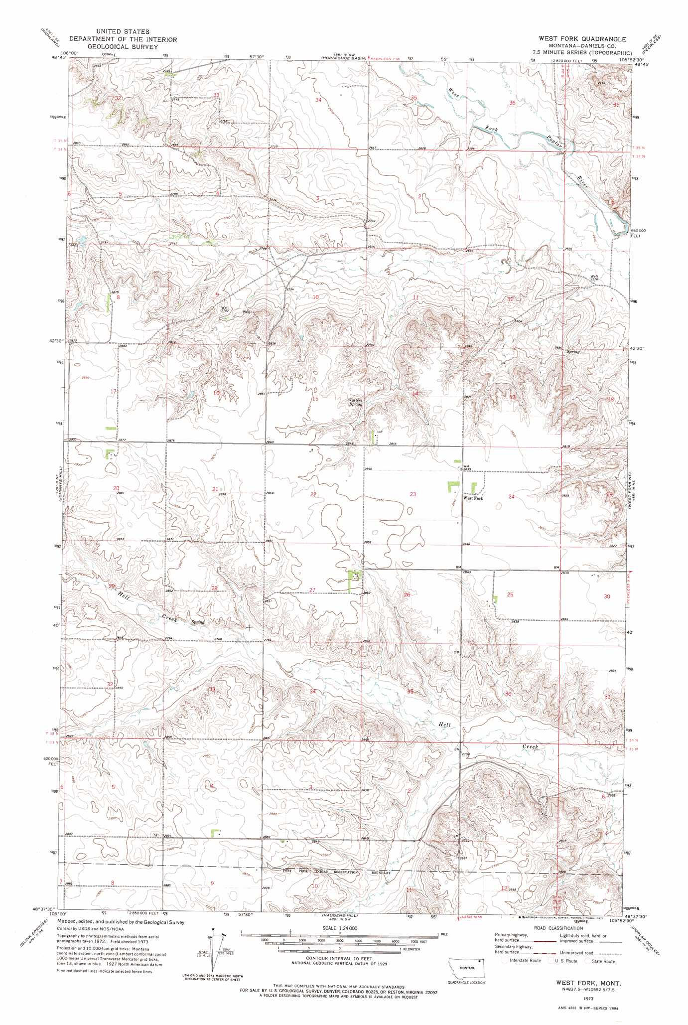
USGS Topo Quad 48105f8 - 1:24,000 scale
| Topo Map Name: | West Fork |
| USGS Topo Quad ID: | 48105f8 |
| Print Size: | ca. 21 1/4" wide x 27" high |
| Southeast Coordinates: | 48.625° N latitude / 105.875° W longitude |
| Map Center Coordinates: | 48.6875° N latitude / 105.9375° W longitude |
| U.S. State: | MT |
| Filename: | o48105f8.jpg |
| Download Map JPG Image: | West Fork topo map 1:24,000 scale |
| Map Type: | Topographic |
| Topo Series: | 7.5´ |
| Map Scale: | 1:24,000 |
| Source of Map Images: | United States Geological Survey (USGS) |
| Alternate Map Versions: |
West Fork MT 1973, updated 1977 Download PDF Buy paper map West Fork MT 2011 Download PDF Buy paper map West Fork MT 2014 Download PDF Buy paper map |
1:24,000 Topo Quads surrounding West Fork
Kaminski Hill |
Brockway Spring |
Flaherty Coulee |
Carbert |
Four Buttes Nw |
Glentana East |
Richland |
Horseshoe Basin |
Peerless |
Killenbeck Reservoir |
Larslan Nw |
Johnnys Hill |
West Fork |
West Fork Ne |
Peerless 4 Nw |
Larslan |
Blink Springs |
Haugens Hill |
Poplar Coulee |
Peerless 4 Sw |
Spring Valley West |
Spring Valley East |
Lustre |
Todd Lakes Ne |
Volt |
> Back to 48105e1 at 1:100,000 scale
> Back to 48104a1 at 1:250,000 scale
> Back to U.S. Topo Maps home
West Fork topo map: Gazetteer
West Fork: Airports
Oglesby Farms Inc Airport elevation 866m 2841′West Fork: Populated Places
West Fork elevation 866m 2841′West Fork: Post Offices
West Fork Post Office (historical) elevation 866m 2841′West Fork: Springs
Walters Spring elevation 850m 2788′West Fork: Wells
33N44E10BABB01 Well elevation 876m 2874′West Fork digital topo map on disk
Buy this West Fork topo map showing relief, roads, GPS coordinates and other geographical features, as a high-resolution digital map file on DVD:
Eastern Montana & Western North Dakota
Buy digital topo maps: Eastern Montana & Western North Dakota