Flaherty Coulee Topo Map Montana
To zoom in, hover over the map of Flaherty Coulee
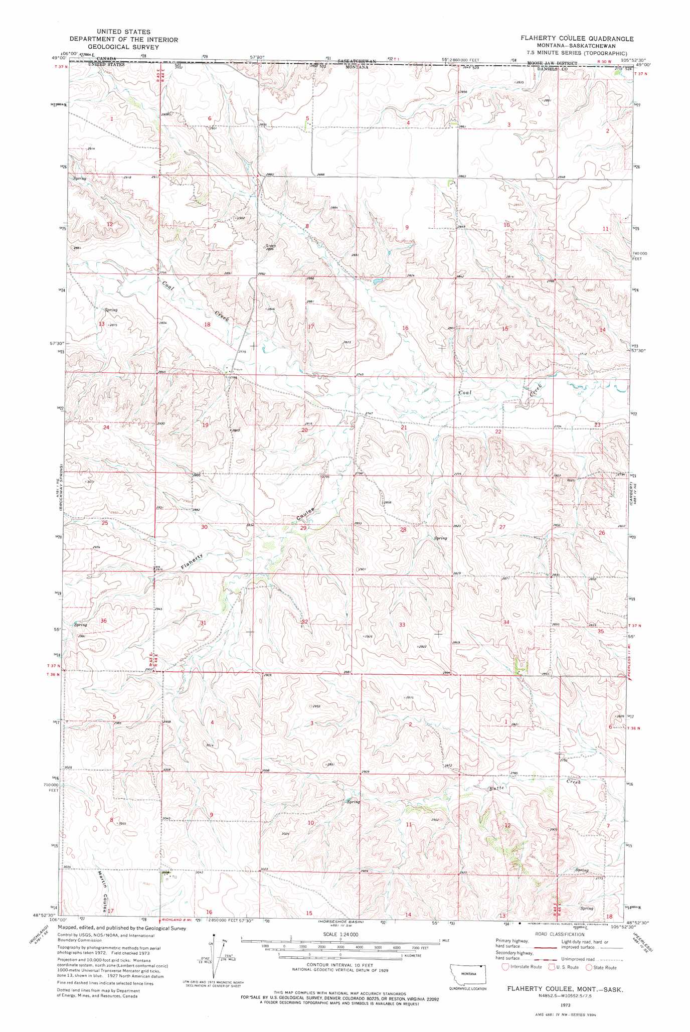
USGS Topo Quad 48105h8 - 1:24,000 scale
| Topo Map Name: | Flaherty Coulee |
| USGS Topo Quad ID: | 48105h8 |
| Print Size: | ca. 21 1/4" wide x 27" high |
| Southeast Coordinates: | 48.875° N latitude / 105.875° W longitude |
| Map Center Coordinates: | 48.9375° N latitude / 105.9375° W longitude |
| U.S. State: | MT |
| Filename: | o48105h8.jpg |
| Download Map JPG Image: | Flaherty Coulee topo map 1:24,000 scale |
| Map Type: | Topographic |
| Topo Series: | 7.5´ |
| Map Scale: | 1:24,000 |
| Source of Map Images: | United States Geological Survey (USGS) |
| Alternate Map Versions: |
Flaherty Coulee MT 1973, updated 1976 Download PDF Buy paper map Flaherty Coulee MT 2011 Download PDF Buy paper map Flaherty Coulee MT 2014 Download PDF Buy paper map |
1:24,000 Topo Quads surrounding Flaherty Coulee
Kaminski Hill |
Brockway Spring |
Flaherty Coulee |
Carbert |
Four Buttes Nw |
Glentana East |
Richland |
Horseshoe Basin |
Peerless |
Killenbeck Reservoir |
Larslan Nw |
Johnnys Hill |
West Fork |
West Fork Ne |
Peerless 4 Nw |
> Back to 48105e1 at 1:100,000 scale
> Back to 48104a1 at 1:250,000 scale
> Back to U.S. Topo Maps home
Flaherty Coulee topo map: Gazetteer
Flaherty Coulee: Valleys
Flaherty Coulee elevation 838m 2749′Flaherty Coulee: Wells
36N44E16BBBD01 Well elevation 928m 3044′37N43E25DDDD01 Well elevation 890m 2919′
37N44E03BCCB01 Well elevation 872m 2860′
37N44E03CDCD01 Well elevation 871m 2857′
37N44E04ADDD01 Well elevation 873m 2864′
37N44E04ADDD02 Well elevation 873m 2864′
37N44E04DCCD01 Well elevation 878m 2880′
37N44E05ACCC01 Well elevation 882m 2893′
37N44E05DBBB01 Well elevation 882m 2893′
37N44E07AAAA01 Well elevation 873m 2864′
37N44E08DBDB01 Well elevation 854m 2801′
37N44E09AAAA01 Well elevation 874m 2867′
37N44E32ADDA01 Well elevation 874m 2867′
Flaherty Coulee digital topo map on disk
Buy this Flaherty Coulee topo map showing relief, roads, GPS coordinates and other geographical features, as a high-resolution digital map file on DVD:
Eastern Montana & Western North Dakota
Buy digital topo maps: Eastern Montana & Western North Dakota