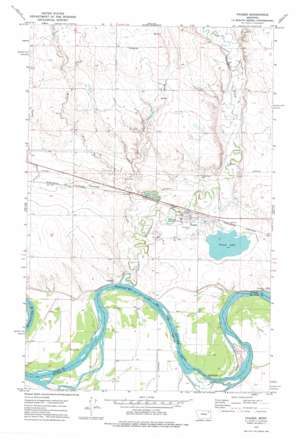
Frazer Topo Map Montana
To zoom in, hover over the map of Frazer
USGS Topo Quad 48106a1 - 1:24,000 scale
| Topo Map Name: | Frazer |
| USGS Topo Quad ID: | 48106a1 |
| Print Size: | ca. 21 1/4" wide x 27" high |
| Southeast Coordinates: | 48° N latitude / 106° W longitude |
| Map Center Coordinates: | 48.0625° N latitude / 106.0625° W longitude |
| U.S. State: | MT |
| Filename: | o48106a1.jpg |
| Download Map JPG Image: | Frazer topo map 1:24,000 scale |
| Map Type: | Topographic |
| Topo Series: | 7.5´ |
| Map Scale: | 1:24,000 |
| Source of Map Images: | United States Geological Survey (USGS) |
| Alternate Map Versions: |
Frazer MT 1972, updated 1975 Download PDF Buy paper map Frazer MT 2011 Download PDF Buy paper map Frazer MT 2014 Download PDF Buy paper map |
1:24,000 Topo Quads surrounding Frazer
> Back to 48106a1 at 1:100,000 scale
> Back to 48106a1 at 1:250,000 scale
> Back to U.S. Topo Maps home
Frazer topo map: Gazetteer
Frazer: Dams
Frazer Lake Dam East elevation 632m 2073′Little Porcupine Dam elevation 630m 2066′
Frazer: Parks
In Memoriam Historical Marker elevation 630m 2066′Frazer: Populated Places
Frazer elevation 628m 2060′Frazer: Post Offices
Blackmon Post Office (historical) elevation 610m 2001′Frazer Post Office elevation 628m 2060′
Frazer: Reservoirs
Frazer Lake elevation 632m 2073′Frazer: Streams
Charley Creek elevation 618m 2027′East Fork Charley Creek elevation 622m 2040′
Hungry Creek elevation 612m 2007′
Kintyre Creek elevation 629m 2063′
Little Porcupine Creek elevation 613m 2011′
West Fork Charley Creek elevation 623m 2043′
Frazer: Wells
26N43E12DD__01 Well elevation 616m 2020′26N43E24AA__01 Well elevation 612m 2007′
26N44E05CC__01 Well elevation 617m 2024′
26N44E05DD__01 Well elevation 612m 2007′
26N44E07AA__01 Well elevation 612m 2007′
26N44E07AD__01 Well elevation 612m 2007′
26N44E07AD__02 Well elevation 612m 2007′
26N44E07BA__01 Well elevation 615m 2017′
26N44E07DA__01 Well elevation 616m 2020′
26N44E07DA__02 Well elevation 616m 2020′
26N44E07DD__01 Well elevation 616m 2020′
26N44E08AA__01 Well elevation 617m 2024′
26N44E08AB__01 Well elevation 617m 2024′
26N44E08AC__01 Well elevation 615m 2017′
26N44E08AC__02 Well elevation 615m 2017′
26N44E08BA__01 Well elevation 615m 2017′
26N44E08BA__02 Well elevation 615m 2017′
26N44E08CB__01 Well elevation 616m 2020′
26N44E08DD__01 Well elevation 615m 2017′
26N44E09AC__01 Well elevation 616m 2020′
26N44E09BC__01 Well elevation 616m 2020′
26N44E09CB__01 Well elevation 614m 2014′
26N44E09CC__01 Well elevation 615m 2017′
26N44E10BC__01 Well elevation 614m 2014′
26N44E11BB__01 Well elevation 615m 2017′
26N44E11CD__01 Well elevation 615m 2017′
26N44E14CC__01 Well elevation 614m 2014′
26N44E15BB__01 Well elevation 613m 2011′
26N44E15BC__01 Well elevation 613m 2011′
26N44E16BC__01 Well elevation 614m 2014′
26N44E16CA__01 Well elevation 613m 2011′
26N44E16CC__01 Well elevation 612m 2007′
26N44E16CC__02 Well elevation 612m 2007′
26N44E17AA__01 Well elevation 615m 2017′
26N44E17AA__02 Well elevation 615m 2017′
26N44E17AA__03 Well elevation 615m 2017′
26N44E17AB__01 Well elevation 616m 2020′
26N44E17BD__01 Well elevation 615m 2017′
26N44E17CB__01 Well elevation 616m 2020′
26N44E17CC__01 Well elevation 615m 2017′
26N44E17CD__01 Well elevation 614m 2014′
26N44E17DB__01 Well elevation 616m 2020′
26N44E17DC__01 Well elevation 615m 2017′
26N44E17DC__02 Well elevation 615m 2017′
26N44E18AA__01 Well elevation 617m 2024′
26N44E18AC__03 Well elevation 616m 2020′
26N44E18AD__01 Well elevation 615m 2017′
26N44E18AD__02 Well elevation 615m 2017′
26N44E18CD__01 Well elevation 614m 2014′
26N44E18DA__01 Well elevation 616m 2020′
26N44E18DC__01 Well elevation 615m 2017′
27N43E25AD__01 Well elevation 625m 2050′
27N44E26CB__01 Well elevation 641m 2103′
27N44E27BC__01 Well elevation 632m 2073′
27N44E27BCCA01 Well elevation 632m 2073′
27N44E28CC__01 Well elevation 620m 2034′
27N44E28DC__01 Well elevation 622m 2040′
27N44E28DD__01 Well elevation 628m 2060′
27N44E31AA__01 Well elevation 637m 2089′
27N44E32CA__01 Well elevation 619m 2030′
27N44E32DC__01 Well elevation 618m 2027′
27N44E33AC__01 Well elevation 628m 2060′
27N44E33AD__01 Well elevation 630m 2066′
27N44E33BC__01 Well elevation 625m 2050′
27N44E34AC__01 Well elevation 632m 2073′
27N44E34ACAB01 Well elevation 635m 2083′
Frazer digital topo map on disk
Buy this Frazer topo map showing relief, roads, GPS coordinates and other geographical features, as a high-resolution digital map file on DVD:
Eastern Montana & Western North Dakota
Buy digital topo maps: Eastern Montana & Western North Dakota


