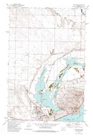
Fort Peck Topo Map Montana
To zoom in, hover over the map of Fort Peck
USGS Topo Quad 48106a4 - 1:24,000 scale
| Topo Map Name: | Fort Peck |
| USGS Topo Quad ID: | 48106a4 |
| Print Size: | ca. 21 1/4" wide x 27" high |
| Southeast Coordinates: | 48° N latitude / 106.375° W longitude |
| Map Center Coordinates: | 48.0625° N latitude / 106.4375° W longitude |
| U.S. State: | MT |
| Filename: | o48106a4.jpg |
| Download Map JPG Image: | Fort Peck topo map 1:24,000 scale |
| Map Type: | Topographic |
| Topo Series: | 7.5´ |
| Map Scale: | 1:24,000 |
| Source of Map Images: | United States Geological Survey (USGS) |
| Alternate Map Versions: |
Fort Peck MT 1972, updated 1975 Download PDF Buy paper map Fort Peck MT 2011 Download PDF Buy paper map Fort Peck MT 2014 Download PDF Buy paper map |
1:24,000 Topo Quads surrounding Fort Peck
> Back to 48106a1 at 1:100,000 scale
> Back to 48106a1 at 1:250,000 scale
> Back to U.S. Topo Maps home
Fort Peck topo map: Gazetteer
Fort Peck: Capes
Jefferson Point elevation 622m 2040′Fort Peck: Dams
Fort Peck Dam elevation 705m 2312′Fort Peck Dam elevation 686m 2250′
Fort Peck: Islands
Duck Island elevation 623m 2043′Scout Island elevation 627m 2057′
Fort Peck: Parks
Big Muddy Park elevation 683m 2240′Coleman Wildlife Park elevation 626m 2053′
Downstream Recreation Area elevation 625m 2050′
Flag Pole Park elevation 668m 2191′
John Hahn Memorial Field elevation 683m 2240′
Mall Park elevation 668m 2191′
Old Fort Peck Historical Marker elevation 708m 2322′
Osage Circle Park elevation 662m 2171′
Trout Pond Recreation Area elevation 622m 2040′
Fort Peck: Populated Places
Cactus Flat (historical) elevation 654m 2145′Delano Heights (historical) elevation 717m 2352′
Fort Peck elevation 670m 2198′
Free Deal (historical) elevation 628m 2060′
Idlewile (historical) elevation 628m 2060′
Lakeview (historical) elevation 716m 2349′
McCone City (historical) elevation 641m 2103′
Midway (historical) elevation 620m 2034′
New Deal (historical) elevation 634m 2080′
Park Dale (historical) elevation 628m 2060′
Park Grove elevation 630m 2066′
Square Deal (historical) elevation 663m 2175′
Fort Peck: Post Offices
Fort Peck Post Office elevation 668m 2191′Galpin Post Office (historical) elevation 655m 2148′
McCone City Post Office (historical) elevation 641m 2103′
New Deal Post Office (historical) elevation 634m 2080′
Fort Peck: Reservoirs
Fort Peck Lake elevation 705m 2312′Fort Peck Trout Pond elevation 620m 2034′
Lake Fort Peck elevation 686m 2250′
Fort Peck: Streams
Duck Creek elevation 620m 2034′Fort Peck: Valleys
Fullerton Coulee elevation 645m 2116′Galpin Coulee elevation 630m 2066′
Fort Peck: Wells
27N41E05DDDC01 Well elevation 656m 2152′Fort Peck digital topo map on disk
Buy this Fort Peck topo map showing relief, roads, GPS coordinates and other geographical features, as a high-resolution digital map file on DVD:
Eastern Montana & Western North Dakota
Buy digital topo maps: Eastern Montana & Western North Dakota


