Milk River Coulee Topo Map Montana
To zoom in, hover over the map of Milk River Coulee
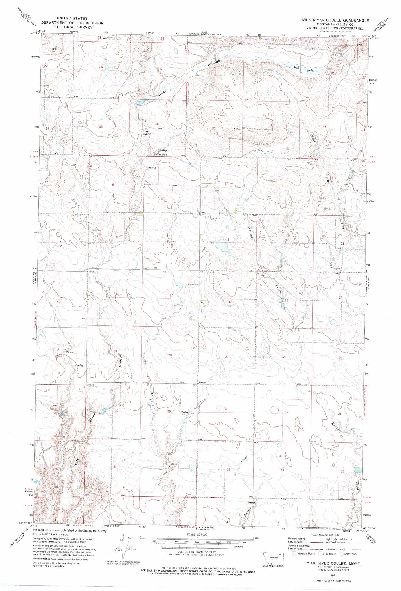
USGS Topo Quad 48106b2 - 1:24,000 scale
| Topo Map Name: | Milk River Coulee |
| USGS Topo Quad ID: | 48106b2 |
| Print Size: | ca. 21 1/4" wide x 27" high |
| Southeast Coordinates: | 48.125° N latitude / 106.125° W longitude |
| Map Center Coordinates: | 48.1875° N latitude / 106.1875° W longitude |
| U.S. State: | MT |
| Filename: | o48106b2.jpg |
| Download Map JPG Image: | Milk River Coulee topo map 1:24,000 scale |
| Map Type: | Topographic |
| Topo Series: | 7.5´ |
| Map Scale: | 1:24,000 |
| Source of Map Images: | United States Geological Survey (USGS) |
| Alternate Map Versions: |
Milk River Coulee MT 1972, updated 1975 Download PDF Buy paper map Milk River Coulee MT 2011 Download PDF Buy paper map Milk River Coulee MT 2014 Download PDF Buy paper map |
1:24,000 Topo Quads surrounding Milk River Coulee
Lookout |
Bullhead Reservoir |
Spring Valley West |
Spring Valley East |
Lustre |
Uhlan Coulee |
Sargent Creek |
Spring Creek Sw |
Hauck Coulee |
Todd Lakes |
Lindeke Coulee |
Nashua |
Milk River Coulee |
Dubbe Reservoir |
Oswego Nw |
Fort Peck |
Milk River Hills |
Kintyre |
Frazer |
Oswego |
York Island |
Bobcat Creek |
Mcrae Springs |
Pasture Creek |
Turtle Creek |
> Back to 48106a1 at 1:100,000 scale
> Back to 48106a1 at 1:250,000 scale
> Back to U.S. Topo Maps home
Milk River Coulee topo map: Gazetteer
Milk River Coulee: Dams
Fort Peck Reservation Number 15 Dam elevation 688m 2257′Milk River Coulee: Swamps
Mud Lake elevation 786m 2578′Milk River Coulee: Wells
28N43E07AABD01 Well elevation 742m 2434′Milk River Coulee digital topo map on disk
Buy this Milk River Coulee topo map showing relief, roads, GPS coordinates and other geographical features, as a high-resolution digital map file on DVD:
Eastern Montana & Western North Dakota
Buy digital topo maps: Eastern Montana & Western North Dakota