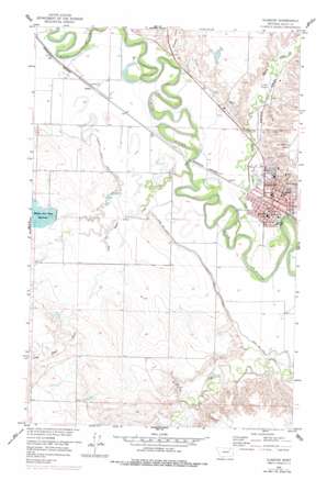
Glasgow Topo Map Montana
To zoom in, hover over the map of Glasgow
USGS Topo Quad 48106b6 - 1:24,000 scale
| Topo Map Name: | Glasgow |
| USGS Topo Quad ID: | 48106b6 |
| Print Size: | ca. 21 1/4" wide x 27" high |
| Southeast Coordinates: | 48.125° N latitude / 106.625° W longitude |
| Map Center Coordinates: | 48.1875° N latitude / 106.6875° W longitude |
| U.S. State: | MT |
| Filename: | o48106b6.jpg |
| Download Map JPG Image: | Glasgow topo map 1:24,000 scale |
| Map Type: | Topographic |
| Topo Series: | 7.5´ |
| Map Scale: | 1:24,000 |
| Source of Map Images: | United States Geological Survey (USGS) |
| Alternate Map Versions: |
Glasgow MT 1958, updated 1960 Download PDF Buy paper map Glasgow MT 1958, updated 1975 Download PDF Buy paper map Glasgow MT 1958, updated 1978 Download PDF Buy paper map Glasgow MT 2011 Download PDF Buy paper map Glasgow MT 2014 Download PDF Buy paper map |
1:24,000 Topo Quads surrounding Glasgow
> Back to 48106a1 at 1:100,000 scale
> Back to 48106a1 at 1:250,000 scale
> Back to U.S. Topo Maps home
Glasgow topo map: Gazetteer
Glasgow: Dams
Glasgow Sewage Lagoon Dam elevation 639m 2096′Little Brazil Number 3 Dam elevation 678m 2224′
Maham and Hoyt Reservoir Dam elevation 645m 2116′
Sweet Carolyn Dam elevation 670m 2198′
Glasgow: Parks
Alumni Park elevation 639m 2096′Buffalo Country Historical Marker elevation 641m 2103′
Bundy Park elevation 642m 2106′
Candy Cane Park elevation 656m 2152′
Hoyt Park elevation 636m 2086′
Red Rock Plaza Park elevation 637m 2089′
Scotty Park elevation 666m 2185′
Glasgow: Populated Places
Glasgow elevation 638m 2093′Glasgow: Post Offices
Glasgow Post Office elevation 637m 2089′Glasgow: Reservoirs
Mahan and Hoyt Reservoir elevation 646m 2119′Glasgow: Streams
Brazil Creek elevation 629m 2063′Cherry Creek elevation 628m 2060′
Little Brazil Creek elevation 637m 2089′
O'Neil Creek elevation 634m 2080′
Glasgow: Valleys
Martin Coulee elevation 651m 2135′Richardson Coulee elevation 641m 2103′
Rock Coulee elevation 651m 2135′
Glasgow: Wells
28N39E08ADCB01 Well elevation 639m 2096′28N39E11CBDD01 Well elevation 635m 2083′
28N39E14CBAD01 Well elevation 635m 2083′
28N39E20ABCC01 Well elevation 644m 2112′
28N39E20CA__01 Well elevation 647m 2122′
28N39E32CCDD01 Well elevation 683m 2240′
29N39E28DCCC01 Well elevation 681m 2234′
Glasgow digital topo map on disk
Buy this Glasgow topo map showing relief, roads, GPS coordinates and other geographical features, as a high-resolution digital map file on DVD:
Eastern Montana & Western North Dakota
Buy digital topo maps: Eastern Montana & Western North Dakota


