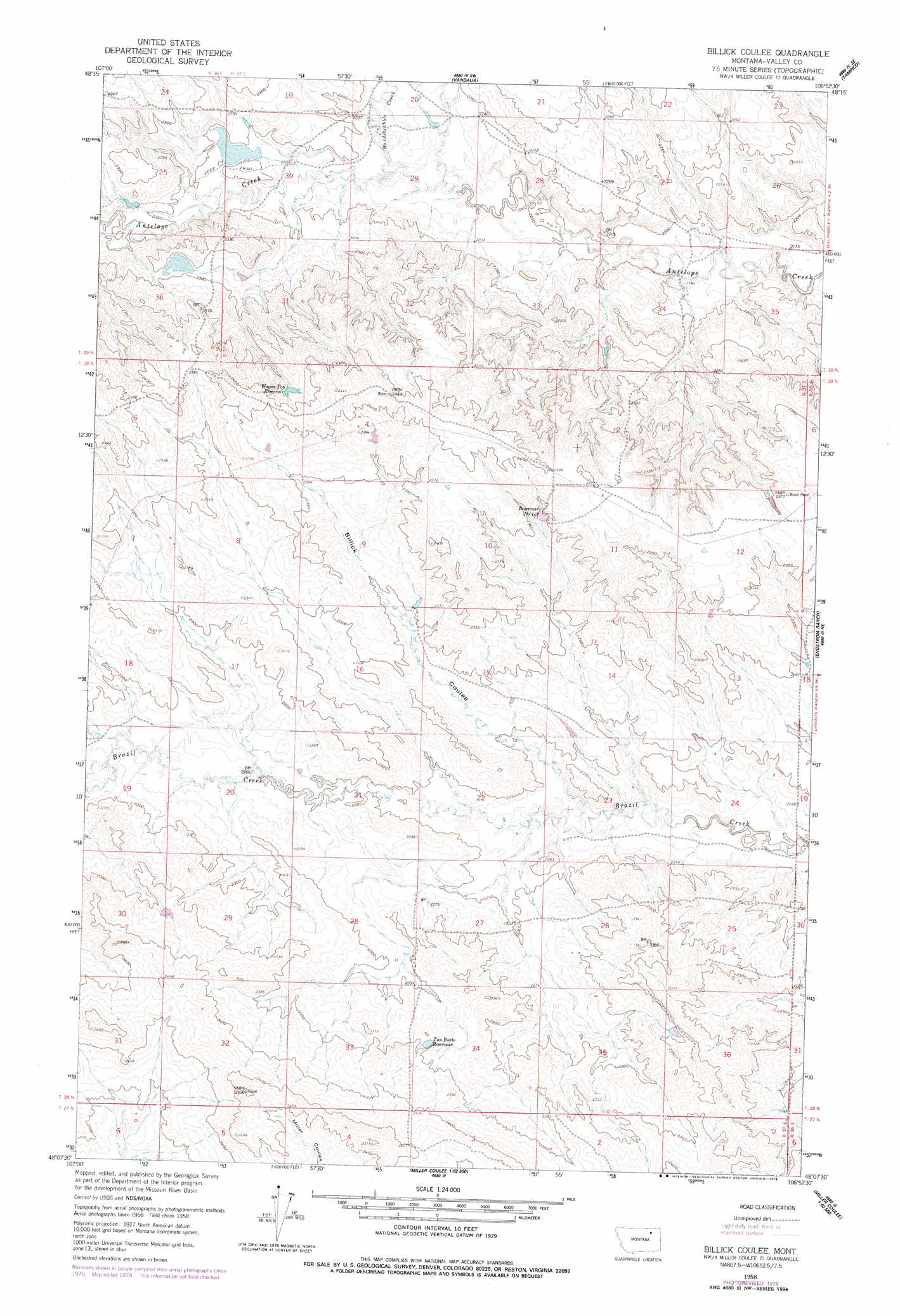
Billick Coulee Topo Map Montana
To zoom in, hover over the map of Billick Coulee
USGS Topo Quad 48106b8 - 1:24,000 scale
| Topo Map Name: | Billick Coulee |
| USGS Topo Quad ID: | 48106b8 |
| Print Size: | ca. 21 1/4" wide x 27" high |
| Southeast Coordinates: | 48.125° N latitude / 106.875° W longitude |
| Map Center Coordinates: | 48.1875° N latitude / 106.9375° W longitude |
| U.S. State: | MT |
| Filename: | o48106b8.jpg |
| Download Map JPG Image: | Billick Coulee topo map 1:24,000 scale |
| Map Type: | Topographic |
| Topo Series: | 7.5´ |
| Map Scale: | 1:24,000 |
| Source of Map Images: | United States Geological Survey (USGS) |
| Alternate Map Versions: |
Billick Coulee MT 1958, updated 1960 Download PDF Buy paper map Billick Coulee MT 1958, updated 1978 Download PDF Buy paper map Billick Coulee MT 2011 Download PDF Buy paper map Billick Coulee MT 2014 Download PDF Buy paper map |
1:24,000 Topo Quads surrounding Billick Coulee
Hinsdale Nw |
Hinsdale |
Ellsworth Coulee |
Tampico Ne |
Cornwell Reservoir |
Ashford Coulee |
Hinsdale Se |
Vandalia |
Tampico |
Chapman Coulee |
Christmas Reservoir |
Hardpan Coulee |
Billick Coulee |
Engstrom Ranch |
Glasgow |
Burnett Flats West |
Burnett Flats East |
Miller Coulee West |
Miller Coulee East |
Blanchard Ranch |
Triple Crossing Res. West |
Triple Crossing Res. East |
Collins Reservoir |
Bomber Coulee |
Lewis Reservoir |
> Back to 48106a1 at 1:100,000 scale
> Back to 48106a1 at 1:250,000 scale
> Back to U.S. Topo Maps home
Billick Coulee topo map: Gazetteer
Billick Coulee: Dams
Carie Dam elevation 696m 2283′Billick Coulee: Reservoirs
Reservoir Number 14 elevation 696m 2283′Reservoir Number One Hundred Forty-eight elevation 715m 2345′
Two Butte Reservoir elevation 717m 2352′
Wagon Top Reservoir elevation 723m 2372′
Billick Coulee: Streams
Hardscrabble Creek elevation 674m 2211′Billick Coulee: Valleys
Billick Coulee elevation 677m 2221′Billick Coulee digital topo map on disk
Buy this Billick Coulee topo map showing relief, roads, GPS coordinates and other geographical features, as a high-resolution digital map file on DVD:
Eastern Montana & Western North Dakota
Buy digital topo maps: Eastern Montana & Western North Dakota