Hauck Coulee Topo Map Montana
To zoom in, hover over the map of Hauck Coulee
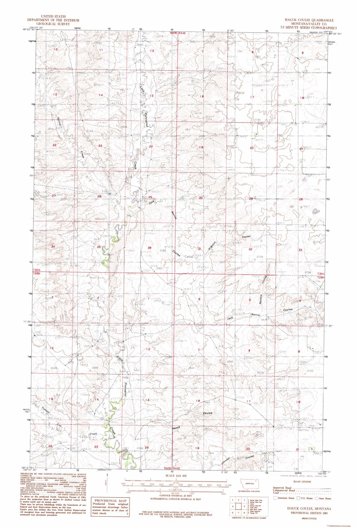
USGS Topo Quad 48106c1 - 1:24,000 scale
| Topo Map Name: | Hauck Coulee |
| USGS Topo Quad ID: | 48106c1 |
| Print Size: | ca. 21 1/4" wide x 27" high |
| Southeast Coordinates: | 48.25° N latitude / 106° W longitude |
| Map Center Coordinates: | 48.3125° N latitude / 106.0625° W longitude |
| U.S. State: | MT |
| Filename: | o48106c1.jpg |
| Download Map JPG Image: | Hauck Coulee topo map 1:24,000 scale |
| Map Type: | Topographic |
| Topo Series: | 7.5´ |
| Map Scale: | 1:24,000 |
| Source of Map Images: | United States Geological Survey (USGS) |
| Alternate Map Versions: |
Hauck Coulee MT 1983, updated 1983 Download PDF Buy paper map Hauck Coulee MT 2011 Download PDF Buy paper map Hauck Coulee MT 2014 Download PDF Buy paper map |
1:24,000 Topo Quads surrounding Hauck Coulee
Baylor Se |
Larslan |
Blink Springs |
Haugens Hill |
Poplar Coulee |
Bullhead Reservoir |
Spring Valley West |
Spring Valley East |
Lustre |
Todd Lakes Ne |
Sargent Creek |
Spring Creek Sw |
Hauck Coulee |
Todd Lakes |
Todd Lakes Se |
Nashua |
Milk River Coulee |
Dubbe Reservoir |
Oswego Nw |
Flynn Creek North |
Milk River Hills |
Kintyre |
Frazer |
Oswego |
Flynn Creek South |
> Back to 48106a1 at 1:100,000 scale
> Back to 48106a1 at 1:250,000 scale
> Back to U.S. Topo Maps home
Hauck Coulee topo map: Gazetteer
Hauck Coulee: Streams
Spring Creek elevation 758m 2486′Tomato Can Creek elevation 736m 2414′
Hauck Coulee: Valleys
Hauck Coulee elevation 729m 2391′Jack Norris Coulee elevation 757m 2483′
Neufeld Coulee elevation 798m 2618′
O'Watch Coulee elevation 785m 2575′
Hauck Coulee: Wells
29N44E09ACDC01 Well elevation 837m 2746′29N44E09ACDD01 Well elevation 836m 2742′
29N44E16DDDC01 Well elevation 834m 2736′
30N44E07DDD_01 Well elevation 853m 2798′
30N44E09CBAB01 Well elevation 845m 2772′
30N44E20ACBA01 Well elevation 856m 2808′
30N44E28DCDB01 Well elevation 848m 2782′
Hauck Coulee digital topo map on disk
Buy this Hauck Coulee topo map showing relief, roads, GPS coordinates and other geographical features, as a high-resolution digital map file on DVD:
Eastern Montana & Western North Dakota
Buy digital topo maps: Eastern Montana & Western North Dakota