Hawk Coulee Topo Map Montana
To zoom in, hover over the map of Hawk Coulee
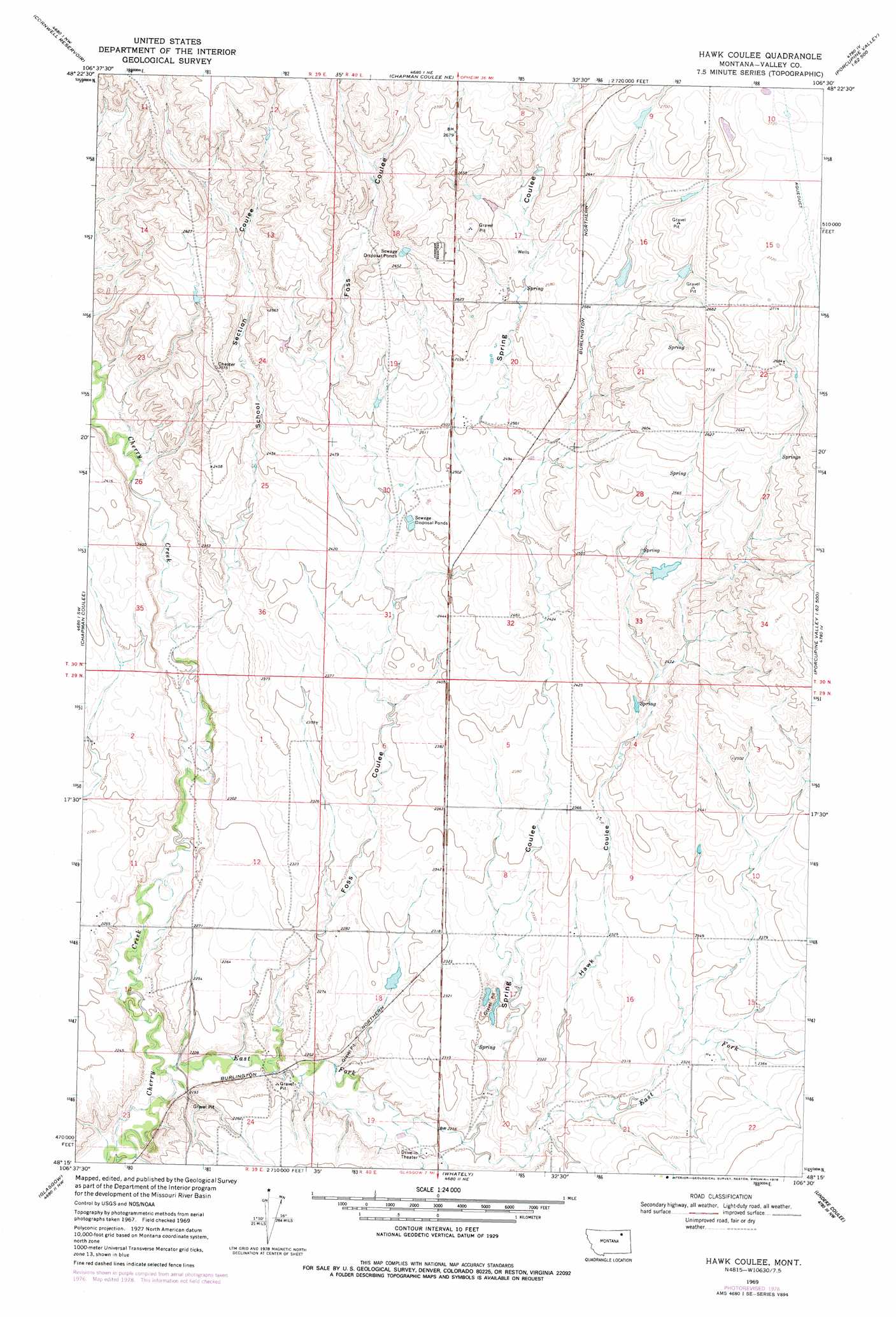
USGS Topo Quad 48106c5 - 1:24,000 scale
| Topo Map Name: | Hawk Coulee |
| USGS Topo Quad ID: | 48106c5 |
| Print Size: | ca. 21 1/4" wide x 27" high |
| Southeast Coordinates: | 48.25° N latitude / 106.5° W longitude |
| Map Center Coordinates: | 48.3125° N latitude / 106.5625° W longitude |
| U.S. State: | MT |
| Filename: | o48106c5.jpg |
| Download Map JPG Image: | Hawk Coulee topo map 1:24,000 scale |
| Map Type: | Topographic |
| Topo Series: | 7.5´ |
| Map Scale: | 1:24,000 |
| Source of Map Images: | United States Geological Survey (USGS) |
| Alternate Map Versions: |
Hawk Coulee MT 1969, updated 1972 Download PDF Buy paper map Hawk Coulee MT 1969, updated 1978 Download PDF Buy paper map Hawk Coulee MT 2011 Download PDF Buy paper map Hawk Coulee MT 2014 Download PDF Buy paper map |
1:24,000 Topo Quads surrounding Hawk Coulee
Laundry Hill |
Forsman Reservoir |
Dry Fork Creek |
Cameron Point |
Baylor Se |
Tampico Ne |
Cornwell Reservoir |
Chapman Coulee Ne |
Lookout |
Bullhead Reservoir |
Tampico |
Chapman Coulee |
Hawk Coulee |
Uhlan Coulee |
Sargent Creek |
Engstrom Ranch |
Glasgow |
Whately |
Lindeke Coulee |
Nashua |
Miller Coulee East |
Blanchard Ranch |
Wheeler |
Fort Peck |
Milk River Hills |
> Back to 48106a1 at 1:100,000 scale
> Back to 48106a1 at 1:250,000 scale
> Back to U.S. Topo Maps home
Hawk Coulee topo map: Gazetteer
Hawk Coulee: Dams
Allie Dam elevation 702m 2303′Big Deal Dam elevation 794m 2604′
Hawk-Eye Dam elevation 817m 2680′
Nyquist Number 1 Dam elevation 768m 2519′
Hawk Coulee: Populated Places
Rose Hill (historical) elevation 823m 2700′Hawk Coulee: Streams
East Fork Cherry Creek elevation 663m 2175′Hawk Coulee: Valleys
Foss Coulee elevation 673m 2208′Hawk Coulee elevation 695m 2280′
School Section Coulee elevation 705m 2312′
Spring Coulee elevation 686m 2250′
Hawk Coulee digital topo map on disk
Buy this Hawk Coulee topo map showing relief, roads, GPS coordinates and other geographical features, as a high-resolution digital map file on DVD:
Eastern Montana & Western North Dakota
Buy digital topo maps: Eastern Montana & Western North Dakota