Chapman Coulee Topo Map Montana
To zoom in, hover over the map of Chapman Coulee
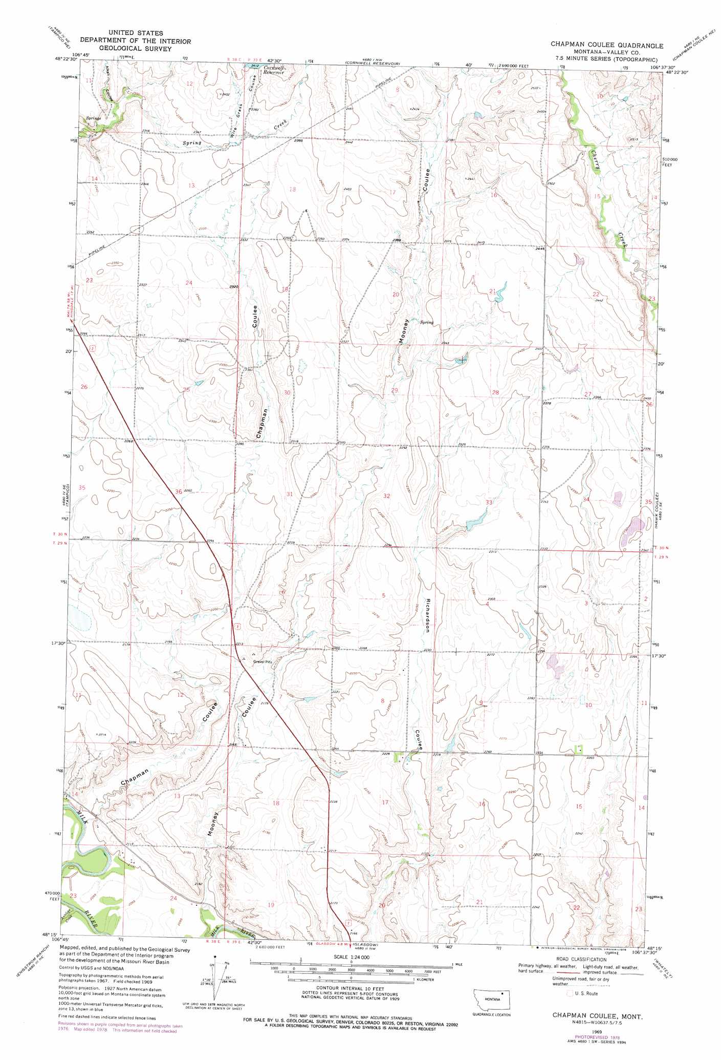
USGS Topo Quad 48106c6 - 1:24,000 scale
| Topo Map Name: | Chapman Coulee |
| USGS Topo Quad ID: | 48106c6 |
| Print Size: | ca. 21 1/4" wide x 27" high |
| Southeast Coordinates: | 48.25° N latitude / 106.625° W longitude |
| Map Center Coordinates: | 48.3125° N latitude / 106.6875° W longitude |
| U.S. State: | MT |
| Filename: | o48106c6.jpg |
| Download Map JPG Image: | Chapman Coulee topo map 1:24,000 scale |
| Map Type: | Topographic |
| Topo Series: | 7.5´ |
| Map Scale: | 1:24,000 |
| Source of Map Images: | United States Geological Survey (USGS) |
| Alternate Map Versions: |
Chapman Coulee MT 1969, updated 1972 Download PDF Buy paper map Chapman Coulee MT 1969, updated 1978 Download PDF Buy paper map Chapman Coulee MT 2011 Download PDF Buy paper map Chapman Coulee MT 2014 Download PDF Buy paper map |
1:24,000 Topo Quads surrounding Chapman Coulee
Miller Springs |
Laundry Hill |
Forsman Reservoir |
Dry Fork Creek |
Cameron Point |
Ellsworth Coulee |
Tampico Ne |
Cornwell Reservoir |
Chapman Coulee Ne |
Lookout |
Vandalia |
Tampico |
Chapman Coulee |
Hawk Coulee |
Uhlan Coulee |
Billick Coulee |
Engstrom Ranch |
Glasgow |
Whately |
Lindeke Coulee |
Miller Coulee West |
Miller Coulee East |
Blanchard Ranch |
Wheeler |
Fort Peck |
> Back to 48106a1 at 1:100,000 scale
> Back to 48106a1 at 1:250,000 scale
> Back to U.S. Topo Maps home
Chapman Coulee topo map: Gazetteer
Chapman Coulee: Dams
Cornwall Dam elevation 742m 2434′The Man Dam elevation 703m 2306′
Chapman Coulee: Populated Places
Riverside (historical) elevation 642m 2106′Chapman Coulee: Reservoirs
Cornwell Reservoir elevation 735m 2411′Chapman Coulee: Streams
Antelope Creek elevation 633m 2076′Chapman Coulee: Valleys
Alkali Coulee elevation 698m 2290′Chapman Coulee elevation 639m 2096′
Mooney Coulee elevation 638m 2093′
Wire Grass Coulee elevation 718m 2355′
Chapman Coulee digital topo map on disk
Buy this Chapman Coulee topo map showing relief, roads, GPS coordinates and other geographical features, as a high-resolution digital map file on DVD:
Eastern Montana & Western North Dakota
Buy digital topo maps: Eastern Montana & Western North Dakota