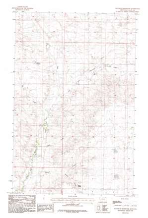
Bullhead Reservoir Topo Map Montana
To zoom in, hover over the map of Bullhead Reservoir
USGS Topo Quad 48106d3 - 1:24,000 scale
| Topo Map Name: | Bullhead Reservoir |
| USGS Topo Quad ID: | 48106d3 |
| Print Size: | ca. 21 1/4" wide x 27" high |
| Southeast Coordinates: | 48.375° N latitude / 106.25° W longitude |
| Map Center Coordinates: | 48.4375° N latitude / 106.3125° W longitude |
| U.S. State: | MT |
| Filename: | o48106d3.jpg |
| Download Map JPG Image: | Bullhead Reservoir topo map 1:24,000 scale |
| Map Type: | Topographic |
| Topo Series: | 7.5´ |
| Map Scale: | 1:24,000 |
| Source of Map Images: | United States Geological Survey (USGS) |
| Alternate Map Versions: |
Bullhead Reservoir MT 1983, updated 1983 Download PDF Buy paper map Bullhead Reservoir MT 2011 Download PDF Buy paper map Bullhead Reservoir MT 2014 Download PDF Buy paper map |
1:24,000 Topo Quads surrounding Bullhead Reservoir
> Back to 48106a1 at 1:100,000 scale
> Back to 48106a1 at 1:250,000 scale
> Back to U.S. Topo Maps home
Bullhead Reservoir topo map: Gazetteer
Bullhead Reservoir: Areas
Three Forks elevation 788m 2585′Bullhead Reservoir: Dams
Fort Peck Reservation Number 11 Dam elevation 805m 2641′Bullhead Reservoir: Reservoirs
Bullhead Reservoir elevation 806m 2644′Bullhead Reservoir: Springs
Gillman Spring elevation 826m 2709′Bullhead Reservoir: Valleys
Black Coulee elevation 755m 2477′Bonnies Coulee elevation 772m 2532′
Hay Coulee elevation 764m 2506′
Spring Coulee elevation 747m 2450′
The Pass elevation 794m 2604′
Bullhead Reservoir: Wells
30N42E04DCDA01 Well elevation 842m 2762′30N42E08BBAA01 Well elevation 832m 2729′
31N42E27BABA01 Well elevation 861m 2824′
31N42E28DCDD01 Well elevation 849m 2785′
Bullhead Reservoir digital topo map on disk
Buy this Bullhead Reservoir topo map showing relief, roads, GPS coordinates and other geographical features, as a high-resolution digital map file on DVD:
Eastern Montana & Western North Dakota
Buy digital topo maps: Eastern Montana & Western North Dakota


