Forsman Reservoir Topo Map Montana
To zoom in, hover over the map of Forsman Reservoir
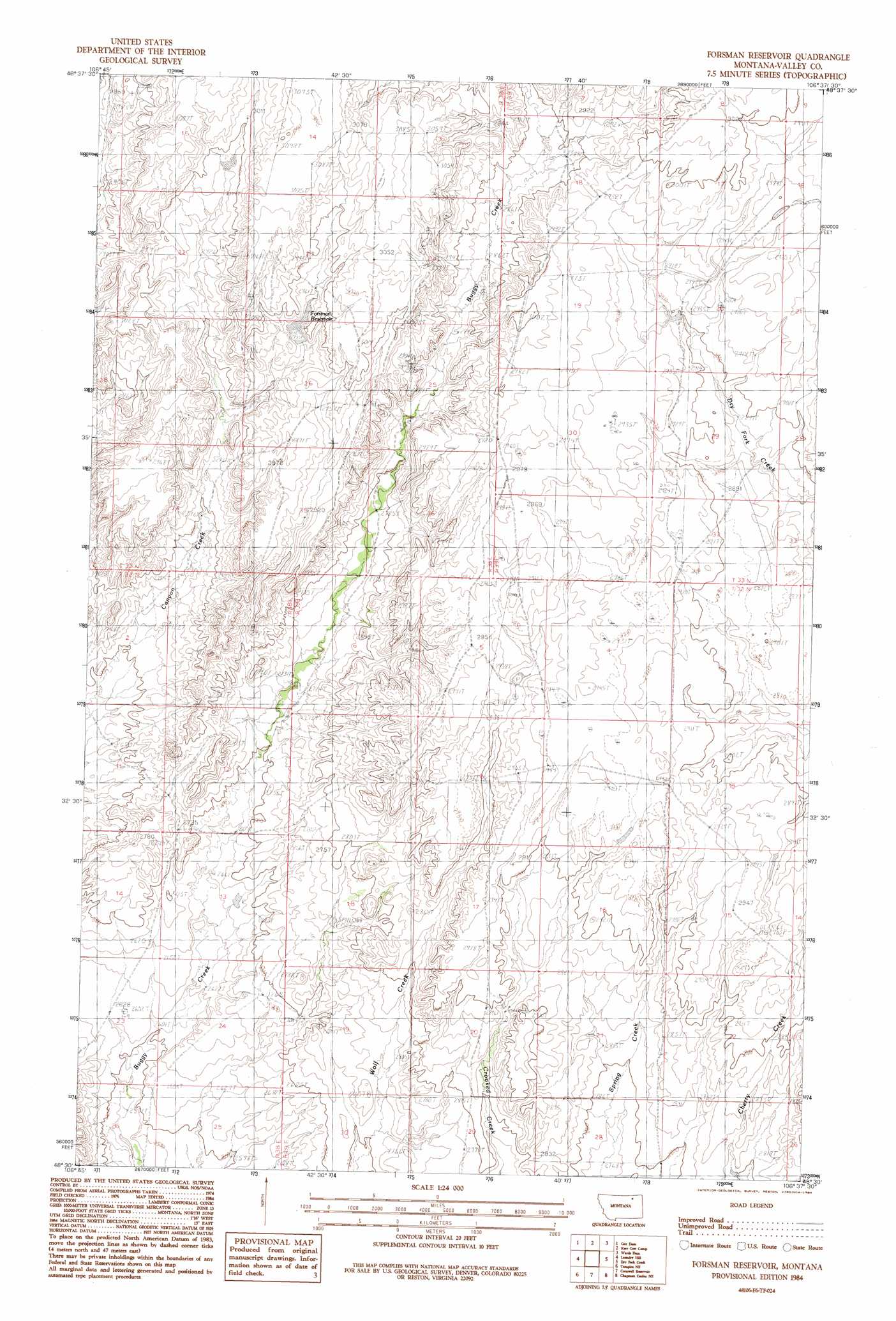
USGS Topo Quad 48106e6 - 1:24,000 scale
| Topo Map Name: | Forsman Reservoir |
| USGS Topo Quad ID: | 48106e6 |
| Print Size: | ca. 21 1/4" wide x 27" high |
| Southeast Coordinates: | 48.5° N latitude / 106.625° W longitude |
| Map Center Coordinates: | 48.5625° N latitude / 106.6875° W longitude |
| U.S. State: | MT |
| Filename: | o48106e6.jpg |
| Download Map JPG Image: | Forsman Reservoir topo map 1:24,000 scale |
| Map Type: | Topographic |
| Topo Series: | 7.5´ |
| Map Scale: | 1:24,000 |
| Source of Map Images: | United States Geological Survey (USGS) |
| Alternate Map Versions: |
Forsman Reservoir MT 1984, updated 1984 Download PDF Buy paper map Forsman Reservoir MT 2011 Download PDF Buy paper map Forsman Reservoir MT 2014 Download PDF Buy paper map |
1:24,000 Topo Quads surrounding Forsman Reservoir
Antelope Pass |
Last Chance Res. |
Dodge Reservoir |
O'Juel Lake |
Opheim |
Burnett Creek |
Gay Dam |
Kerr Cow Camp |
Wards Dam |
Baylor |
Miller Springs |
Laundry Hill |
Forsman Reservoir |
Dry Fork Creek |
Cameron Point |
Ellsworth Coulee |
Tampico Ne |
Cornwell Reservoir |
Chapman Coulee Ne |
Lookout |
Vandalia |
Tampico |
Chapman Coulee |
Hawk Coulee |
Uhlan Coulee |
> Back to 48106e1 at 1:100,000 scale
> Back to 48106a1 at 1:250,000 scale
> Back to U.S. Topo Maps home
Forsman Reservoir topo map: Gazetteer
Forsman Reservoir: Dams
Buggy Reservoir Dam elevation 829m 2719′Forsman Reservoir: Reservoirs
Forsman Reservoir elevation 903m 2962′Forsman Reservoir digital topo map on disk
Buy this Forsman Reservoir topo map showing relief, roads, GPS coordinates and other geographical features, as a high-resolution digital map file on DVD:
Eastern Montana & Western North Dakota
Buy digital topo maps: Eastern Montana & Western North Dakota