Johnnys Hill Topo Map Montana
To zoom in, hover over the map of Johnnys Hill
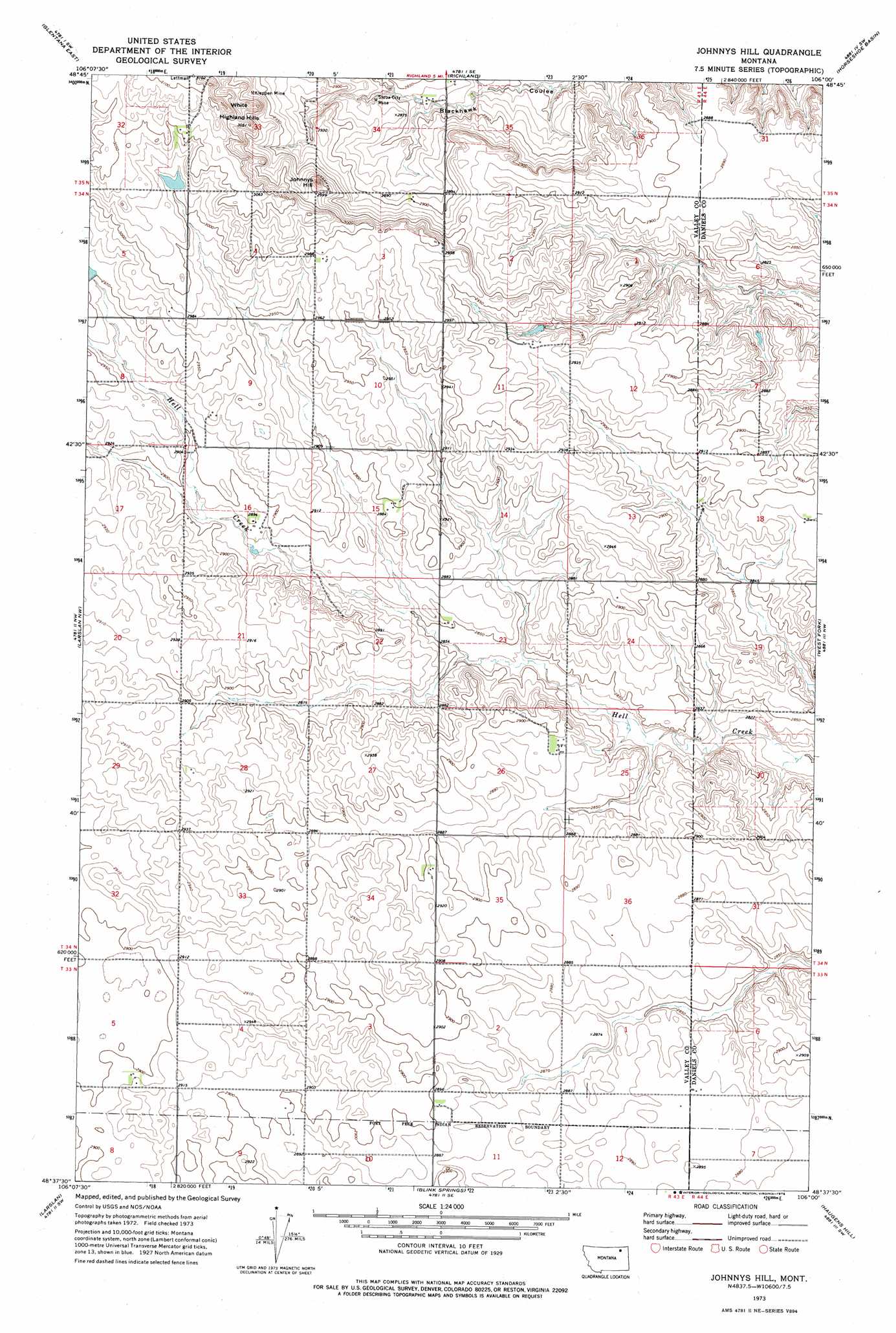
USGS Topo Quad 48106f1 - 1:24,000 scale
| Topo Map Name: | Johnnys Hill |
| USGS Topo Quad ID: | 48106f1 |
| Print Size: | ca. 21 1/4" wide x 27" high |
| Southeast Coordinates: | 48.625° N latitude / 106° W longitude |
| Map Center Coordinates: | 48.6875° N latitude / 106.0625° W longitude |
| U.S. State: | MT |
| Filename: | o48106f1.jpg |
| Download Map JPG Image: | Johnnys Hill topo map 1:24,000 scale |
| Map Type: | Topographic |
| Topo Series: | 7.5´ |
| Map Scale: | 1:24,000 |
| Source of Map Images: | United States Geological Survey (USGS) |
| Alternate Map Versions: |
Johnnys Hill MT 1973, updated 1976 Download PDF Buy paper map Johnnys Hill MT 2011 Download PDF Buy paper map Johnnys Hill MT 2014 Download PDF Buy paper map |
1:24,000 Topo Quads surrounding Johnnys Hill
Glass Hill |
Kaminski Hill |
Brockway Spring |
Flaherty Coulee |
Carbert |
Glentana West |
Glentana East |
Richland |
Horseshoe Basin |
Peerless |
Baylor Ne |
Larslan Nw |
Johnnys Hill |
West Fork |
West Fork Ne |
Baylor Se |
Larslan |
Blink Springs |
Haugens Hill |
Poplar Coulee |
Bullhead Reservoir |
Spring Valley West |
Spring Valley East |
Lustre |
Todd Lakes Ne |
> Back to 48106e1 at 1:100,000 scale
> Back to 48106a1 at 1:250,000 scale
> Back to U.S. Topo Maps home
Johnnys Hill topo map: Gazetteer
Johnnys Hill: Dams
Ghost Number 5 Dam elevation 917m 3008′Johnnys Hill: Mines
Kleppen Mine elevation 906m 2972′Sioux City Mine elevation 873m 2864′
Johnnys Hill: Summits
Johnnys Hill elevation 930m 3051′White Highland Hills elevation 943m 3093′
Johnnys Hill: Wells
33N44E06CCCC01 Well elevation 879m 2883′37N43E32CADB01 Well elevation 880m 2887′
Johnnys Hill digital topo map on disk
Buy this Johnnys Hill topo map showing relief, roads, GPS coordinates and other geographical features, as a high-resolution digital map file on DVD:
Eastern Montana & Western North Dakota
Buy digital topo maps: Eastern Montana & Western North Dakota