Antelope Pass Topo Map Montana
To zoom in, hover over the map of Antelope Pass
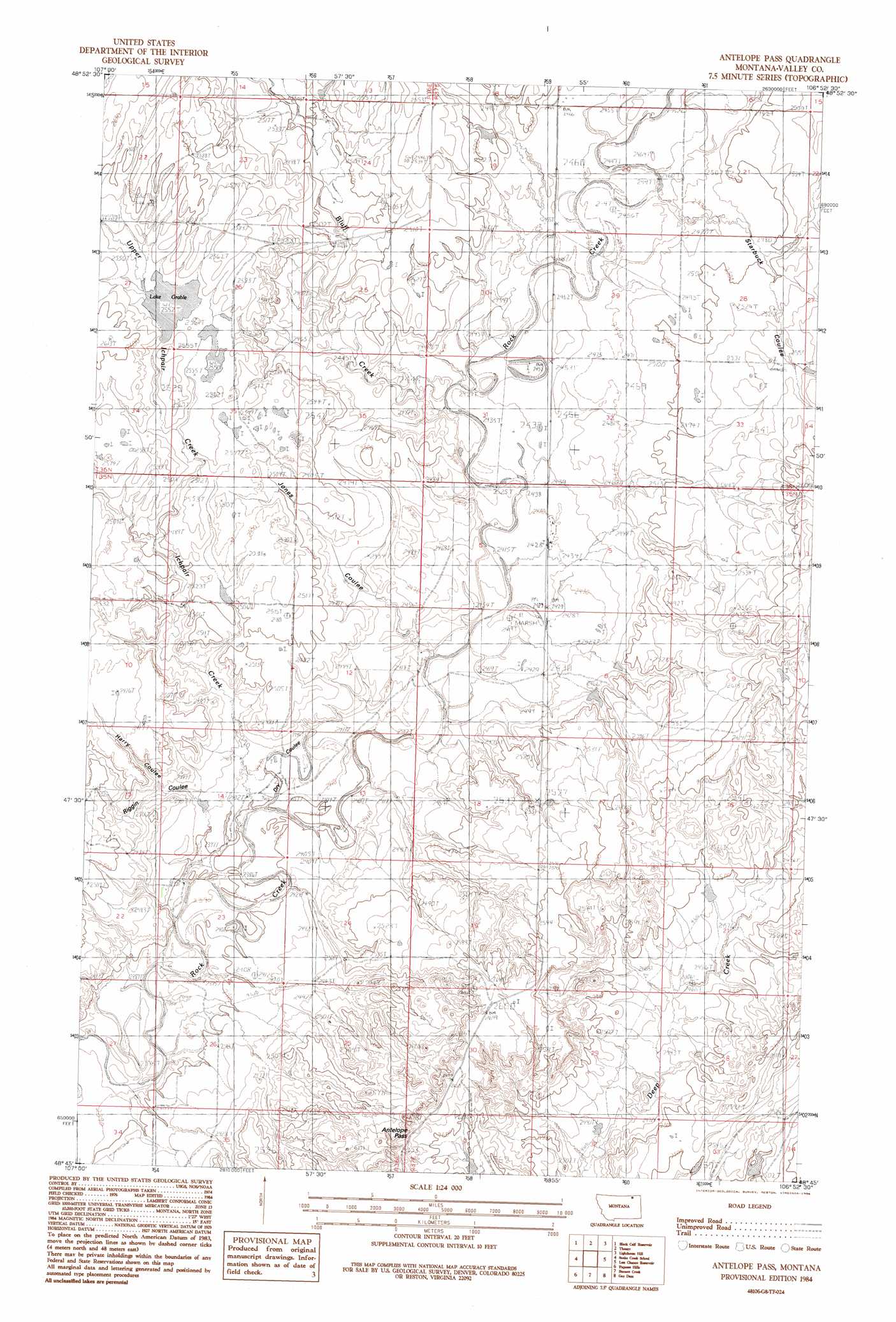
USGS Topo Quad 48106g8 - 1:24,000 scale
| Topo Map Name: | Antelope Pass |
| USGS Topo Quad ID: | 48106g8 |
| Print Size: | ca. 21 1/4" wide x 27" high |
| Southeast Coordinates: | 48.75° N latitude / 106.875° W longitude |
| Map Center Coordinates: | 48.8125° N latitude / 106.9375° W longitude |
| U.S. State: | MT |
| Filename: | o48106g8.jpg |
| Download Map JPG Image: | Antelope Pass topo map 1:24,000 scale |
| Map Type: | Topographic |
| Topo Series: | 7.5´ |
| Map Scale: | 1:24,000 |
| Source of Map Images: | United States Geological Survey (USGS) |
| Alternate Map Versions: |
Antelope Pass MT 1984, updated 1984 Download PDF Buy paper map Antelope Pass MT 2011 Download PDF Buy paper map Antelope Pass MT 2014 Download PDF Buy paper map |
1:24,000 Topo Quads surrounding Antelope Pass
Crow Creek Dam |
Black Calf Reservoir |
Thoeny |
Lighthouse Hill |
Coal Mine Creek West |
Coulter Coulee |
Snake Creek School |
Antelope Pass |
Last Chance Res. |
Dodge Reservoir |
Genevieve |
Papoose Hills |
Burnett Creek |
Gay Dam |
Kerr Cow Camp |
Bjornberg Bridge |
Jones Coulee |
Miller Springs |
Laundry Hill |
Forsman Reservoir |
> Back to 48106e1 at 1:100,000 scale
> Back to 48106a1 at 1:250,000 scale
> Back to U.S. Topo Maps home
Antelope Pass topo map: Gazetteer
Antelope Pass: Dams
John Black Number 4 Dam elevation 777m 2549′Antelope Pass: Gaps
Antelope Pass elevation 805m 2641′Antelope Pass: Lakes
Lake Grable elevation 779m 2555′Antelope Pass: Streams
Bluff Creek elevation 754m 2473′Ichpair Creek elevation 729m 2391′
Upper Ichpair Creek elevation 761m 2496′
Antelope Pass: Valleys
Dry Coulee elevation 732m 2401′Harry Coulee elevation 743m 2437′
Riggin Coulee elevation 729m 2391′
Starbuck Coulee elevation 747m 2450′
Antelope Pass: Wells
36N44E20DDCD01 Well elevation 783m 2568′Antelope Pass digital topo map on disk
Buy this Antelope Pass topo map showing relief, roads, GPS coordinates and other geographical features, as a high-resolution digital map file on DVD:
Eastern Montana & Western North Dakota
Buy digital topo maps: Eastern Montana & Western North Dakota