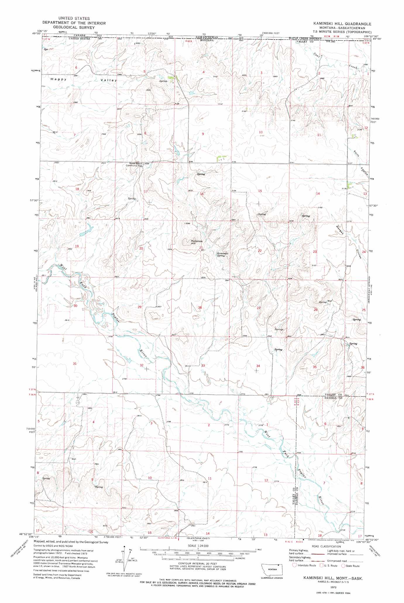
Kaminski Hill Topo Map Montana
To zoom in, hover over the map of Kaminski Hill
USGS Topo Quad 48106h2 - 1:24,000 scale
| Topo Map Name: | Kaminski Hill |
| USGS Topo Quad ID: | 48106h2 |
| Print Size: | ca. 21 1/4" wide x 27" high |
| Southeast Coordinates: | 48.875° N latitude / 106.125° W longitude |
| Map Center Coordinates: | 48.9375° N latitude / 106.1875° W longitude |
| U.S. State: | MT |
| Filename: | o48106h2.jpg |
| Download Map JPG Image: | Kaminski Hill topo map 1:24,000 scale |
| Map Type: | Topographic |
| Topo Series: | 7.5´ |
| Map Scale: | 1:24,000 |
| Source of Map Images: | United States Geological Survey (USGS) |
| Alternate Map Versions: |
Kaminski Hill MT 1973, updated 1976 Download PDF Buy paper map Kaminski Hill MT 2011 Download PDF Buy paper map Kaminski Hill MT 2014 Download PDF Buy paper map |
1:24,000 Topo Quads surrounding Kaminski Hill
Roanwood |
Glass Hill |
Kaminski Hill |
Brockway Spring |
Flaherty Coulee |
Opheim |
Glentana West |
Glentana East |
Richland |
Horseshoe Basin |
Baylor |
Baylor Ne |
Larslan Nw |
Johnnys Hill |
West Fork |
> Back to 48106e1 at 1:100,000 scale
> Back to 48106a1 at 1:250,000 scale
> Back to U.S. Topo Maps home
Kaminski Hill topo map: Gazetteer
Kaminski Hill: Dams
Ghost Number 1 Dam elevation 872m 2860′Kaminski Hill: Springs
Kaminski Spring elevation 895m 2936′Kaminski Hill: Streams
Roanwood Creek elevation 852m 2795′Kaminski Hill: Summits
Kaminski Hill elevation 947m 3106′Kaminski Hill: Wells
36N43E06ADAD01 Well elevation 866m 2841′37N42E02CBCD02 Well elevation 926m 3038′
37N42E05DAAD01 Well elevation 939m 3080′
37N42E05DADA01 Well elevation 939m 3080′
37N42E09DDCC01 Well elevation 955m 3133′
37N42E09DDCD01 Well elevation 955m 3133′
37N42E12CBBA01 Well elevation 956m 3136′
37N42E12CBBA02 Well elevation 956m 3136′
37N42E12CBBA03 Well elevation 956m 3136′
37N42E13BCCB01 Well elevation 951m 3120′
37N42E16AABB01 Well elevation 952m 3123′
37N42E17BAAA01 Well elevation 920m 3018′
37N42E29ABCC01 Well elevation 879m 2883′
37N42E29CACA01 Well elevation 870m 2854′
37N42E34ADBB01 Well elevation 864m 2834′
37N45E02CBCD01 Well elevation 928m 3044′
Kaminski Hill digital topo map on disk
Buy this Kaminski Hill topo map showing relief, roads, GPS coordinates and other geographical features, as a high-resolution digital map file on DVD:
Eastern Montana & Western North Dakota
Buy digital topo maps: Eastern Montana & Western North Dakota