Spencer Point Topo Map Montana
To zoom in, hover over the map of Spencer Point
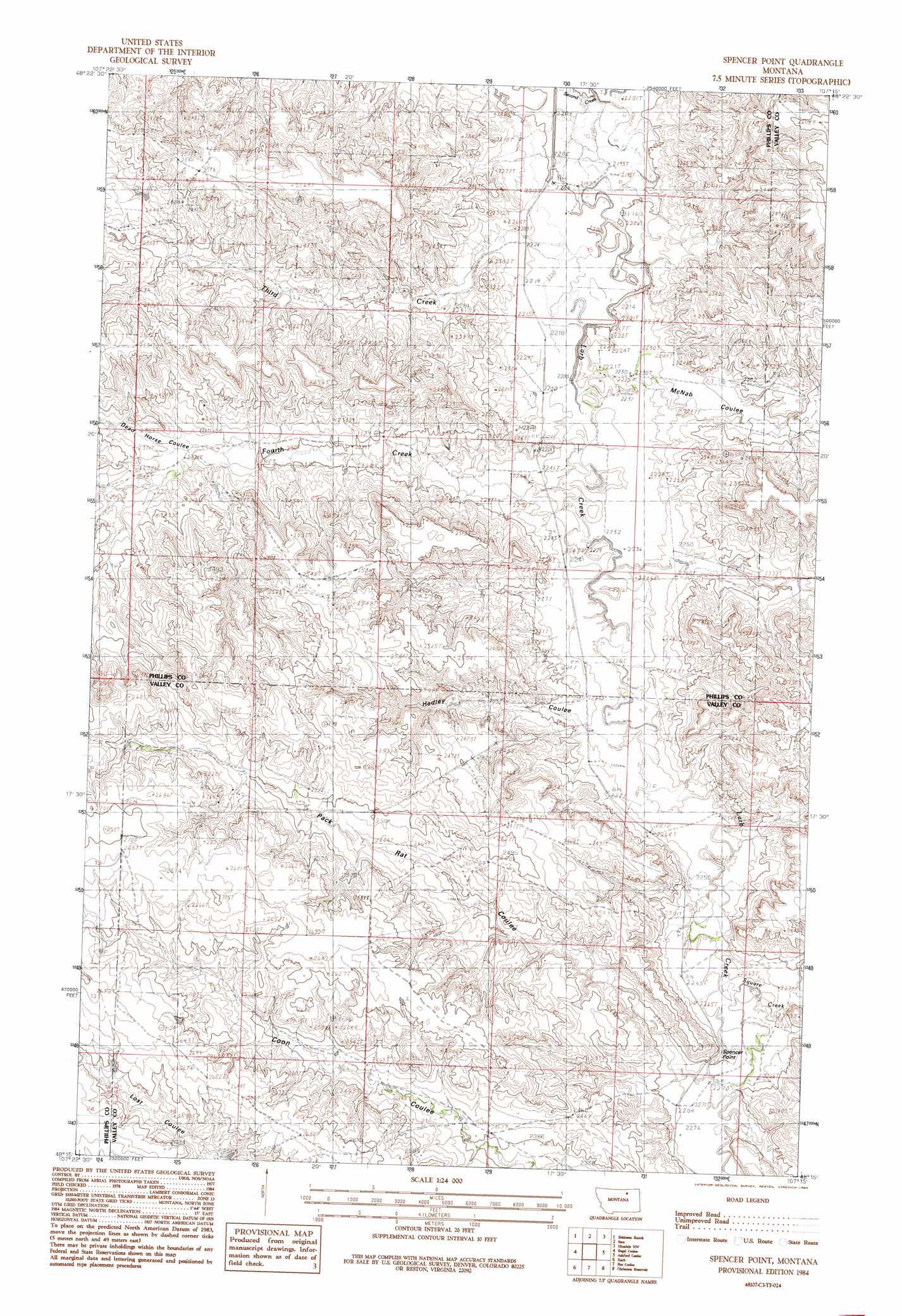
USGS Topo Quad 48107c3 - 1:24,000 scale
| Topo Map Name: | Spencer Point |
| USGS Topo Quad ID: | 48107c3 |
| Print Size: | ca. 21 1/4" wide x 27" high |
| Southeast Coordinates: | 48.25° N latitude / 107.25° W longitude |
| Map Center Coordinates: | 48.3125° N latitude / 107.3125° W longitude |
| U.S. State: | MT |
| Filename: | o48107c3.jpg |
| Download Map JPG Image: | Spencer Point topo map 1:24,000 scale |
| Map Type: | Topographic |
| Topo Series: | 7.5´ |
| Map Scale: | 1:24,000 |
| Source of Map Images: | United States Geological Survey (USGS) |
| Alternate Map Versions: |
Spencer Point MT 1984, updated 1984 Download PDF Buy paper map Spencer Point MT 2011 Download PDF Buy paper map Spencer Point MT 2014 Download PDF Buy paper map |
1:24,000 Topo Quads surrounding Spencer Point
Hewitt Lake |
Cole |
Double S Hill |
Bjornberg Bridge |
Jones Coulee |
Bowdoin |
Robinson Ranch |
Saco |
Hinsdale Nw |
Hinsdale |
Pinks |
Regal Coulee |
Spencer Point |
Ashford Coulee |
Hinsdale Se |
Johnson Dam |
Harb |
Flat Coulee |
Christmas Reservoir |
Hardpan Coulee |
Content |
Harb Sw |
Craig Reservoir |
Burnett Flats West |
Burnett Flats East |
> Back to 48107a1 at 1:100,000 scale
> Back to 48106a1 at 1:250,000 scale
> Back to U.S. Topo Maps home
Spencer Point topo map: Gazetteer
Spencer Point: Dams
Romo Dam elevation 812m 2664′Spencer Point: Streams
Fourth Creek elevation 678m 2224′Square Creek elevation 689m 2260′
Third Creek elevation 677m 2221′
Spencer Point: Summits
Spencer Point elevation 733m 2404′Spencer Point: Valleys
Dead Horse Coulee elevation 706m 2316′Hadley Coulee elevation 682m 2237′
McNab Coulee elevation 672m 2204′
Pack Rat Coulee elevation 688m 2257′
Spencer Point digital topo map on disk
Buy this Spencer Point topo map showing relief, roads, GPS coordinates and other geographical features, as a high-resolution digital map file on DVD:
Eastern Montana & Western North Dakota
Buy digital topo maps: Eastern Montana & Western North Dakota