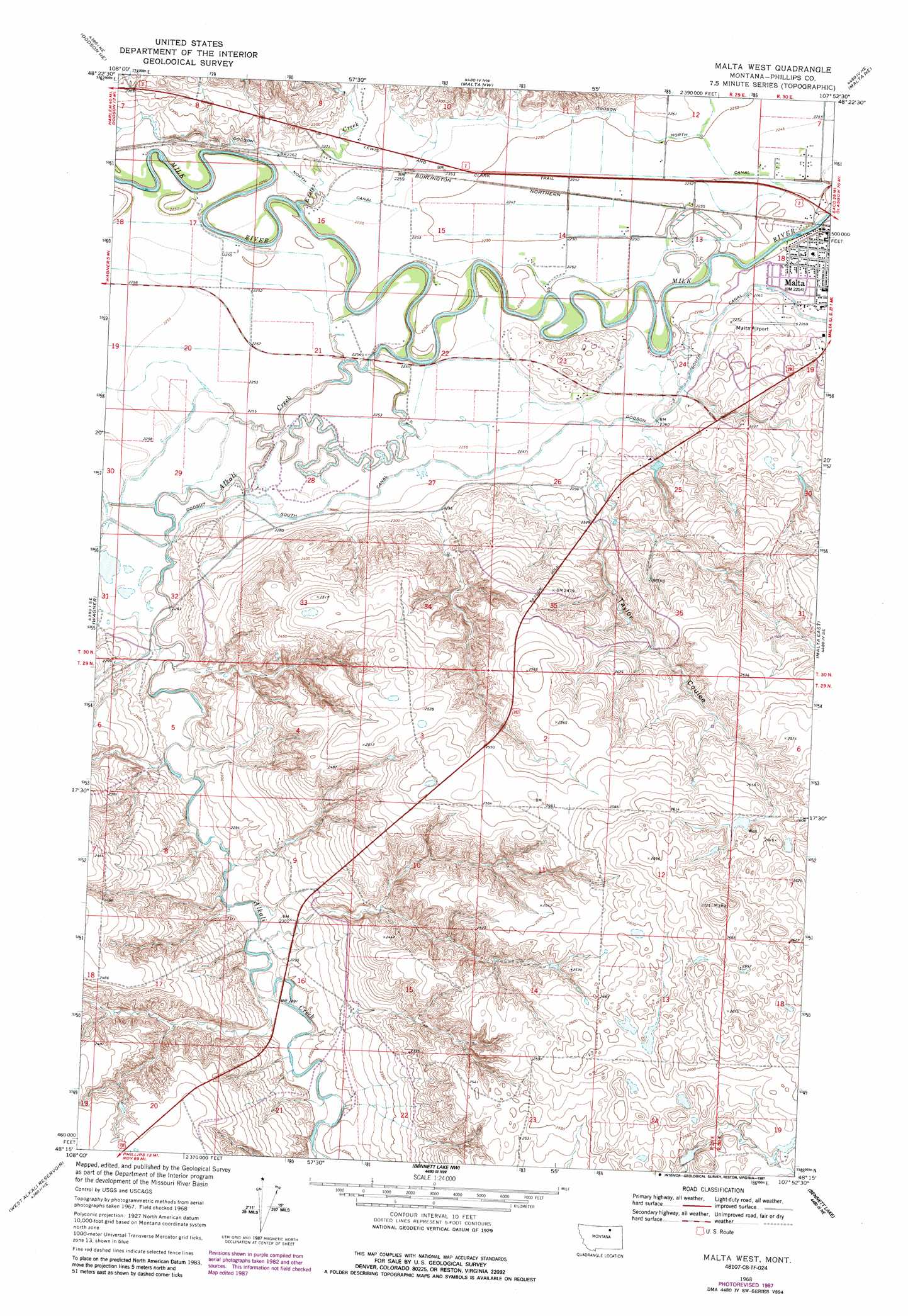
Malta West Topo Map Montana
To zoom in, hover over the map of Malta West
USGS Topo Quad 48107c8 - 1:24,000 scale
| Topo Map Name: | Malta West |
| USGS Topo Quad ID: | 48107c8 |
| Print Size: | ca. 21 1/4" wide x 27" high |
| Southeast Coordinates: | 48.25° N latitude / 107.875° W longitude |
| Map Center Coordinates: | 48.3125° N latitude / 107.9375° W longitude |
| U.S. State: | MT |
| Filename: | o48107c8.jpg |
| Download Map JPG Image: | Malta West topo map 1:24,000 scale |
| Map Type: | Topographic |
| Topo Series: | 7.5´ |
| Map Scale: | 1:24,000 |
| Source of Map Images: | United States Geological Survey (USGS) |
| Alternate Map Versions: |
Malta West MT 1968, updated 1971 Download PDF Buy paper map Malta West MT 1968, updated 1987 Download PDF Buy paper map Malta West MT 2011 Download PDF Buy paper map Malta West MT 2014 Download PDF Buy paper map |
1:24,000 Topo Quads surrounding Malta West
Hubert Hill Sw |
Hubert Hill Se |
Garland Creek |
Fanny Hill |
Hewitt Lake Sw |
Dodson |
Dodson Ne |
Malta Nw |
Malta Ne |
Lake Bowdoin |
Cow Creek |
Wagner |
Malta West |
Malta East |
Clanton Coulee |
Wild Horse Reservoir |
West Alkali Reservoir |
Bennett Lake Nw |
Bennett Lake |
Content Nw |
Phillips |
Seymour Reservoir |
Button Butte |
Mitchell Corner |
Horse Pasture Coulee |
> Back to 48107a1 at 1:100,000 scale
> Back to 48106a1 at 1:250,000 scale
> Back to U.S. Topo Maps home
Malta West topo map: Gazetteer
Malta West: Airports
Malta Airport elevation 694m 2276′Malta West: Dams
Onwatt Dam elevation 785m 2575′Malta West: Parks
Early Day Outlaws Historical Marker elevation 704m 2309′Little Rocky Mountains Historical Marker elevation 706m 2316′
Riverview Park elevation 687m 2253′
Malta West: Streams
Alkali Creek elevation 683m 2240′Exeter Creek elevation 683m 2240′
Malta West: Valleys
Taylor Coulee elevation 692m 2270′Malta West: Wells
29N29E14ADBB01 Well elevation 784m 2572′29N30E18BBDC01 Well elevation 813m 2667′
Malta West digital topo map on disk
Buy this Malta West topo map showing relief, roads, GPS coordinates and other geographical features, as a high-resolution digital map file on DVD:
Eastern Montana & Western North Dakota
Buy digital topo maps: Eastern Montana & Western North Dakota