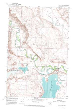
Hewitt Lake Topo Map Montana
To zoom in, hover over the map of Hewitt Lake
USGS Topo Quad 48107e5 - 1:24,000 scale
| Topo Map Name: | Hewitt Lake |
| USGS Topo Quad ID: | 48107e5 |
| Print Size: | ca. 21 1/4" wide x 27" high |
| Southeast Coordinates: | 48.5° N latitude / 107.5° W longitude |
| Map Center Coordinates: | 48.5625° N latitude / 107.5625° W longitude |
| U.S. State: | MT |
| Filename: | o48107e5.jpg |
| Download Map JPG Image: | Hewitt Lake topo map 1:24,000 scale |
| Map Type: | Topographic |
| Topo Series: | 7.5´ |
| Map Scale: | 1:24,000 |
| Source of Map Images: | United States Geological Survey (USGS) |
| Alternate Map Versions: |
Hewitt Lake MT 1968, updated 1971 Download PDF Buy paper map Hewitt Lake MT 2011 Download PDF Buy paper map Hewitt Lake MT 2014 Download PDF Buy paper map |
1:24,000 Topo Quads surrounding Hewitt Lake
> Back to 48107e1 at 1:100,000 scale
> Back to 48106a1 at 1:250,000 scale
> Back to U.S. Topo Maps home
Hewitt Lake topo map: Gazetteer
Hewitt Lake: Bridges
Milk River Ford Bridge elevation 665m 2181′Hewitt Lake: Canals
Nelson Canal elevation 673m 2208′Nelson South Canal elevation 674m 2211′
Hewitt Lake: Dams
Hewitt Dam elevation 670m 2198′Nelson Dikes A,B,C, and D elevation 675m 2214′
Oxarart Dam elevation 666m 2185′
Hewitt Lake: Lakes
McNeil Slough elevation 669m 2194′Hewitt Lake: Parks
Hewitt Lake National Wildlife Refuge elevation 672m 2204′Hewitt Lake: Populated Places
Cree Crossing elevation 665m 2181′Hewitt Lake: Reservoirs
Big McNeil Slough elevation 666m 2185′Hewitt Lake elevation 670m 2198′
Hewitt Lake: Streams
Shotgun Creek elevation 674m 2211′Hewitt Lake: Valleys
Alkali Coulee elevation 672m 2204′Hymer Coulee elevation 729m 2391′
Joe Bell Coulee elevation 678m 2224′
Hewitt Lake digital topo map on disk
Buy this Hewitt Lake topo map showing relief, roads, GPS coordinates and other geographical features, as a high-resolution digital map file on DVD:
Eastern Montana & Western North Dakota
Buy digital topo maps: Eastern Montana & Western North Dakota


