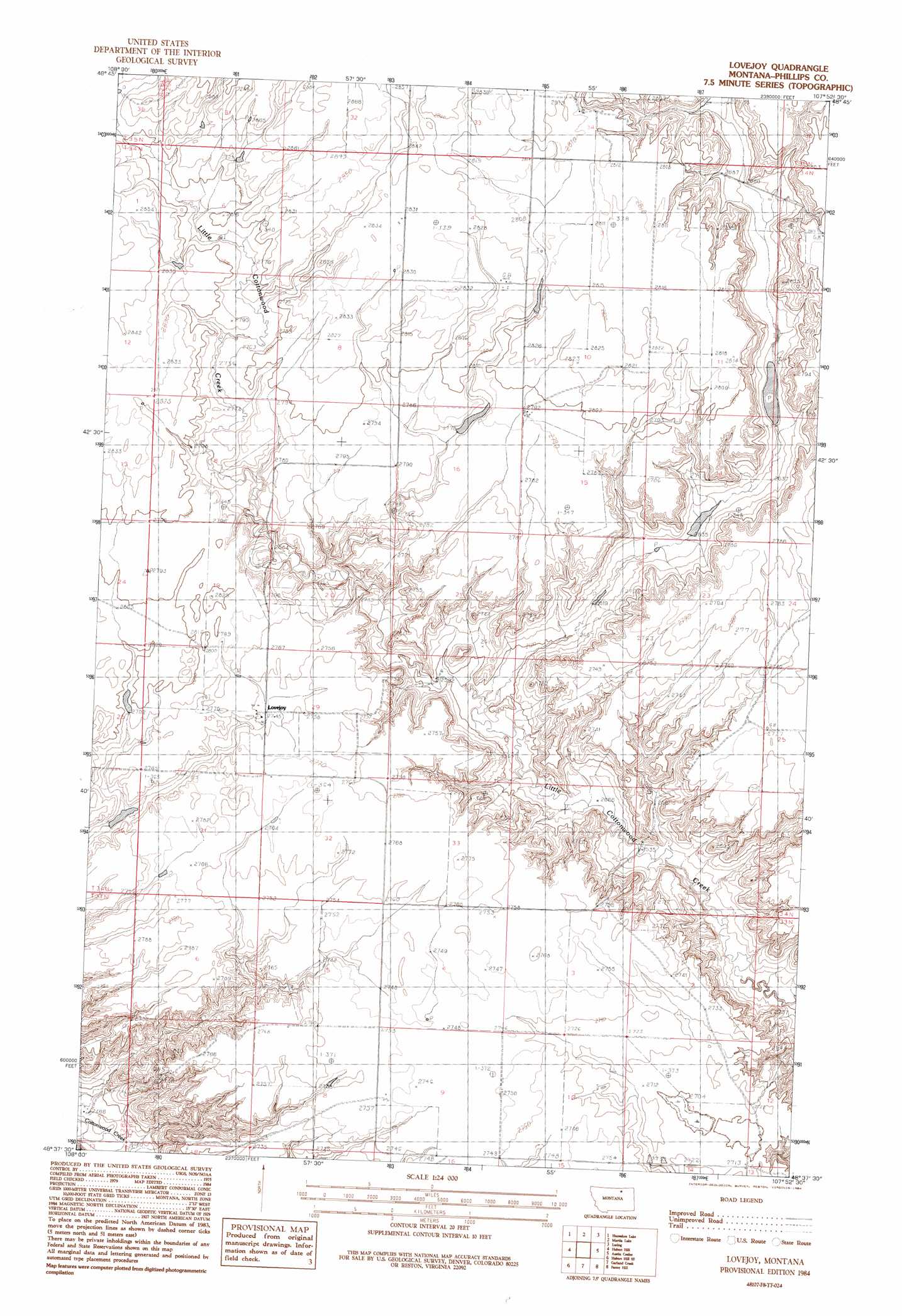
Lovejoy Topo Map Montana
To zoom in, hover over the map of Lovejoy
USGS Topo Quad 48107f8 - 1:24,000 scale
| Topo Map Name: | Lovejoy |
| USGS Topo Quad ID: | 48107f8 |
| Print Size: | ca. 21 1/4" wide x 27" high |
| Southeast Coordinates: | 48.625° N latitude / 107.875° W longitude |
| Map Center Coordinates: | 48.6875° N latitude / 107.9375° W longitude |
| U.S. State: | MT |
| Filename: | o48107f8.jpg |
| Download Map JPG Image: | Lovejoy topo map 1:24,000 scale |
| Map Type: | Topographic |
| Topo Series: | 7.5´ |
| Map Scale: | 1:24,000 |
| Source of Map Images: | United States Geological Survey (USGS) |
| Alternate Map Versions: |
Lovejoy MT 1984, updated 1984 Download PDF Buy paper map Lovejoy MT 2011 Download PDF Buy paper map Lovejoy MT 2014 Download PDF Buy paper map |
1:24,000 Topo Quads surrounding Lovejoy
Chapman Nw |
Sunny Slope School |
Loring Nw |
Morgan |
Gustin Coulee |
Chapman |
Horseshoe Lake |
Martin Lake |
Loring |
Whitewater West |
Emerick Bench |
Hubert Hill |
Lovejoy |
Austin Coulee |
Austin Lake |
Hubert Hill Sw |
Hubert Hill Se |
Garland Creek |
Fanny Hill |
Hewitt Lake Sw |
Dodson |
Dodson Ne |
Malta Nw |
Malta Ne |
Lake Bowdoin |
> Back to 48107e1 at 1:100,000 scale
> Back to 48106a1 at 1:250,000 scale
> Back to U.S. Topo Maps home
Lovejoy topo map: Gazetteer
Lovejoy: Dams
Cottonwood Grazing Number 4 Dam elevation 837m 2746′Lovejoy: Post Offices
Lovejoy Post Office (historical) elevation 839m 2752′Lovejoy: Wells
34N29E31ADD_01 Well elevation 841m 2759′Lovejoy digital topo map on disk
Buy this Lovejoy topo map showing relief, roads, GPS coordinates and other geographical features, as a high-resolution digital map file on DVD:
Eastern Montana & Western North Dakota
Buy digital topo maps: Eastern Montana & Western North Dakota