Loring Topo Map Montana
To zoom in, hover over the map of Loring
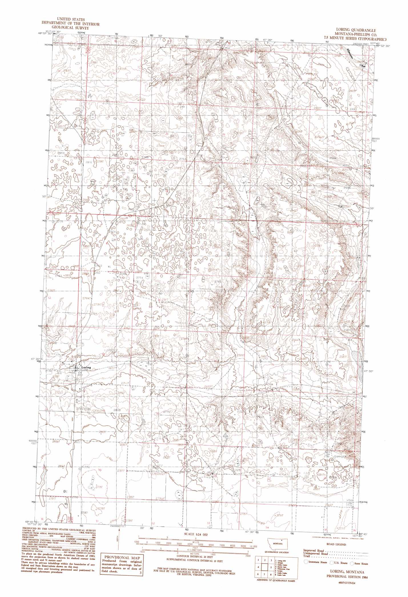
USGS Topo Quad 48107g7 - 1:24,000 scale
| Topo Map Name: | Loring |
| USGS Topo Quad ID: | 48107g7 |
| Print Size: | ca. 21 1/4" wide x 27" high |
| Southeast Coordinates: | 48.75° N latitude / 107.75° W longitude |
| Map Center Coordinates: | 48.8125° N latitude / 107.8125° W longitude |
| U.S. State: | MT |
| Filename: | o48107g7.jpg |
| Download Map JPG Image: | Loring topo map 1:24,000 scale |
| Map Type: | Topographic |
| Topo Series: | 7.5´ |
| Map Scale: | 1:24,000 |
| Source of Map Images: | United States Geological Survey (USGS) |
| Alternate Map Versions: |
Loring MT 1984, updated 1984 Download PDF Buy paper map Loring MT 2011 Download PDF Buy paper map Loring MT 2014 Download PDF Buy paper map |
1:24,000 Topo Quads surrounding Loring
Sunny Slope School |
Loring Nw |
Morgan |
Gustin Coulee |
Pea Lake |
Horseshoe Lake |
Martin Lake |
Loring |
Whitewater West |
Whitewater East |
Hubert Hill |
Lovejoy |
Austin Coulee |
Austin Lake |
Tattnall |
Hubert Hill Se |
Garland Creek |
Fanny Hill |
Hewitt Lake Sw |
Hewitt Lake |
> Back to 48107e1 at 1:100,000 scale
> Back to 48106a1 at 1:250,000 scale
> Back to U.S. Topo Maps home
Loring topo map: Gazetteer
Loring: Dams
Not Much Dam elevation 792m 2598′Loring: Populated Places
Loring elevation 825m 2706′Loring: Post Offices
Loring Post Office elevation 822m 2696′Loring: Wells
35N30E19CD__01 Well elevation 848m 2782′35N30E31____01 Well elevation 850m 2788′
36N30E32CDAB01 Well elevation 854m 2801′
Loring digital topo map on disk
Buy this Loring topo map showing relief, roads, GPS coordinates and other geographical features, as a high-resolution digital map file on DVD:
Eastern Montana & Western North Dakota
Buy digital topo maps: Eastern Montana & Western North Dakota