Lake Seventeen West Topo Map Montana
To zoom in, hover over the map of Lake Seventeen West
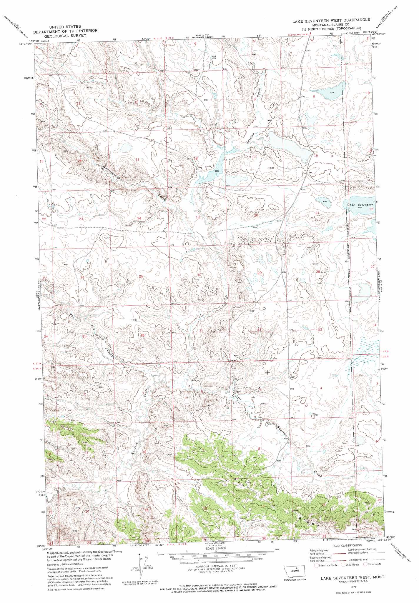
USGS Topo Quad 48108a8 - 1:24,000 scale
| Topo Map Name: | Lake Seventeen West |
| USGS Topo Quad ID: | 48108a8 |
| Print Size: | ca. 21 1/4" wide x 27" high |
| Southeast Coordinates: | 48° N latitude / 108.875° W longitude |
| Map Center Coordinates: | 48.0625° N latitude / 108.9375° W longitude |
| U.S. State: | MT |
| Filename: | o48108a8.jpg |
| Download Map JPG Image: | Lake Seventeen West topo map 1:24,000 scale |
| Map Type: | Topographic |
| Topo Series: | 7.5´ |
| Map Scale: | 1:24,000 |
| Source of Map Images: | United States Geological Survey (USGS) |
| Alternate Map Versions: |
Lake Seventeen West MT 1971, updated 1974 Download PDF Buy paper map Lake Seventeen West MT 2011 Download PDF Buy paper map Lake Seventeen West MT 2014 Download PDF Buy paper map |
1:24,000 Topo Quads surrounding Lake Seventeen West
Cleveland |
Miles Butte |
Newhouse Reservoir |
Fort Belknap Agency Se |
Wild Horse Butte |
Scotty Butte |
Suction Butte |
Putnam Lake |
Lake Seventeen Ne |
Lodge Pole Nw |
Runyan Bench |
Rattlesnake |
Lake Seventeen West |
Lake Seventeen East |
Stiffarm Coulee |
Sandpiper Reservoir |
Butch Reservoir |
John Coulee |
Crazyman Coulee |
Hays |
Bird Rapids |
Sturgeon Island |
Cow Island |
Shetland Divide |
D Y Junction |
> Back to 48108a1 at 1:100,000 scale
> Back to 48108a1 at 1:250,000 scale
> Back to U.S. Topo Maps home
Lake Seventeen West topo map: Gazetteer
Lake Seventeen West: Dams
Carter Dam elevation 964m 3162′Mitchell Dam elevation 934m 3064′
Lake Seventeen West: Post Offices
Timber Ridge Post Office (historical) elevation 986m 3234′Lake Seventeen West: Ridges
Timber Ridge elevation 1018m 3339′Lake Seventeen West: Streams
Little Suction Creek elevation 905m 2969′Rattlesnake Creek elevation 918m 3011′
Tin Cup Coulee elevation 903m 2962′
Lake Seventeen West: Valleys
Jacks Coulee elevation 935m 3067′West Fork Jacks Coulee elevation 981m 3218′
Lake Seventeen West: Wells
27N22E30BABC01 Well elevation 934m 3064′Lake Seventeen West digital topo map on disk
Buy this Lake Seventeen West topo map showing relief, roads, GPS coordinates and other geographical features, as a high-resolution digital map file on DVD: