Big Flat East Topo Map Montana
To zoom in, hover over the map of Big Flat East
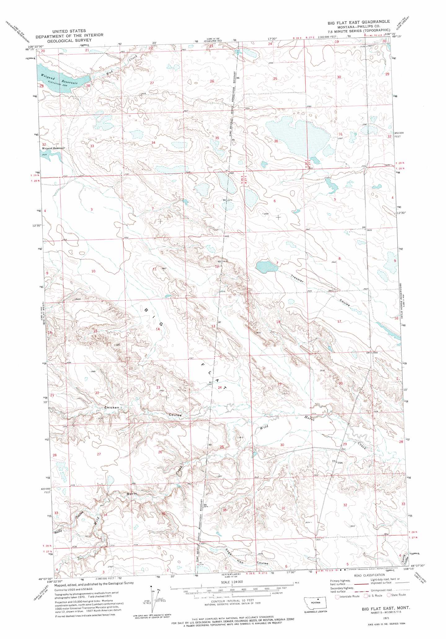
USGS Topo Quad 48108b3 - 1:24,000 scale
| Topo Map Name: | Big Flat East |
| USGS Topo Quad ID: | 48108b3 |
| Print Size: | ca. 21 1/4" wide x 27" high |
| Southeast Coordinates: | 48.125° N latitude / 108.25° W longitude |
| Map Center Coordinates: | 48.1875° N latitude / 108.3125° W longitude |
| U.S. State: | MT |
| Filename: | o48108b3.jpg |
| Download Map JPG Image: | Big Flat East topo map 1:24,000 scale |
| Map Type: | Topographic |
| Topo Series: | 7.5´ |
| Map Scale: | 1:24,000 |
| Source of Map Images: | United States Geological Survey (USGS) |
| Alternate Map Versions: |
Big Flat East MT 1971, updated 1974 Download PDF Buy paper map Big Flat East MT 2011 Download PDF Buy paper map Big Flat East MT 2014 Download PDF Buy paper map |
1:24,000 Topo Quads surrounding Big Flat East
Savoy |
Coburg |
Dodson Dam |
Dodson |
Dodson Ne |
Bigby Lake |
Weigand Reservoir |
Coburg Se |
Cow Creek |
Wagner |
Lodge Pole Ne |
Big Flat West |
Big Flat East |
Wild Horse Reservoir |
West Alkali Reservoir |
Lodge Pole |
Ball Coulee |
Ester Lake |
Phillips |
Seymour Reservoir |
Zortman |
Bear Mountain |
Coburn Butte |
Veseth Reservoir |
Holzhey Reservoir |
> Back to 48108a1 at 1:100,000 scale
> Back to 48108a1 at 1:250,000 scale
> Back to U.S. Topo Maps home
Big Flat East topo map: Gazetteer
Big Flat East: Dams
Ernest Dam elevation 807m 2647′JFK Dam elevation 781m 2562′
Big Flat East: Flats
Big Flat elevation 784m 2572′Big Flat East: Valleys
Chicken Coulee elevation 784m 2572′Rocky Coulee elevation 814m 2670′
Big Flat East: Wells
28N27E18AB__01 Well elevation 808m 2650′29N27E31DCC_01 Well elevation 790m 2591′
Big Flat East digital topo map on disk
Buy this Big Flat East topo map showing relief, roads, GPS coordinates and other geographical features, as a high-resolution digital map file on DVD: