Wagner Topo Map Montana
To zoom in, hover over the map of Wagner
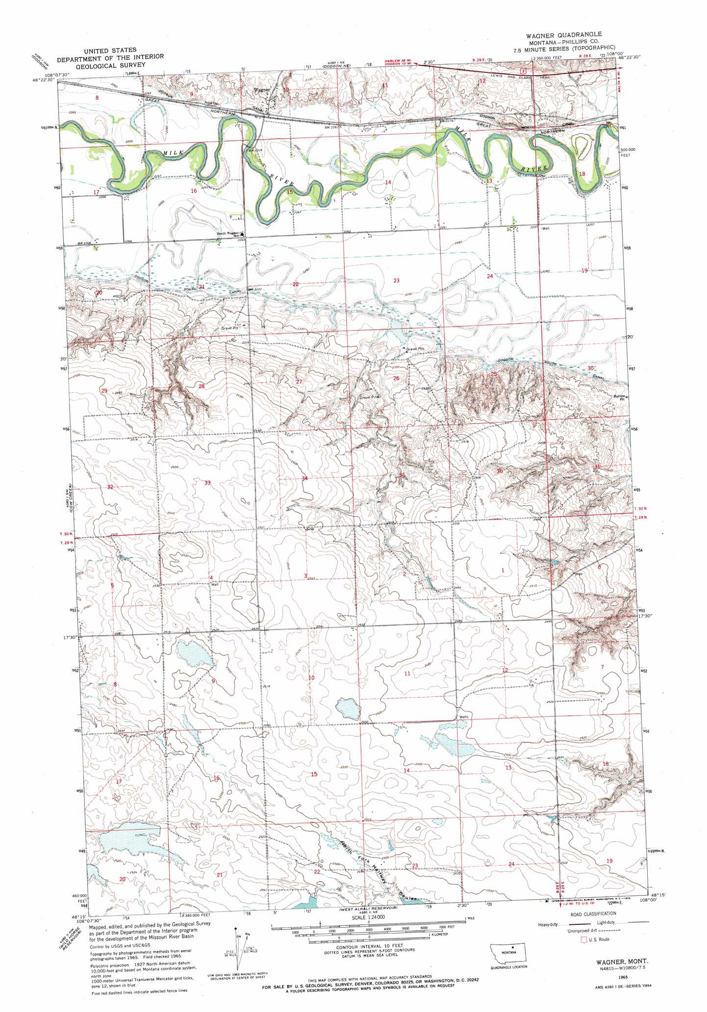
USGS Topo Quad 48108c1 - 1:24,000 scale
| Topo Map Name: | Wagner |
| USGS Topo Quad ID: | 48108c1 |
| Print Size: | ca. 21 1/4" wide x 27" high |
| Southeast Coordinates: | 48.25° N latitude / 108° W longitude |
| Map Center Coordinates: | 48.3125° N latitude / 108.0625° W longitude |
| U.S. State: | MT |
| Filename: | o48108c1.jpg |
| Download Map JPG Image: | Wagner topo map 1:24,000 scale |
| Map Type: | Topographic |
| Topo Series: | 7.5´ |
| Map Scale: | 1:24,000 |
| Source of Map Images: | United States Geological Survey (USGS) |
| Alternate Map Versions: |
Wagner MT 1965, updated 1969 Download PDF Buy paper map Wagner MT 2011 Download PDF Buy paper map Wagner MT 2014 Download PDF Buy paper map |
1:24,000 Topo Quads surrounding Wagner
Down Reservoir |
Hubert Hill Sw |
Hubert Hill Se |
Garland Creek |
Fanny Hill |
Dodson Dam |
Dodson |
Dodson Ne |
Malta Nw |
Malta Ne |
Coburg Se |
Cow Creek |
Wagner |
Malta West |
Malta East |
Big Flat East |
Wild Horse Reservoir |
West Alkali Reservoir |
Bennett Lake Nw |
Bennett Lake |
Ester Lake |
Phillips |
Seymour Reservoir |
Button Butte |
Mitchell Corner |
> Back to 48108a1 at 1:100,000 scale
> Back to 48108a1 at 1:250,000 scale
> Back to U.S. Topo Maps home
Wagner topo map: Gazetteer
Wagner: Bridges
Milk River Bridge elevation 685m 2247′Wagner: Dams
Buckin' Horse Dam elevation 769m 2522′Gilda Radner Dam elevation 691m 2267′
Halfway Dam elevation 767m 2516′
Wagner: Populated Places
Wagner elevation 699m 2293′Wagner: Post Offices
Wagner Post Office (historical) elevation 699m 2293′Wagner: Wells
30N28E10CCAB01 Well elevation 691m 2267′30N28E10CDBB01 Well elevation 693m 2273′
Wagner digital topo map on disk
Buy this Wagner topo map showing relief, roads, GPS coordinates and other geographical features, as a high-resolution digital map file on DVD: