Dodson Topo Map Montana
To zoom in, hover over the map of Dodson
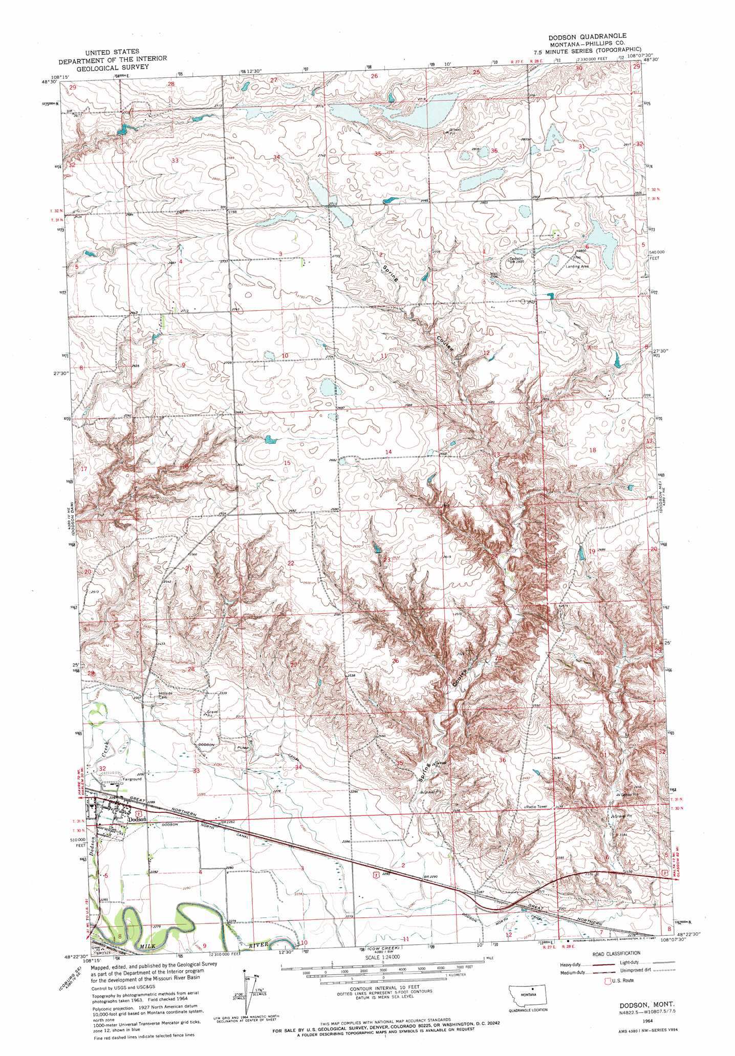
USGS Topo Quad 48108d2 - 1:24,000 scale
| Topo Map Name: | Dodson |
| USGS Topo Quad ID: | 48108d2 |
| Print Size: | ca. 21 1/4" wide x 27" high |
| Southeast Coordinates: | 48.375° N latitude / 108.125° W longitude |
| Map Center Coordinates: | 48.4375° N latitude / 108.1875° W longitude |
| U.S. State: | MT |
| Filename: | o48108d2.jpg |
| Download Map JPG Image: | Dodson topo map 1:24,000 scale |
| Map Type: | Topographic |
| Topo Series: | 7.5´ |
| Map Scale: | 1:24,000 |
| Source of Map Images: | United States Geological Survey (USGS) |
| Alternate Map Versions: |
Dodson MT 1964, updated 1967 Download PDF Buy paper map Dodson MT 2011 Download PDF Buy paper map Dodson MT 2014 Download PDF Buy paper map |
1:24,000 Topo Quads surrounding Dodson
Down Reservoir Nw |
Down Reservoir Ne |
Emerick Bench |
Hubert Hill |
Lovejoy |
Down Reservoir Sw |
Down Reservoir |
Hubert Hill Sw |
Hubert Hill Se |
Garland Creek |
Coburg |
Dodson Dam |
Dodson |
Dodson Ne |
Malta Nw |
Weigand Reservoir |
Coburg Se |
Cow Creek |
Wagner |
Malta West |
Big Flat West |
Big Flat East |
Wild Horse Reservoir |
West Alkali Reservoir |
Bennett Lake Nw |
> Back to 48108a1 at 1:100,000 scale
> Back to 48108a1 at 1:250,000 scale
> Back to U.S. Topo Maps home
Dodson topo map: Gazetteer
Dodson: Bridges
Burlington Northern Overpass Bridge elevation 699m 2293′Dodson: Canals
Dodson North Canal elevation 695m 2280′Dodson Pump Canal elevation 702m 2303′
Dodson: Dams
Herman Number 1 Dam elevation 818m 2683′Dodson: Populated Places
Dodson elevation 697m 2286′Dodson: Post Offices
Dodson Post Office elevation 697m 2286′Dodson: Streams
Dodson Creek elevation 691m 2267′Dodson: Valleys
Hay Coulee elevation 696m 2283′Spring Coulee elevation 702m 2303′
Wagner Coulee elevation 698m 2290′
Dodson: Wells
31N27E09BABC01 Well elevation 814m 2670′Dodson digital topo map on disk
Buy this Dodson topo map showing relief, roads, GPS coordinates and other geographical features, as a high-resolution digital map file on DVD: