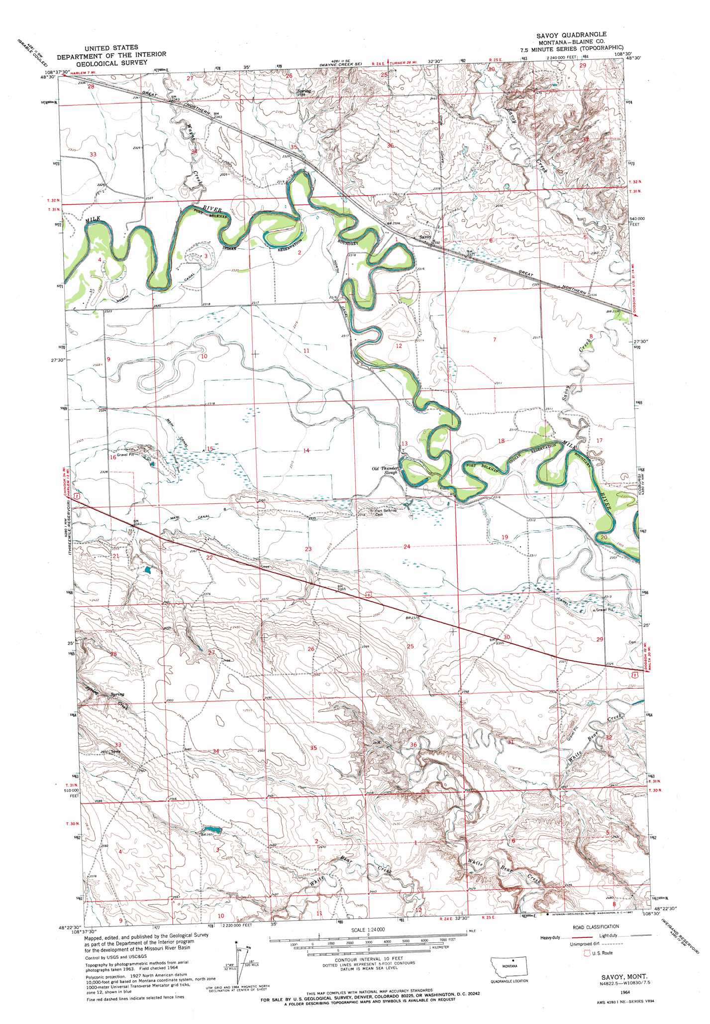
Savoy Topo Map Montana
To zoom in, hover over the map of Savoy
USGS Topo Quad 48108d5 - 1:24,000 scale
| Topo Map Name: | Savoy |
| USGS Topo Quad ID: | 48108d5 |
| Print Size: | ca. 21 1/4" wide x 27" high |
| Southeast Coordinates: | 48.375° N latitude / 108.5° W longitude |
| Map Center Coordinates: | 48.4375° N latitude / 108.5625° W longitude |
| U.S. State: | MT |
| Filename: | o48108d5.jpg |
| Download Map JPG Image: | Savoy topo map 1:24,000 scale |
| Map Type: | Topographic |
| Topo Series: | 7.5´ |
| Map Scale: | 1:24,000 |
| Source of Map Images: | United States Geological Survey (USGS) |
| Alternate Map Versions: |
Savoy MT 1964, updated 1967 Download PDF Buy paper map Savoy MT 2011 Download PDF Buy paper map Savoy MT 2014 Download PDF Buy paper map |
1:24,000 Topo Quads surrounding Savoy
East Butte |
Wayne Creek Nw |
Hornbeck Lake |
Down Reservoir Nw |
Down Reservoir Ne |
Harlem |
Grable Coulee |
Wayne Creek Se |
Down Reservoir Sw |
Down Reservoir |
Fort Belknap Agency |
Threemile Reservoir |
Savoy |
Coburg |
Dodson Dam |
Fort Belknap Agency Se |
Wild Horse Butte |
Bigby Lake |
Weigand Reservoir |
Coburg Se |
Lake Seventeen Ne |
Lodge Pole Nw |
Lodge Pole Ne |
Big Flat West |
Big Flat East |
> Back to 48108a1 at 1:100,000 scale
> Back to 48108a1 at 1:250,000 scale
> Back to U.S. Topo Maps home
Savoy topo map: Gazetteer
Savoy: Canals
Main Canal B elevation 710m 2329′Savoy: Guts
Old Thunder Slough elevation 701m 2299′Savoy: Populated Places
Dogtown (historical) elevation 708m 2322′Savoy elevation 711m 2332′
Savoy: Post Offices
Savoy Post Office (historical) elevation 711m 2332′Savoy: Streams
Savoy Creek elevation 701m 2299′Wayne Creek elevation 709m 2326′
Savoy: Wells
31N24E02DAD_01 Well elevation 707m 2319′31N24E03CABC01 Well elevation 708m 2322′
31N24E03CDBB01 Well elevation 708m 2322′
31N24E03DCBC01 Well elevation 708m 2322′
31N24E04CDC_01 Well elevation 708m 2322′
31N24E09____01 Well elevation 708m 2322′
31N24E13CAA_01 Well elevation 703m 2306′
31N24E16ADC_01 Well elevation 710m 2329′
31N24E16ADCD01 Well elevation 714m 2342′
31N24E21ABDD01 Well elevation 714m 2342′
31N24E21ACDA01 Well elevation 717m 2352′
31N24E21CABA01 Well elevation 721m 2365′
31N24E23AADC01 Well elevation 706m 2316′
31N24E23DBCD01 Well elevation 713m 2339′
31N24E23DCC_01 Well elevation 718m 2355′
31N25E21CABA01 Well elevation 721m 2365′
Savoy digital topo map on disk
Buy this Savoy topo map showing relief, roads, GPS coordinates and other geographical features, as a high-resolution digital map file on DVD: